2008 - Communication Across the Curriculum (CAC)
2008 - Communication Across the Curriculum (CAC)
2008 - Communication Across the Curriculum (CAC)

You also want an ePaper? Increase the reach of your titles
YUMPU automatically turns print PDFs into web optimized ePapers that Google loves.
L a n d S u r v e y i n g<br />
The Future of<br />
Non-Terrestrial<br />
Surveying<br />
by Randy<br />
Robertson<br />
SRVY 1349: Survey Calculations II. Students were<br />
asked to submit an essay about <strong>the</strong> ma<strong>the</strong>matics<br />
involved in land surveying and how ma<strong>the</strong>matics<br />
are incorporated into <strong>the</strong> technology used by<br />
surveyors today. Randy’s paper took a path that<br />
I had not expected by examining <strong>the</strong> technology<br />
currently being used to survey and map <strong>the</strong> surface<br />
of Mars. As we moved westward to develop this<br />
country many years ago, <strong>the</strong> land surveyor was out<br />
in front of that movement. Now, surveys of Mars<br />
are being performed in preparation for development<br />
that may take place many decades in <strong>the</strong> future.<br />
Randy’s paper challenges surveyors to become<br />
better educated and better qualified to be again<br />
in <strong>the</strong> forefront of this exciting work. As it is in all<br />
professions, <strong>the</strong> ability to communicate in a written<br />
format is a very important skill for professional land<br />
surveyors. Randy’s paper demonstrates this ability.<br />
Roger W. McDonald, RPLS<br />
Surveyors have for centuries had to contend with advances<br />
in technology and application. While original surveys were made<br />
with no knowledge of what existed one thousand miles away, or<br />
even one hundred miles in some cases, <strong>the</strong>re has been a<br />
slow evolution of regional, continental, and global control<br />
networks based on <strong>the</strong> development of accurate geoid/<br />
ellipsoid models, especially in recent years. This has<br />
also cause unending headaches as local-level surveys<br />
must be referenced to <strong>the</strong>se new control networks. In<br />
many cases, this highly complicated conversion gives<br />
results that are not entirely satisfactory. Even successful<br />
conversions are doomed to obsolescence by continued<br />
explosive technological growth.<br />
But consider how this profession would be different if events<br />
had been reversed. What would <strong>the</strong> surveyor’s profession be<br />
like today if we had started with a global control network and<br />
<strong>the</strong>n worked it into greater detail, finally ending with local-level<br />
surveys<br />
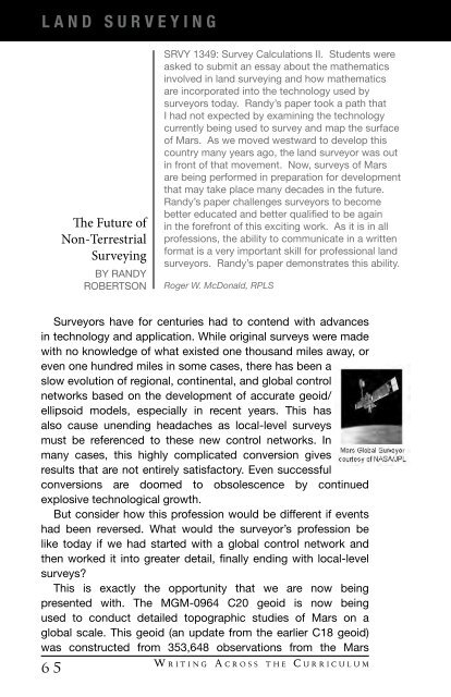
This is exactly <strong>the</strong> opportunity that we are now being<br />
presented with. The MGM-0964 C20 geoid is now being<br />
used to conduct detailed topographic studies of Mars on a<br />
global scale. This geoid (an update from <strong>the</strong> earlier C18 geoid)<br />
was constructed from 353,648 observations from <strong>the</strong> Mars<br />
6 5<br />
W r i t i n g A c r o s s t h e C u r r i c u l u m