Condit Dam Removal Condit Dam Removal - Access Washington
Condit Dam Removal Condit Dam Removal - Access Washington
Condit Dam Removal Condit Dam Removal - Access Washington

You also want an ePaper? Increase the reach of your titles
YUMPU automatically turns print PDFs into web optimized ePapers that Google loves.
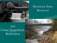
<strong>Condit</strong> <strong>Dam</strong> Hydroelectric Project<br />
Final Supplemental EIS<br />
and contain one edge that is lake fringe. Delta wetlands total 0.9 acre in area. Wetlands 5, 8,<br />
and 10 are rated as Category II and Wetland 12 along <strong>Condit</strong> Creek is rated as Category III.<br />
Wetland 26 was identified by URS staff during a May 30, 2005 site visit to review recent<br />
changes in the proposed deconstruction plan. It is shown on Figure 4.4-2. This 4-foot-wide<br />
by 45-foot-long (0.004 acre) roadside wetland is located about 1,000 feet southeast of <strong>Condit</strong><br />
<strong>Dam</strong> directly west of Powerhouse Road. This palustrine emergent slope wetland is watered<br />
by a seep that appears to receive seasonal groundwater discharge fed by an irrigated orchard<br />
about 100 feet upslope on the opposite side of Powerhouse Road. Water moves through the<br />
small wetland and continues across the surface of the existing dam access road before<br />
infiltrating underground further down the slope. In the winter there may be more flow<br />
causing the downslope section to be an ephemeral stream for a short distance, but there are<br />
no wetland characteristics beyond the area delineated as Wetland 26. Soils were saturated to<br />
the surface with free water at 10 inches in the soil pit during the May 30, 2005 site visit. The<br />
dark brown (10YR 3/3) A soil horizon to 9 inches over a deep dark grayish brown (10YR<br />
3/2) B soil horizon generally matches the Hood loam soil series identified for this site in the<br />
Natural Resources Conservation Service (NRCS) Soil Survey of Klickitat County (CH2M<br />
Hill 2003, Haagen 1990). Soils are possibly relic disturbed or fill material from the adjacent<br />
two roadways. Dominant vegetation includes the herbaceous giant horsetail (Equisetum<br />
telmateia/FACW) and bluejoint reedgrass (Calamagrostis canadensis/FACW+). Other<br />
species present include cleavers (Galium aparine/FACU), small fruited bulrush (Scirpus<br />
microcarpus/OBL), and creeping bentgrass (Agrostis stolonifera/FAC). Wetland 26 is rated<br />
as a Category IV wetland. The wetland data sheet is available in Appendix D.<br />
4.4.2 Impacts<br />
Pre-<strong>Dam</strong> <strong>Removal</strong> Activities<br />
Wetland 12 would be partially filled for construction of a haul road between the eastern end<br />
of the dam and the proposed concrete storage/disposal area. A culvert is anticipated to be<br />
placed within the wetland at the <strong>Condit</strong> Creek crossing. At the probable crossing location,<br />
the delta wetland is up to 25 feet wide on each side of the creek where it meets the lake.<br />
Because the road would need to turn just past the crossing, it is presumed that a culvert 40<br />
feet long would be required. Up to 1,000 square feet of wetland on each side of the <strong>Condit</strong><br />
Creek crossing could be filled.<br />
At Wetland 21, a maximum of 875 square feet of wetland would be filled in order to<br />
complete the concrete storage/disposal area haul road, if it follows the old road route at this<br />
point. Since this would include the point of discharge of the seep that feeds the wetland, it is<br />
presumed that the seep would be culverted to allow it to continue supplying water to the<br />
downslope part of the wetland. It appears that the road could be rerouted at this location to<br />
avoid part of the wetland and put the road farther from a cabin. If that is done, the wetland<br />
impact is estimated to be about 440 square feet.<br />
Wetland 26 would be filled during expansion of the access road from Powerhouse Road to<br />
the lower side of the dam for construction vehicles and machinery. It is presumed that all of<br />
Wetland 26 (180 square feet) would be excavated and/or filled in order to build the access<br />
4.4-5