Condit Dam Removal Condit Dam Removal - Access Washington
Condit Dam Removal Condit Dam Removal - Access Washington
Condit Dam Removal Condit Dam Removal - Access Washington

You also want an ePaper? Increase the reach of your titles
YUMPU automatically turns print PDFs into web optimized ePapers that Google loves.
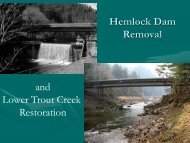
<strong>Condit</strong> <strong>Dam</strong> Hydroelectric Project<br />
Final Supplemental EIS<br />
4.0 AFFECTED ENVIRONMENT, IMPACTS, MITIGATION<br />
MEASURES, AND SIGNIFICANT UNAVOIDABLE<br />
ADVERSE IMPACTS<br />
4.1 GEOLOGY, SOILS, AND SEDIMENTS<br />
This section describes the affected environment and the effects of dam breaching and removal<br />
activities and processes on geology and soils. It also describes sediment movement and potential<br />
sedimentation that could occur from the dam removal and other removal activities. For a<br />
discussion of the impacts of sedimentation on water quality, please see Section 4.2 (Water<br />
Resources). Mitigation for sedimentation effects on the environment is described below, along<br />
with significant unavoidable impacts.<br />
4.1.1 Affected Environment<br />
The affected environment for geology, soils, and sediments includes Northwestern Lake (<strong>Condit</strong><br />
<strong>Dam</strong> reservoir), the area immediately surrounding <strong>Condit</strong> <strong>Dam</strong>, access roads to work areas and<br />
staging areas, the tailrace from the power plant, the corridor occupied by the wood stave pipe and<br />
the power line, and the spillway from the surge tank to the White Salmon River. It includes the<br />
White Salmon River and its floodplain from the dam down to and including part of the pool for<br />
the Bonneville <strong>Dam</strong> on the Columbia River.<br />
The project site is located on the White Salmon River in an area of rugged topography<br />
approximately three miles upstream from the confluence of the White Salmon and Columbia<br />
Rivers (USGS 1994). Soils in the White Salmon River Basin are generally characterized as<br />
loams and silt-loams derived from the regional basaltic bedrock, andesite, and pumice. Near<br />
<strong>Condit</strong> <strong>Dam</strong>, these soils are shallow and typically underlain by an intermediate gravel unit above<br />
the bedrock. Bedrock outcrops are common in areas of steeper topography along the river<br />
(FERC 1996).<br />
Immediately west of the dam, the geology is dominated by colluvial deposits, capped by coarse<br />
glacial outwash material at the rim of the canyon. East of the dam, the topography is somewhat<br />
less severe, supporting a thin veneer of soil over the basaltic bedrock. North of the dam, the soils<br />
along the shores of Northwestern Lake are composed principally of the Hood loam (USDA<br />
1990). Bedrock is present over much of the channel of the White Salmon River below the dam.<br />
At the time of dam removal, an estimated 2.7 million cubic yards of sediment (2.3 million<br />
according to Finley 2006), primarily silt and sand with some gravel, will have accumulated in<br />
Northwestern Lake since the construction of <strong>Condit</strong> <strong>Dam</strong> in 1913. More than 7,500 feet<br />
upstream from the dam and primarily upstream from Northwestern Lake Bridge, the size of<br />
reservoir sediments is dominantly in the sand (.075-4.75 mm) and gravel (4.75-75 mm) range.<br />
Closer to the dam, the sediments are primarily sand and silt (.0039-.075 mm), and finally silt and<br />
clay (