Condit Dam Removal Condit Dam Removal - Access Washington
Condit Dam Removal Condit Dam Removal - Access Washington
Condit Dam Removal Condit Dam Removal - Access Washington

You also want an ePaper? Increase the reach of your titles
YUMPU automatically turns print PDFs into web optimized ePapers that Google loves.
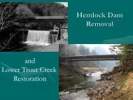
<strong>Condit</strong> <strong>Dam</strong> Hydroelectric Project<br />
Final Supplemental EIS<br />
4.10 AESTHETICS AND SCENIC RESOURCES<br />
This section evaluates Aesthetics and Scenic Resources that could be affected as a result of<br />
the proposed action. Recreational impacts and mitigation measures were addressed in<br />
previous FERC documents and are not addressed in this section. Other discussions related to<br />
aesthetics and scenic resources are included in Land Use/Critical Areas (Section 4.9) and<br />
Aquatic Resources (Section 4.3). A previous document entitled <strong>Condit</strong> Hydroelectric Project<br />
Visual Analysis (PacifiCorp 1991), prepared in conjunction with the FERC NEPA<br />
environmental process, is used as a reference for the analysis in this document. The previous<br />
documents followed the USFS Visual Management System, Existing Visual <strong>Condit</strong>ions<br />
(EVC) evaluation procedure. This method is used in this document.<br />
4.10.1 Affected Environment<br />
For the proposed action, the affected area analyzed is the area from Northwestern Lake<br />
(reservoir), extending about 1.8 miles from the dam to approximately the Northwestern Lake<br />
Road bridge. Other aesthetic and scenic resources in the vicinity include the Lower White<br />
Salmon National Wild and Scenic River area upstream of the reservoir and the Columbia<br />
Gorge National Scenic Area, which extends over virtually the entire proposed action area.<br />
The EVC evaluation procedure involves a comparison of the natural appearing landscape<br />
with degrees of differences in landscape alteration. Landscapes are classified into six types<br />
(Table 4.10-1).<br />
Table 4.10-1<br />
Existing Visual <strong>Condit</strong>ion Types<br />
Type I Areas in which only ecological change has taken place except for trails needed for access. They appear<br />
to be untouched by human activities.<br />
Type II Areas in which changes in the landscape are not visually evident to the average person unless pointed<br />
out. They are normally not noticed.<br />
Type III Areas in which changes in the landscape are noticed by the average forest visitor, but they do not attract<br />
attention. The natural appearance of the landscape still remains dominant. They appear to be minor<br />
disturbances.<br />
Type IV Areas in which changes in the landscape are easily noticed by the average forest visitor and may attract<br />
some attention.<br />
Type V Areas in which changes in the landscape are strong and are obvious to the average forest visitor. These<br />
changes stand out as a dominating impression of the landscape. They appear to be major disturbances.<br />
Type VI Areas in which changes in the landscape are in glaring contrast to the natural appearance. Almost all<br />
forest visitors would be displeased with the effect. They appear to be drastic disturbances.<br />
Source: USFS 1980<br />
The 2002 Final SEIS evaluated key areas along the reservoir. These areas included the<br />
<strong>Condit</strong> <strong>Dam</strong> and Forebay Boat Ramp, the Reservoir Shoreline, and Northwestern Lake Park<br />
(Figures 4.10-1 through 4.10-10 show the general areas).<br />
<strong>Condit</strong> <strong>Dam</strong>/Forebay Boat Ramp<br />
The dam is visible from the forebay boat ramp area, which is about 500 feet north of the dam.<br />
Public access is currently available to the dam via Powerhouse Road. Public access to the<br />
4.10-1