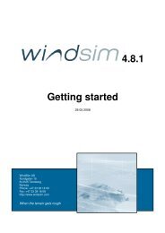
4.7 Getting started - WindSim
4.7 Getting started - WindSim
4.7 Getting started - WindSim

You also want an ePaper? Increase the reach of your titles
YUMPU automatically turns print PDFs into web optimized ePapers that Google loves.
2 <strong>WindSim</strong> AS<br />
<strong>WindSim</strong> <strong>4.7</strong>.0, demo version<br />
Introduction<br />
<strong>WindSim</strong> is software dedicated to design of wind parks. It´s possible to perform numerical<br />
simulations of the wind field (speed, direction, turbulence) over a given digital terrain. The<br />
best location for the wind turbines is therefore found by coupling the wind field results with<br />
long term wind measurements, by usage of statistical means. It´s also possible to estimate<br />
the loads on the wind turbines once the wind turbulence has known. Different layouts of wind<br />
parks provide therefore different energy production but also different loads on the turbines.<br />
The described process typical of a micrositing project can be carried out with the software<br />
<strong>WindSim</strong>, which is subdivided in six modules covering the steps to be taken in a wind park<br />
drawing:<br />
• Import digital terrain map. Terrain module;<br />
• Calculate flow field over the given terrain. Wind Fields module;<br />
• Place wind turbines and measurements stations. Objects module;<br />
• Analyse the flow field. Results module;<br />
• Combine wind field data with anemometers data by statistical means to provide:<br />
o Mean wind maps. Wind Resources module;<br />
o Annual Energy Production (AEP) for the chosen layout. Energy module.<br />
A typical screen shot of <strong>WindSim</strong> is shown in Figure 1, the Result module is enabled and a x<br />
component of wind speed contour map is visualised.<br />
About the technology<br />
<strong>WindSim</strong> <strong>4.7</strong>.0 is software for wind energy assessment, based on Computational Fluid<br />
Dynamics (CFD) simulations of the wind flow over given terrains. The CFD simulations are<br />
based on the integration of Reynolds Averaged Navier-Stokes (RANS) equations over a<br />
portion of the lower atmosphere, the computational domain. The RANS equations are<br />
discretised on a computational grid and integrated with a finite-volume procedure, two<br />
solvers are available, a segregated and a coupled one. Turbulence is taken into account<br />
using the standard k-epsilon turbulence model which allows closing the set of equations.<br />
<strong>WindSim</strong> is therefore able to assess wind resources with a higher degree of accuracy than<br />
other tools with simpler computational models. Even terrain with fairly complex features can<br />
be processed with <strong>WindSim</strong>.<br />
The demo version of <strong>WindSim</strong> contains all the features of the commercial version. The only<br />
restriction that has been put to the demo version is the maximum number of cells used to<br />
discretise the computational domain, with 5000 cells in total, and with 10 layers of cells