wind energy resource evaluation in a site of central italy ... - WindSim
wind energy resource evaluation in a site of central italy ... - WindSim
wind energy resource evaluation in a site of central italy ... - WindSim
Create successful ePaper yourself
Turn your PDF publications into a flip-book with our unique Google optimized e-Paper software.
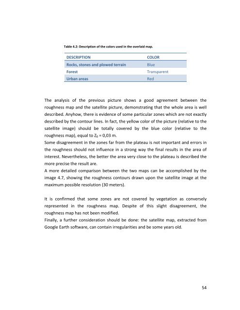
Table 4.2: Description <strong>of</strong> the colors used <strong>in</strong> the overlaid map.DESCRIPTIONRocks, stones and plowed terra<strong>in</strong>ForestUrban areasCOLORBlueTransparentRedThe analysis <strong>of</strong> the previous picture shows a good agreement between theroughness map and the satellite picture, demonstrat<strong>in</strong>g that the whole area is welldescribed. Anyhow, there is evidence <strong>of</strong> some particular zones which are not exactlydescribed by the contour l<strong>in</strong>es. In fact, the yellow color <strong>of</strong> the picture (relative to thesatellite image) should be totally covered by the blue color (relative to theroughness map), equal to Z 0 = 0,03 m.Some disagreement <strong>in</strong> the zones far from the plateau is not important and errors <strong>in</strong>the roughness should not <strong>in</strong>fluence <strong>in</strong> a strong way the f<strong>in</strong>al results <strong>in</strong> the area <strong>of</strong><strong>in</strong>terest. Nevertheless, the better the area very close to the plateau is described themore precise the result are.A more detailed comparison between the two maps can be accomplished by theimage 4.7, show<strong>in</strong>g the roughness contours drawn upon the satellite image at themaximum possible resolution (30 meters).It is confirmed that some zones are not covered by vegetation as converselyrepresented <strong>in</strong> the roughness map. Despite <strong>of</strong> this slight disagreement, theroughness map has not been modified.F<strong>in</strong>ally, a further consideration should be done: the satellite map, extracted fromGoogle Earth s<strong>of</strong>tware, can conta<strong>in</strong> irregularities and be some years old.54


