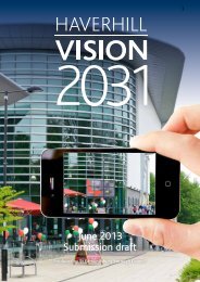
St Edmundsbury Core Strategy (December 2010)
St Edmundsbury Core Strategy (December 2010)
St Edmundsbury Core Strategy (December 2010)

You also want an ePaper? Increase the reach of your titles
YUMPU automatically turns print PDFs into web optimized ePapers that Google loves.
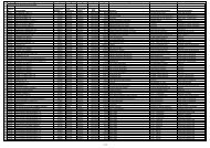
Natural and Historic Environment2.18 Within the borough there are a number of internationally, nationally andlocally important nature conservation sites. Special Landscape Areas cover theLark Valley, the Brecks, and the area south of Bury <strong>St</strong> Edmunds. There are twoSpecial Areas of Conservation (SACs) within the Borough (Breckland SAC andWaveney and Little Ouse Valley Fens SAC). In addition to these, the importantnatural environment sites include the historic parks and gardens at Culford,Euston, Ickworth and the Abbey Gardens and Precincts in Bury <strong>St</strong> Edmunds, andcounty and local wildlife sites. The borough also has a range of assets in terms ofthe built environment and these will continue to be preserved and enhanced.2.19 However, it is recognised that there are shortfalls in open space provision insome areas of the borough. A Recreational Open Space Assessment prepared forthe Council in 2005 initially highlighted this and the Green Infrastructure <strong>St</strong>udy(2009) undertaken to support the <strong>Core</strong> <strong>St</strong>rategy emphasises that open space isstill lacking in some parts of the borough. In partnership with all district andborough councils in Suffolk, in 2009 the County Council published a SuffolkLandscape Character Assessment in order to assist with the review andreplacement of local countryside designations. The landscape character typesidentified around <strong>St</strong> <strong>Edmundsbury</strong> include undulating estate farmland and ancientfarmland to the south and estates and lands to the north-west and plateau estatefarmland to the north-east.2.20 As Table 2.2 and Map 2.1 show, large areas of the Borough are covered byan environmental designation:Table 2.2 <strong>St</strong> <strong>Edmundsbury</strong> Environmental DesignationsArea TypeApproximate Size ofArea (ha)% ofBoroughSpecial Protection Area 3,473.00 5.3%Sites of Special ScientificInterest (SSSI)5,449.58 8.3%National Nature Reserve 169.99 0.25%Special Landscape Area 16,687.52 25.5%Special Area of Conservation 256.67 0.39Total Borough 65,450.002.21 These figures show that over 30% of the borough is either within a SpecialProtection Area or Special Landscape Area, and in addition, 8.3% of the boroughis within a Site of Special Scientific Interest (although designated areas mayoverlap). There is also one Regionally Important Geological Site (RIGS) atThelnetham called Bugg‟s Hole Fen.2.22 Bury <strong>St</strong> Edmunds is an exceptional historic town both in the region, and inthe national context. Laid out in the 12 th century as a medieval planned town ithas an exceptional range of historic buildings from early timber framed structuresto buildings of the later periods, especially from the Georgian period, and also theVictorian period. Its rich collection of built heritage and archaeology survives19