Appendix B: Historic Maps of the Conservation Area
Appendix B: Historic Maps of the Conservation Area
Appendix B: Historic Maps of the Conservation Area
- No tags were found...

You also want an ePaper? Increase the reach of your titles
YUMPU automatically turns print PDFs into web optimized ePapers that Google loves.
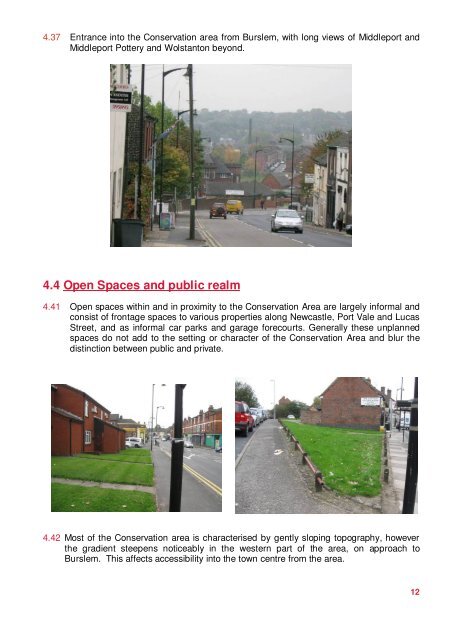
4.37 Entrance into <strong>the</strong> <strong>Conservation</strong> area from Burslem, with long views <strong>of</strong> Middleport andMiddleport Pottery and Wolstanton beyond.4.4 Open Spaces and public realm4.41 Open spaces within and in proximity to <strong>the</strong> <strong>Conservation</strong> <strong>Area</strong> are largely informal andconsist <strong>of</strong> frontage spaces to various properties along Newcastle, Port Vale and LucasStreet, and as informal car parks and garage forecourts. Generally <strong>the</strong>se unplannedspaces do not add to <strong>the</strong> setting or character <strong>of</strong> <strong>the</strong> <strong>Conservation</strong> <strong>Area</strong> and blur <strong>the</strong>distinction between public and private.4.42 Most <strong>of</strong> <strong>the</strong> <strong>Conservation</strong> area is characterised by gently sloping topography, however<strong>the</strong> gradient steepens noticeably in <strong>the</strong> western part <strong>of</strong> <strong>the</strong> area, on approach toBurslem. This affects accessibility into <strong>the</strong> town centre from <strong>the</strong> area.12