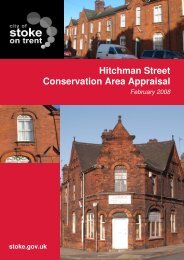
Appendix B: Historic Maps of the Conservation Area
Appendix B: Historic Maps of the Conservation Area
Appendix B: Historic Maps of the Conservation Area
- No tags were found...

You also want an ePaper? Increase the reach of your titles
YUMPU automatically turns print PDFs into web optimized ePapers that Google loves.
A declining image that creates poor perceptions <strong>of</strong> public safety, discouraging peoplefrom using and enjoying <strong>the</strong> area during <strong>the</strong> day and night timeContinued impact upon <strong>the</strong> character <strong>of</strong> <strong>the</strong> area by vehicles and increases invehicular traffic associated with regeneration proposals in <strong>the</strong> Middleport area, but alsomore widelyProposed redevelopment in proximity to <strong>the</strong> <strong>Conservation</strong> <strong>Area</strong>, most notably <strong>the</strong>Shirley Street and Wood’s Pottery regeneration sitesContinued lack <strong>of</strong> investment in public spaces and <strong>the</strong> street environment that willmake <strong>the</strong> area even less attractive to private investment39