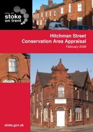
Appendix B: Historic Maps of the Conservation Area
Appendix B: Historic Maps of the Conservation Area
Appendix B: Historic Maps of the Conservation Area
- No tags were found...

Create successful ePaper yourself
Turn your PDF publications into a flip-book with our unique Google optimized e-Paper software.
4.43 On <strong>the</strong> opposite side <strong>of</strong> Newcastle Street to <strong>the</strong> <strong>Conservation</strong> <strong>Area</strong> <strong>the</strong>re are significantareas <strong>of</strong> open frontage and several street-end spaces created from stopped <strong>of</strong>f streetsor to define corners, such as those at Ellgreave Street and Dale Street, where designedpublic realm has been created. Cumulatively <strong>the</strong> frontage spaces, forecourts and smallareas <strong>of</strong> designed public realm create a fragmented character to this side <strong>of</strong> <strong>the</strong> street,which is far less cohesive compared to <strong>the</strong> sou<strong>the</strong>rn side.4.44 A modest area <strong>of</strong> space at <strong>the</strong> Trubshaw Cross junction, in front <strong>of</strong> Ivy House ispresently excluded from <strong>the</strong> <strong>Conservation</strong> <strong>Area</strong> boundary but it does helps to green thishighway dominated entrance to <strong>the</strong> <strong>Conservation</strong> <strong>Area</strong>.4.45 At <strong>the</strong> eastern end <strong>of</strong> <strong>the</strong> <strong>Conservation</strong> <strong>Area</strong>, <strong>the</strong> townscape grain is looser as aconsequence <strong>of</strong> <strong>the</strong> substantial plots associated with <strong>the</strong> Gymnastics centre andPortland House, which also contain mature trees. This greens <strong>the</strong> gateway and frames<strong>the</strong> long view into and beyond <strong>the</strong> <strong>Conservation</strong> <strong>Area</strong>.4.46 In general terms <strong>the</strong> public realm within <strong>the</strong> <strong>Conservation</strong> <strong>Area</strong> is in poor condition.Surfaces are generally <strong>of</strong> poor quality and in a poor state <strong>of</strong> repair and <strong>the</strong>re is an uncoordinatedand unsympa<strong>the</strong>tic approach to street furniture. It has a fragmented and tiredcharacter that typifies <strong>the</strong> lack <strong>of</strong> sustained investment in <strong>the</strong> area. Recently installedstreet lighting is distinct in its design but its scale, placement and frequency overlydominates <strong>the</strong> street environment and is geared more to creating safe conditions formotorists ra<strong>the</strong>r than pedestrians.4.47 Extensive guard railing is installed in proximity to <strong>the</strong> pedestrian crossing outside <strong>the</strong>Co-op foodstore. This serves to fur<strong>the</strong>r emphasise <strong>the</strong> vehicle dominance in <strong>the</strong> areaand reinforces impressions that it is an unsafe environment for pedestrians.4.48 In <strong>the</strong> future, as part <strong>of</strong> <strong>the</strong> uplift <strong>of</strong> <strong>the</strong> area, <strong>the</strong>re is a need for significant investment in<strong>the</strong> area’s public realm to re-balance <strong>the</strong> street for pedestrians and help to improve <strong>the</strong>attractiveness and functionality <strong>of</strong> <strong>the</strong> area as a local centre4.49 There are some vacant/underused Brownfield sites and open spaces within <strong>the</strong><strong>Conservation</strong> <strong>Area</strong> that would be better served if <strong>the</strong>y were re-developed or treatedsensitively to fur<strong>the</strong>r enhance <strong>the</strong> townscape.4.5 Floorscape4.51 There is little evidence <strong>of</strong> traditional paving materials in <strong>the</strong> <strong>Conservation</strong> <strong>Area</strong>. On <strong>the</strong>sou<strong>the</strong>rn side <strong>of</strong> Newcastle Street, immediately outside and to <strong>the</strong> west <strong>of</strong> <strong>the</strong> 3 storeyshopping parade is a section <strong>of</strong> pavement made up <strong>of</strong> concrete paving slabs withmacadam repairs and some concrete rainwater gulleys associated with down pipes onbuildings, Elsewhere <strong>the</strong> surface is predominantly macadam, with some more recentlylaid areas. Pavements including concrete service and utility covers. Outside <strong>the</strong> newerSteelite building <strong>the</strong> widened pavement comprises herringbone brick paviers and blackbollards.4.52 There are remnants <strong>of</strong> stone sett gulley edges along parts <strong>of</strong> Newcastle Street andsome side streets. Concrete kerbing defines <strong>the</strong> carriageway edge along NewcastleStreet and on side streets, Blister paving is widely used on more recently surfacedpavements to define pedestrian crossing points. In proximity to Reid Street, apedestrian central refuge has been created in Newcastle Street comprising plasticinternally illuminated highway bollards and blister paving.13