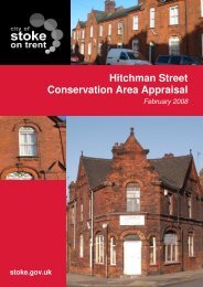
Appendix B: Historic Maps of the Conservation Area
Appendix B: Historic Maps of the Conservation Area
Appendix B: Historic Maps of the Conservation Area
- No tags were found...

You also want an ePaper? Increase the reach of your titles
YUMPU automatically turns print PDFs into web optimized ePapers that Google loves.
List <strong>of</strong> <strong>Maps</strong>MAP 1: Yates 1775 map <strong>of</strong> <strong>the</strong> area (www.<strong>the</strong>potteries.org)MAP 2: Map showing <strong>the</strong> location <strong>of</strong> <strong>the</strong> <strong>Conservation</strong> <strong>Area</strong>.MAP 3 Map from 1832 showing <strong>the</strong> Canal and <strong>the</strong> relatively undeveloped <strong>Conservation</strong><strong>Area</strong>. (www.<strong>the</strong>potteries.org)MAP 4 Townscape Appraisal 1: viewsMAP 5 Townscape Appraisal 2: Open Spaces, Trees, Green EdgesMAP 6:.Townscape Appraisal 2: Development and Enhancement Opportunities2