Appendix B: Historic Maps of the Conservation Area
Appendix B: Historic Maps of the Conservation Area
Appendix B: Historic Maps of the Conservation Area
- No tags were found...

Create successful ePaper yourself
Turn your PDF publications into a flip-book with our unique Google optimized e-Paper software.
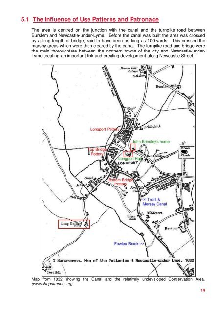
5.1 The Influence <strong>of</strong> Use Patterns and PatronageThe area is centred on <strong>the</strong> junction with <strong>the</strong> canal and <strong>the</strong> turnpike road betweenBurslem and Newcastle-under-Lyme. Before <strong>the</strong> canal was built <strong>the</strong> area was crossedby a long length <strong>of</strong> bridge, said to have been as long as 100 yards. This crossed <strong>the</strong>marshy areas which were <strong>the</strong>n cleared by <strong>the</strong> canal. The turnpike road and bridge were<strong>the</strong> main thoroughfare between <strong>the</strong> nor<strong>the</strong>rn towns <strong>of</strong> <strong>the</strong> city and Newcastle-under-Lyme creating an important link and creating development along Newcastle Street.Map from 1832 showing <strong>the</strong> Canal and <strong>the</strong> relatively undeveloped <strong>Conservation</strong> <strong>Area</strong>.(www.<strong>the</strong>potteries.org)14