Don Field Decommissioning Programme (pdf, 7.8MB) null - BP
Don Field Decommissioning Programme (pdf, 7.8MB) null - BP
Don Field Decommissioning Programme (pdf, 7.8MB) null - BP
Create successful ePaper yourself
Turn your PDF publications into a flip-book with our unique Google optimized e-Paper software.
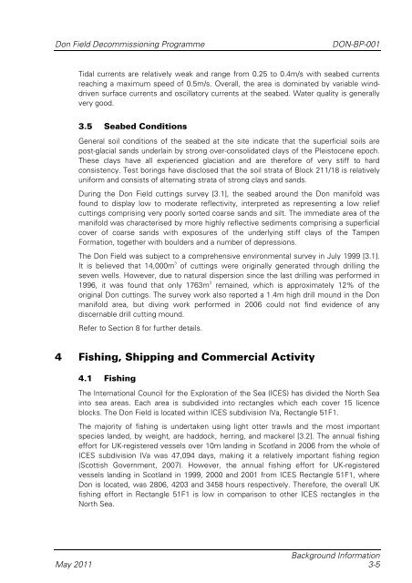
<strong>Don</strong> <strong>Field</strong> <strong>Decommissioning</strong> <strong>Programme</strong>DON-<strong>BP</strong>-001Tidal currents are relatively weak and range from 0.25 to 0.4m/s with seabed currentsreaching a maximum speed of 0.5m/s. Overall, the area is dominated by variable winddrivensurface currents and oscillatory currents at the seabed. Water quality is generallyvery good.3.5 Seabed ConditionsGeneral soil conditions of the seabed at the site indicate that the superficial soils arepost-glacial sands underlain by strong over-consolidated clays of the Pleistocene epoch.These clays have all experienced glaciation and are therefore of very stiff to hardconsistency. Test borings have disclosed that the soil strata of Block 211/18 is relativelyuniform and consists of alternating strata of strong clays and sands.During the <strong>Don</strong> <strong>Field</strong> cuttings survey [3.1], the seabed around the <strong>Don</strong> manifold wasfound to display low to moderate reflectivity, interpreted as representing a low reliefcuttings comprising very poorly sorted coarse sands and silt. The immediate area of themanifold was characterised by more highly reflective sediments comprising a superficialcover of coarse sands with exposures of the underlying stiff clays of the TampenFormation, together with boulders and a number of depressions.The <strong>Don</strong> <strong>Field</strong> was subject to a comprehensive environmental survey in July 1999 [3.1].It is believed that 14,000m 3of cuttings were originally generated through drilling theseven wells. However, due to natural dispersion since the last drilling was performed in1996, it was found that only 1763m 3 remained, which is approximately 12% of theoriginal <strong>Don</strong> cuttings. The survey work also reported a 1.4m high drill mound in the <strong>Don</strong>manifold area, but diving work performed in 2006 could not find evidence of anydiscernable drill cutting mound.Refer to Section 8 for further details.4 Fishing, Shipping and Commercial Activity4.1 FishingThe International Council for the Exploration of the Sea (ICES) has divided the North Seainto sea areas. Each area is subdivided into rectangles which each cover 15 licenceblocks. The <strong>Don</strong> <strong>Field</strong> is located within ICES subdivision IVa, Rectangle 51F1.The majority of fishing is undertaken using light otter trawls and the most importantspecies landed, by weight, are haddock, herring, and mackerel [3.2]. The annual fishingeffort for UK-registered vessels over 10m landing in Scotland in 2006 from the whole ofICES subdivision IVa was 47,094 days, making it a relatively important fishing region(Scottish Government, 2007). However, the annual fishing effort for UK-registeredvessels landing in Scotland in 1999, 2000 and 2001 from ICES Rectangle 51F1, where<strong>Don</strong> is located, was 2806, 4203 and 3458 hours respectively. Therefore, the overall UKfishing effort in Rectangle 51F1 is low in comparison to other ICES rectangles in theNorth Sea.Background InformationMay 2011 3-5



![[PDF] Deepwater Horizon: Accident Investigation Report - BP](https://img.yumpu.com/51697031/1/190x245/pdf-deepwater-horizon-accident-investigation-report-bp.jpg?quality=85)
