- Page 3 and 4: Wells National Estuarine Research R
- Page 5 and 6: Table of ContentsAcknowledgments..
- Page 7 and 8: Representation on the Reserve Manag
- Page 9 and 10: Objectives and Strategies.. . . . .
- Page 11 and 12: XIII. Volunteer Plan.. . . . . . .
- Page 14 and 15: xiiWells National Estuarine Researc
- Page 16 and 17: I. OverviewIntroduction to the Rese
- Page 18 and 19: Exhibits and Interpretive Trails; P
- Page 20 and 21: The Wells Reserve requires specific
- Page 22 and 23: II. IntroductionThe Value of Estuar
- Page 24 and 25: Figure II.3. Biogeographic regions
- Page 26 and 27: 1.2.3.Address coastal management is
- Page 28 and 29: Department of of CommerceNational O
- Page 30 and 31: 16 Wells National Estuarine Researc
- Page 32 and 33: III. Wells NERR SettingPhysical Set
- Page 34 and 35: Figure III.3. The two principal wat
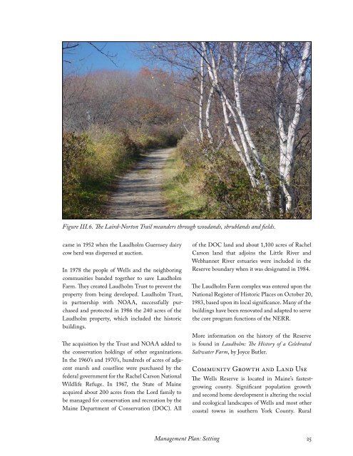
- Page 36 and 37: Wells Reserve campus and adjacent s
- Page 40 and 41: landscapes are assuming a suburban
- Page 43 and 44: IV. Strategic Plan29
- Page 45 and 46: Objective 2: Optimize educational u
- Page 47 and 48: V. Accomplishments33
- Page 49 and 50: Figure V.2. Chris Feurt, the CTP Co
- Page 51 and 52: Figure V.4. The barn complex was co
- Page 53 and 54: ◊With partners (U.S. Fish and Wil
- Page 55 and 56: VI. Administration41
- Page 57 and 58: RMAManagerEducationResearch & Stewa
- Page 59 and 60: ◊The York County Audubon Society,
- Page 61 and 62: The Reserve Manager serves as the c
- Page 63 and 64: Figure VI.4. An October sunrise gra
- Page 65 and 66: VII. Facilities andConstruction51
- Page 67 and 68: ◊Make facilities available to par
- Page 69 and 70: Figure VII.2. The Reserved Life Est
- Page 71 and 72: Killing House (early 1900’s)This
- Page 73 and 74: Estate and are currently privately
- Page 75 and 76: VIII. Public Access61
- Page 77 and 78: Figure VIII.2. An artist at work by
- Page 79 and 80: Figure VIII.4. A family enjoys a wa
- Page 81 and 82: IX. Education and Outreach67
- Page 83 and 84: Strategies◊ Work with partners to
- Page 85 and 86: K-12 EducationThe Wells Reserve edu
- Page 87 and 88: signs of wildlife, water quality mo
- Page 89 and 90:
irds, beach exploration, seasonal m
- Page 91 and 92:
X. Research and Monitoring77
- Page 93 and 94:
Figure X.1. Jeremy Miller (right) a
- Page 95 and 96:
System-wide Monitoring ProgramThe N
- Page 97 and 98:
tions concerning the sustainability
- Page 99 and 100:
permit, the Research Department als
- Page 101 and 102:
XI. Stewardship87
- Page 103 and 104:
◊◊◊◊◊Protect pristine hab
- Page 105 and 106:
Reserve cooperates with the followi
- Page 107 and 108:
will monitor this site (and others
- Page 109 and 110:
Figure XI.6. The Wells Reserve Stew
- Page 111 and 112:
XII. Reserve Boundary andAcquisitio
- Page 113 and 114:
Proposed Changes to the Reserve and
- Page 115 and 116:
Figure XII.2 (top): The main stems
- Page 117 and 118:
By expanding its boundary the Wells
- Page 119 and 120:
forests, and wetlands. It has habit
- Page 121 and 122:
Conservation EasementThe Wells Rese
- Page 123 and 124:
XIII. Volunteers109
- Page 125 and 126:
Figure XIII.1. Beach Profiling volu
- Page 127 and 128:
XIV. Communications113
- Page 129 and 130:
images, and cultivates interest in
- Page 131 and 132:
AppendicesAppendix A: Memoranda of
- Page 133 and 134:
Appendix A: Memoranda ofUnderstandi
- Page 135 and 136:
Appendix A-1Management Plan: Append
- Page 137 and 138:
Appendix A-1Management Plan: Append
- Page 139 and 140:
Appendix A-2Management Plan: Append
- Page 141 and 142:
Management Plan: Appendix A127
- Page 143 and 144:
Appendix A-3Management Plan: Append
- Page 145 and 146:
Management Plan: Appendix A131
- Page 147 and 148:
Appendix A-4Management Plan: Append
- Page 149 and 150:
Appendix A-5Management Plan: Append
- Page 151 and 152:
Appendix A-6Management Plan: Append
- Page 153 and 154:
Appendix A-6Management Plan: Append
- Page 155 and 156:
Appendix B: ConservationEasementsMa
- Page 157 and 158:
Appendix B-1Management Plan: Append
- Page 159 and 160:
Appendix B-1Management Plan: Append
- Page 161 and 162:
Appendix B-1Management Plan: Append
- Page 163 and 164:
Appendix B-1Management Plan: Append
- Page 165 and 166:
Appendix B-1Management Plan: Append
- Page 167 and 168:
Management Plan: Appendix B153
- Page 169 and 170:
Appendix B-2Management Plan: Append
- Page 171 and 172:
Appendix B-2Management Plan: Append
- Page 173 and 174:
Appendix B-2Management Plan: Append
- Page 175 and 176:
Appendix B-2Management Plan: Append
- Page 177 and 178:
Appendix B-2Management Plan: Append
- Page 179 and 180:
Appendix C: State of MaineLegislati
- Page 181 and 182:
Appendix C-1Management Plan: Append
- Page 183 and 184:
Appendix C-1Management Plan: Append
- Page 185 and 186:
Management Plan: Appendix C171
- Page 187 and 188:
Appendix C-2Management Plan: Append
- Page 189 and 190:
Appendix D: Rules forPublic UseMana
- Page 191 and 192:
Appendix Das part of the Reserve. T
- Page 193 and 194:
Appendix D(a) No person shall remov
- Page 195 and 196:
Appendix D(a) Third through fifth g
- Page 197 and 198:
Appendix E: NaturalResource LawsMan
- Page 199 and 200:
Appendix Ecomponents of the Program
- Page 201 and 202:
Appendix Eability of these areas to
- Page 203 and 204:
Appendix ETowns experiencing less g
- Page 205 and 206:
Appendix Emust be in place before a
- Page 207 and 208:
Appendix F: FederalRegulations—NE
- Page 209 and 210:
Appendix Ffor resource management p
- Page 211 and 212:
Appendix F(b) The biogeographic cla
- Page 213 and 214:
Appendix Fzone. Key land and water
- Page 215 and 216:
Appendix Fminor construction projec
- Page 217 and 218:
Appendix Finterests therein, for an
- Page 219 and 220:
Appendix Fagencies and/or private o
- Page 221 and 222:
Appendix Fand the additional compon
- Page 223 and 224:
Appendix FResearch Reserve System.(
- Page 225 and 226:
Appendix FDC 20235. The following m
- Page 227 and 228:
Appendix FThis typology system refl
- Page 229 and 230:
Appendix Fthe boring clam Playdon,
- Page 231 and 232:
Appendix FC. Inlet type. Inlets in
- Page 233 and 234:
Appendix FB. pH Regime: This is ind
- Page 235 and 236:
Appendix G:CZMA—Section 315Manage
- Page 237 and 238:
Appendix GIn developing the guideli
- Page 239 and 240:
Appendix H:Wells National Estuarine
- Page 241:
Appendix HWells National Estuarine