


Create successful ePaper yourself
Turn your PDF publications into a flip-book with our unique Google optimized e-Paper software.
type of area over time. The focus of this study is to determine the value of<br />
cropping raster imagery based on small area polygons so as to automatically<br />
detect values in the image, so the specifics of the type of bog or other factors<br />
which can be determined from further processing have not been developed, save<br />
to flag the necessary properties (i.e. The spectral values set in the sampling section<br />
and identified in this sample, and the area property of being larger than four<br />
hectares –which eliminates all other probable land cover types).<br />
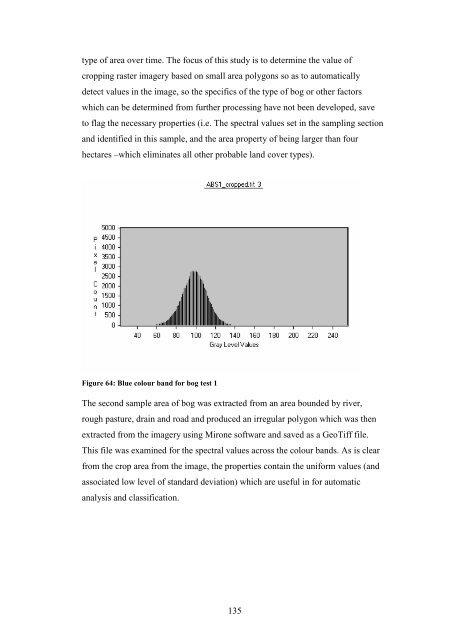
Figure 64: Blue colour band for bog test 1<br />
The second sample area of bog was extracted from an area bounded by river,<br />
rough pasture, drain and road and produced an irregular polygon which was then<br />
extracted from the imagery using Mirone software and saved as a GeoTiff file.<br />
This file was examined for the spectral values across the colour bands. As is clear<br />
from the crop area from the image, the properties contain the uniform values (and<br />
associated low level of standard deviation) which are useful in for automatic<br />
analysis and classification.<br />
135


