- Page 1 and 2:
TOWN OF MILTON The ONE HUNDRED SEVE
- Page 3 and 4:
TOWN OF MILTON The ONE HUNDRED SEVE
- Page 5:
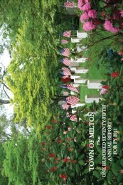
EXPLANATION OF COVER ART In 2009, t
- Page 8 and 9:
Police Department . . . . . . . . .
- Page 10 and 11:
TRUSTEES OF THE PUBLIC LIBRARY Hyac
- Page 12 and 13:
PRECINCT TWO TERM EXPIRES APRIL 201
- Page 14 and 15:
PRECINCT FOUR TERM EXPIRES APRIL 20
- Page 16 and 17:
PRECINCT SIX TERM EXPIRES APRIL 201
- Page 18 and 19:
PRECINCT EIGHT TERM EXPIRES APRIL 2
- Page 20 and 21:
PRECINCT TEN TERM EXPIRES APRIL 201
- Page 22 and 23:
TOWN OFFICERS OF MILTON APPOINTED B
- Page 24 and 25:
Business and Citizens Advisory Comm
- Page 26 and 27:
Cultural Council DAVID DEMARCO, 303
- Page 28 and 29:
APPOINTED BY THE BOARD OF HEALTH Ag
- Page 30 and 31:
LEGISLATIVE COMMITTEE (Article 5 of
- Page 33 and 34:
Town Records 31
- Page 35 and 36:
2009 SPECIAL TOWN MEETING WARRANT C
- Page 37 and 38:
PRECINCT THREE: PRECINCT FOUR: PREC
- Page 39 and 40:
Town Meeting Members stood for a mo
- Page 41 and 42:
Commonwealth of Massachusetts) SS.
- Page 43 and 44:
Given under our hands at Milton thi
- Page 45 and 46:
PRECINCT 1 2 3 4 5 6 7 8 9 10 11 TO
- Page 47 and 48:
STATISTICS APRIL 28, 2009 - ANNUAL
- Page 49 and 50:
PRECINCT 6 Vote for Not More Than N
- Page 51 and 52:
PRECINCT OFFICERS - APRIL 28, 2009
- Page 53 and 54:
ADJOURNED TOWN MEETING MAY 4, 2009
- Page 55 and 56:
ARTICLE 2 To see if the Town will v
- Page 57 and 58:
VOTED. The Town voted to appropriat
- Page 59 and 60:
public safety personnel resulting f
- Page 61 and 62:
TOWN CLERK 6 Assistant Town Clerk 4
- Page 63 and 64:
Craftsman, Motor Equipment Operator
- Page 65 and 66:
Motor Equipment Repairman-Helper, A
- Page 67 and 68:
VOTED. The Town voted to appropriat
- Page 69 and 70:
ADJOURNED TOWN MEETING MAY 5, 2009
- Page 71 and 72:
The Board of Selectmen and Conserva
- Page 73 and 74:
B. BOARD OF ASSESSORS Salary - Chai
- Page 75 and 76:
ARTICLE 19 To see what sum of money
- Page 77 and 78:
ARTICLE 20 To see what sum of money
- Page 79 and 80:
Non Contingent Contingent Approp. A
- Page 81 and 82:
Town Meeting Member M. Joseph Manni
- Page 83 and 84:
PRECINCT SIX: PRECINCT SEVEN: PRECI
- Page 85 and 86:
Marjorie S. Jeffries Brian M. Scott
- Page 87 and 88:
pose of providing inspection servic
- Page 89 and 90:
VOTED. The Town voted to continue t
- Page 91 and 92:
site and by a study concluding that
- Page 93 and 94:
and green of a golf course. Distanc
- Page 95 and 96:
efficiently generates the desired a
- Page 97 and 98:
(e) Elevations accurately depicting
- Page 99 and 100:
ARTICLE 46. To see if the Town will
- Page 101 and 102:
(3) Buildings (a) Gross Floor Area.
- Page 103 and 104:
stances. If a particular use is spe
- Page 105 and 106:
ARTICLE 50 To see if the Town will
- Page 107 and 108:
For these purposes the polls will b
- Page 109 and 110:
STATISTICS June 8, 2009 - SPECIAL T
- Page 111 and 112:
PRECINCT SIX Lucas J. McGary, Warde
- Page 113 and 114:
2009 SPECIAL TOWN MEETING WARRANT C
- Page 115 and 116:
James May Robert J. Rota Robert J.
- Page 117 and 118:
Town Meeting Vote Current Reduction
- Page 119 and 120:
ARTICLE 2 To see if the Town will v
- Page 121 and 122:
Given under our hands at Milton thi
- Page 123 and 124:
STATISTIC - DECEMBER 8, 2009 SPECIA
- Page 125 and 126:
Edith L. Chase, Clerk John F. Flemi
- Page 127 and 128:
Department Reports 125
- Page 129 and 130:
REPORT OF THE BOARD OF APPEALS To t
- Page 131 and 132:
TOTAL ESTIMATED CHARGES, FISCAL 200
- Page 133 and 134:
EXCISE TAX 2009 BOAT EXCISE COMMITT
- Page 135 and 136:
The Auxiliary accepted one new memb
- Page 137 and 138:
REPORT OF THE CEMETERY TRUSTEES To
- Page 139 and 140:
REPORT OF THE COUNCIL ON AGING To T
- Page 141 and 142:
ask that you call to schedule an ap
- Page 143 and 144:
Name Title Start Date End Date DeMa
- Page 145 and 146:
The Milton Cultural Council will be
- Page 147 and 148:
REPORT OF THE HEALTH DIRECTOR To th
- Page 149 and 150:
Public Health Outreach Our efforts
- Page 151 and 152:
with state immunization requirement
- Page 153 and 154:
REPORT OF THE MILTON HISTORICAL COM
- Page 155 and 156:
REPORT OF THE MILTON HOUSING AUTHOR
- Page 157 and 158:
BUILDING INSPECTIONAL SERVICES ANNU
- Page 159 and 160:
I wish to extend to the Honorable B
- Page 161 and 162:
REPORT OF THE PUBLIC LIBRARY TRUSTE
- Page 163 and 164:
The Kidder Branch has again closed
- Page 165 and 166:
REPORT OF THE LIBRARY TREASURER To
- Page 167 and 168:
Hyde Park Bank Checking Account 200
- Page 169 and 170:
MAPC strives to make every major de
- Page 171 and 172:
house gas emissions through a great
- Page 173 and 174:
Although town funding for the popul
- Page 175 and 176:
eighth annual Easter Egg hunt at Pi
- Page 177 and 178:
REPORT OF THE PERSONNEL BOARD To th
- Page 179 and 180:
REPORT OF THE PLANNING BOARD To the
- Page 181 and 182:
REPORT OF THE POLICE DEPARTMENT To
- Page 183 and 184:
REPORT OF THE PUBLIC WORKS DEPARTME
- Page 185 and 186:
Engineering Design - Design was com
- Page 187 and 188:
all temperatures were near or above
- Page 189 and 190:
coordinated repairs with the Town
- Page 191 and 192:
FY09 SOLID WASTE REVENUES Trash Sti
- Page 193 and 194:
REPORT OF THE BOARD OF RETIREMENT T
- Page 195 and 196:
DISBURSEMENTS 1 Annuity Savings Fun
- Page 197 and 198:
INVESTMENT INCOME/(LOSS) Investment
- Page 199 and 200:
est tax and communities with a resi
- Page 201 and 202:
Kevin G. Sorgi, Police Department a
- Page 203 and 204:
The Board of Selectmen conducted pu
- Page 205 and 206:
REPORT OF TOWN COUNSEL To the Honor
- Page 207 and 208:
REPORT OF THE TRAFFIC COMMISSION To
- Page 209 and 210:
Financial Statements 207
- Page 211 and 212:
Town of Milton Statement of Revenue
- Page 213 and 214:
$54,000,000 $52,000,000 $50,000,000
- Page 215 and 216:
AT 06/30/09. SCHEDULE OF CAPITAL IM
- Page 217 and 218:
TOWN OF MILTON A =MWRA LOANS O% INT
- Page 219 and 220:
TOWN OF : MILTON COMBINED BALANCE S
- Page 221 and 222:
TOWN OF: BALANCE SHEET DETAIL AS OF
- Page 223 and 224:
TOWN OF: MILTON FISCAL 2009 - ANALY
- Page 225 and 226:
TOWN OF: MILTON - WATER/SEWER ENTER
- Page 227 and 228:
CEMETERY BEQUEST FUND Olive Adams B
- Page 229 and 230:
Joseph A. Hartigan. . . . . . . . .
- Page 231 and 232:
John A. Reilly Fund . . . . . . . .
- Page 233 and 234:
TRUST FUNDS CEMETERY PERPETUAL CARE
- Page 235 and 236:
COLLECTOR'S REPORT 2009 BALANCE COM
- Page 237 and 238:
School Reports 235
- Page 239 and 240:
tion of Advanced Placement Scholar
- Page 241 and 242: MILTON PUBLIC SCHOOLS MILTON, MASSA
- Page 243 and 244: Cunningham Elementary School: The C
- Page 245 and 246: Tucker Elementary School: The year
- Page 247 and 248: Pierce Middle School: We began the
- Page 249 and 250: • Judge Baker Program - a researc
- Page 251 and 252: • BC Calculus • 52 % of the stu
- Page 253 and 254: 4 days in Paris. Mme Laine organize
- Page 255 and 256: Our music department hosted the Eas
- Page 257 and 258: Paul Connor excelled at both indoor
- Page 259 and 260: The integrated classrooms are compo
- Page 261 and 262: In January, students and faculty fr
- Page 263 and 264: Pierce Middle School: Melissa Aceve
- Page 265 and 266: Blue Hills Regional students partic
- Page 267 and 268: post-secondary and apprenticeship p
- Page 269 and 270: Special Committee 267
- Page 271 and 272: Mass General Laws Chapter 29: Secti
- Page 273 and 274: REPORT OF THE WARRANT COMMITTEE FOR
- Page 275 and 276: Under Governor Deval Patrick’s pr
- Page 277 and 278: equest but ultimately rejected it.
- Page 279 and 280: ing voted to transfer funds from th
- Page 281 and 282: partmental impacts we added another
- Page 283 and 284: II. Non-Budget Articles. A. Bylaw A
- Page 285 and 286: idated facilities department. Witho
- Page 287 and 288: REPORT OF THE WARRANT COMMITTEE FOR
- Page 289 and 290: costs exceed the $700,000 estimate.
- Page 291: the State still remains tenuous. Th