

Lake Erie North Shore Watershed Plan - Niagara Peninsula ...
Lake Erie North Shore Watershed Plan - Niagara Peninsula ...
Lake Erie North Shore Watershed Plan - Niagara Peninsula ...

You also want an ePaper? Increase the reach of your titles
YUMPU automatically turns print PDFs into web optimized ePapers that Google loves.
LAKE ERIE NORTH SHORE WATERSHED PLAN<br />
Reeb‟s Bay is east from Rathfon Point to the next rock outcrop is (unnamed). The beach<br />
widens and consistency is mainly sand with some gravel. Aside from a small portion, the<br />
entire shoreline is protected by a number of structures; primarily a seawall. A major dune<br />
system occupies the backshore area in this reach. The dune system is lower at the west<br />
end, rising to elevations about 180m and to 190m at the east end. The dunes in this area<br />
are generally vegetated. Beach access can be obtained by steps that run down the face<br />
of the dune.<br />
East into the next small bay, the dune system reaches an elevation of approximately 215<br />
metres above sea level (masl), and then drops quickly before reaching the headland of<br />
Gravelly Bay. East of the headland, dunes continue to reach significant heights in the<br />
western portion of Gravelly Bay, with an elevation of approximately 185 masl. Bedrock is<br />
visible along the shore throughout most of the bay. Gravelly Bay marks the western<br />
edge of Port Colborne‟s built-up area. Land use in this area consists primarily of<br />
residential, commercial and industrial. Due to the presence of the Welland Canal on the<br />
eastern end of the bay, this portion of the shoreline is entirely man-made and natural<br />
coastal processes have been altered. Numerous shore protection structures are in place<br />
to protect the shoreline.<br />
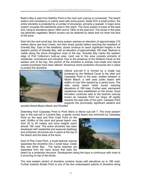
Littoral sub-cell 6 is formed by a single bay<br />
bordered by the Welland Canal to the west and<br />
Cassaday Point to the east; nestled between is<br />
Nickel Beach, a well used public beach with<br />
widths of over 40m backed by a sandy dune. The<br />
wide sandy beach holds dunes reaching<br />
elevations of 189 masl. Further east, permanent<br />
residences have established on the dunes. Dune<br />
formation continues east to the bedrock outcrop<br />
known as Cassady Point but drops off rapidly<br />
towards the east side of the point. Cassady Point<br />
supports the provincially significant wetland and<br />
woodlot Nickel Beach Marsh and Woodlot.<br />
Extending from Cassaday Point to Point Abino is littoral sub-cell 7. The most western<br />
bay in this sub-cell is Lorraine Bay, a gently curved beach bay anchored by Cassaday<br />
Point on the west and Pine Crest Point on the<br />
east. Widths of this sand and gravel beach vary<br />
from 20 to 40 meters and dune heights reach<br />
almost 190 masl. The entire shoreline has been<br />
developed with residential and seasonal dwellings<br />
and protection structures are in place at the top of<br />
the beach and the base of the dune.<br />
East of Pine Crest Point, a small bedrock outcrop<br />
separates the shoreline into 2 small bays; Cedar<br />
Bay and Silver Bay. The sandy beaches are<br />
separated from the sand dunes that back the<br />
beach by a protection structure. Development along the bays is continuous with most of<br />
it occurring on top of the dunes.<br />
The next eastern stretch of shoreline contains dunes with elevations up to 186 masl.<br />
Further towards Shisler Point is one of the few undeveloped extents of shoreline along<br />
29


