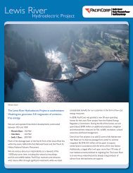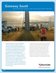
The Lewis River Hydroelectric Projects - PacifiCorp
The Lewis River Hydroelectric Projects - PacifiCorp
The Lewis River Hydroelectric Projects - PacifiCorp

Create successful ePaper yourself
Turn your PDF publications into a flip-book with our unique Google optimized e-Paper software.
<strong>Lewis</strong> <strong>River</strong> Interpretive & Education Plan<br />
Today, the signs of the <strong>Lewis</strong> <strong>River</strong>’s volcanic past are clearly visible, and volcanic<br />
bedrock and deposits play a large role in the valley’s hydrology and biology.<br />
Basalt outcrops occur throughout the valley (many are prominent along route<br />
503). Dense, light blue-gray embankments of volcanic mud and clay can be seen<br />
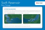
along the roadside and on hillsides. Some areas, such as the hillsides above Swift<br />
Reservoir, harbor lava tubes and channels that can create complex drainage<br />
patterns.<br />
Climate<br />
<strong>The</strong> <strong>Lewis</strong> <strong>River</strong> flows down the west slope of the Cascades, entering the<br />
Columbia <strong>River</strong> less than 100 miles from the Pacific. Moist air masses, pushing<br />
eastward from the ocean, encounter the wall of the Cascades and deflect upward.<br />
As the air rises, it cools, causing water vapor to condense into clouds that cloak<br />
the peaks—and rain and snow that inundate the valleys.<br />
Nestling like an open baseball glove in the path of Pacific rainstorms, the <strong>Lewis</strong><br />
<strong>River</strong> Basin scoops near-maximum potential precipitation from this air-land<br />
interaction. Higher elevations get the brunt of the orographic (mountaininduced)<br />
rain and snowfall. Near the mouth of the river, average annual<br />
precipitation is 37 inches, while at the higher elevations on Mt. Adams it can<br />
reach 140 inches. Most precipitation falls from November through March.<br />
<strong>The</strong> abundance of high-elevation precipitation in the <strong>Lewis</strong> <strong>River</strong> Basin translates<br />
into a massive amount of winter snow (snowfall can exceed 200 inches at<br />
elevations over 3000 feet), which has a strong influence on the hydrology of the<br />
<strong>Lewis</strong>. Snowmelt sustains the river through the dry summers, providing water<br />
for fish habitat, wetlands and wildlife. Winter warm spells and spring thaws bring<br />
rain-on-snow events that can quickly raise river levels.<br />
Temperatures in this moist land are mild. At lower elevations, average summer<br />
temperatures range from the 50s to the 70s, and average winter temperatures<br />
range from the 30s to the 40s. Temperatures are slightly cooler with increasing<br />
elevation.<br />
Vegetation<br />
Vegetation along the <strong>Lewis</strong> <strong>River</strong> varies greatly according to elevation, aspect,<br />
substrate and site history. Before the arrival of Euroamerican settlers, the<br />
valley was cloaked in dense forest of Douglas-fir, western red cedar, and<br />
western hemlock, with small “prairie” grasslands (possibly maintained by<br />
burning) and wetlands nestling in the river bottomlands. Today’s vegetation<br />
differs significantly from this original state; it is the result of over 100 years of<br />
homesteading, timber harvest, and development.<br />
Timber harvest has had an influence on the vegetation of the <strong>Lewis</strong> <strong>River</strong> Basin<br />
since the first logging companies were established in the 1890s. Today, nearly all<br />
of the forested lands along the river have been cut over at least once, and some,<br />
Sea Reach Ltd • 146 NE yamhill Street • Sheridan, OR draft 3 • November 2008 • page 57