The Lewis River Hydroelectric Projects - PacifiCorp
The Lewis River Hydroelectric Projects - PacifiCorp
The Lewis River Hydroelectric Projects - PacifiCorp

Create successful ePaper yourself
Turn your PDF publications into a flip-book with our unique Google optimized e-Paper software.
<strong>Lewis</strong> <strong>River</strong> Interpretive & Education Plan<br />
<strong>The</strong> Forest Service used the <strong>Lewis</strong> <strong>River</strong> Trail as access to remote operations in<br />
the upper <strong>Lewis</strong> <strong>River</strong> and beyond. <strong>The</strong>se operations included fire prevention,<br />
fire detection (the trail was a critical access line for regional fire lookouts), and<br />
recreation development.<br />
Today, the Forest Service continues to be a player in the story of the <strong>Lewis</strong> <strong>River</strong>.<br />
Much of the river’s upper watershed lies on National Forest lands, and many<br />
recreationists are drawn to the region by the nearby Mt. St. Helens National<br />
Volcanic Monument, administered by the Forest Service.<br />
Dams and Change<br />
Plans for creation of hydroelectric plants on the <strong>Lewis</strong> <strong>River</strong> began at the turn<br />
of the 20th century. In the 1920s, surveyors from Inland Light and Power (a<br />
predecessor of Pacific Power/<strong>PacifiCorp</strong>) began photographing the lands that<br />
would eventually be flooded by the Ariel Dam. Land agents worked to buy up<br />
the properties and homesteaders gradually moved out—some took up work on<br />
dam construction or supporting the new “town” that sprang up at Ariel, others<br />
to establish new farms or enterprises elsewhere.<br />
<strong>The</strong> <strong>Hydroelectric</strong> Story<br />
<strong>The</strong> building of Ariel Dam (now Merwin Dam) was just the beginning of the<br />
“electrification” of the <strong>Lewis</strong> <strong>River</strong>. Construction of the Merwin Dam began in<br />
1929 and was completed in 1931. Yale Dam was completed in 1953, and Swift<br />
Dam was completed in 1958. Plans for two other projects further upstream were<br />
never carried out.<br />
Hydro <strong>Projects</strong> of the<br />
<strong>Lewis</strong> <strong>River</strong><br />
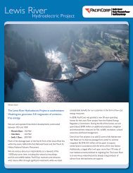
<strong>The</strong> three lakes of the <strong>Lewis</strong> <strong>River</strong>: Merwin, Yale, and Swift (and their associated<br />
reservoirs) are focal points of the valley. To many people, the lakes may seem<br />
like natural landscape elements; there are few places on the main roads from<br />
which the dams can be seen. For many, the lakes are seen primarily as recreation<br />
sites: great places to go waterskiing, fishing, swimming, camping, But these<br />
lakes are actually working reservoirs. All three were constructed for the primary<br />
purpose of supplying electricity. <strong>The</strong>y are all owned and operated (under a<br />
Federal Energy Regulatory Commission license) by <strong>PacifiCorp</strong> Energy, a power<br />
utility company. An additional hydroelectric facility, the Swift No. 2 Project<br />
canal between Swift Dam and Yale Lake, is owned by Cowlitz County PUD and<br />
operated by <strong>PacifiCorp</strong>.<br />
Merwin (Ariel) Project<br />
In the 1920s, Inland Light and Power (later to become Pacific Power and Light,<br />
and eventually <strong>PacifiCorp</strong>) began buying lands in the area above Shirt-tail<br />
Canyon, in the region that would eventually be flooded by Lake Merwin. This<br />
area had been settled at a medium density by homesteaders in the late 1800s;<br />
Sea Reach Ltd • 146 NE yamhill Street • Sheridan, OR draft 3 • November 2008 • page 67