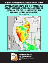
Guam Hazard Mitigation Plan - Western States Seismic Policy Council
Guam Hazard Mitigation Plan - Western States Seismic Policy Council
Guam Hazard Mitigation Plan - Western States Seismic Policy Council

Create successful ePaper yourself
Turn your PDF publications into a flip-book with our unique Google optimized e-Paper software.
SECTIONFOURIsland Descriptioncontains sinkholes, which are natural depressions in the ground caused by weathering processes.However, sinkholes also occur in the southern portion of the island.Five main vegetation-types are associated with the limestone soils of the area. Breadfruit andbanyan forests are generally widespread throughout the area; a Mammea forest occurs in theeastern escarpment of the northern limestone plateau; Cordia scrub-type forest dominates manysteep slopes and cliffs of the area; another forest-type is dominated by tall nunu; and a finalforest-type is dominated by aggag. The northern section of this ecoregion is operated asAndersen Air Force Base.The island of <strong>Guam</strong> is surrounded by living coral reefs. The waters around <strong>Guam</strong> are very deep;the Marianas Trench, the deepest part of the world’s oceans, is directly east of <strong>Guam</strong>. Low-lyingvegetated beaches are found in both the northern and the southern ecoregions of the island. Smallswamps, mangrove, and marsh areas are also found along coastal areas of <strong>Guam</strong>.4.3 CLIMATE<strong>Guam</strong> has a tropical climate, with year-round warm weather, dry and wet seasons, moderate tohigh humidity, and wind speed and direction that varies with its two seasons. Seasonaltemperatures vary approximately 5 degrees Fahrenheit (°F), with an annual average maximumtemperature of 86°F and an annual average minimum temperature of 76°F. The range oftemperature between day and night is approximately 15 to 20 °F. The wet season generally lastsfrom July to December; this season is characterized by an annual average high relative humidityof 86 percent and weak southeasterly or southerly winds. The dry season generally lasts fromJanuary to June; this season is characterized by an annual average low relative humidity of 71percent and “trade winds” from the northeast, though the trade winds do occur year-round.Average annual rainfall varies from about 80 inches in the central and coastal lowlands to up to110 inches on the uplands of southern <strong>Guam</strong>. A wide variation in rainfall can occur from year toyear. In 1952, for example, 145.5 inches of rainfall were recorded, and in 1997 parts of <strong>Guam</strong>received a similar amount of rainfall. In contrast, 60.42 inches of rainfall were recorded in 1955.Analysis of data collected since 1950 found annual rainfall to be approximately 100 inches,though in recent years, average rainfall has been about 86 inches per year.Generally, during the wet season a monsoon weather pattern has surges that can affect <strong>Guam</strong>with sustained western and southwestern winds of up to 45 miles per hour (mph) and 2 to 3weeks of rainy conditions. The wet season in <strong>Guam</strong> is punctuated by tropical cyclones that passnear or over <strong>Guam</strong>. Tropical cyclone is a generic term that includes tropical depressions, tropicalstorms, and typhoons. These storms can produce very destructive winds (gusts of over 150 mphhave been recorded); storm surges and inundation; torrential rains and flooding, with single-dayrainfall often exceeding 10 inches; wind shear and mechanical turbulence; rough seas andhazardous surf; tornadoes; sea salt deposition; erosion and pollution; and slope failures. Thedirection of travel and strength of a tropical cyclone as it passes over <strong>Guam</strong> largely depend onthe relative location of the seasonal monsoon weather pattern. For example, typically fromSeptember to November the focus of the monsoon weather pattern continually migratessouthward and eastward from <strong>Guam</strong>. The tropical cyclones that develop during this time thathead toward <strong>Guam</strong> have more time to develop and intensify than the tropical cyclones thatdevelop and head toward <strong>Guam</strong> when the typical monsoon pattern is focused closer to <strong>Guam</strong>.However, strong tropical cyclones (typhoons) have affected <strong>Guam</strong> at all times of the wet season.4-2