Aircraft Operations
Doc 8168 Aircraft Operations, Volume I Flight Procedures
Doc 8168 Aircraft Operations, Volume I Flight Procedures
- No tags were found...
You also want an ePaper? Increase the reach of your titles
YUMPU automatically turns print PDFs into web optimized ePapers that Google loves.
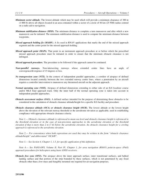
I-1-1-4<br />
Procedures — <strong>Aircraft</strong> <strong>Operations</strong> — Volume I<br />
Minimum sector altitude. The lowest altitude which may be used which will provide a minimum clearance of 300 m<br />
(1 000 ft) above all objects located in an area contained within a sector of a circle of 46 km (25 NM) radius centred<br />
on a radio aid to navigation.<br />
Minimum stabilization distance (MSD). The minimum distance to complete a turn manoeuvre and after which a new<br />
manoeuvre can be initiated. The minimum stabilization distance is used to compute the minimum distance between<br />
waypoints.<br />
Missed approach holding fix (MAHF). A fix used in RNAV applications that marks the end of the missed approach<br />
segment and the centre point for the missed approach holding.<br />
Missed approach point (MAPt). That point in an instrument approach procedure at or before which the prescribed<br />
missed approach procedure must be initiated in order to ensure that the minimum obstacle clearance is not<br />
infringed.<br />
Missed approach procedure. The procedure to be followed if the approach cannot be continued.<br />
Near-parallel runways. Non-intersecting runways whose extended centre lines have an angle of<br />
convergence/divergence of 15 degrees or less.<br />
No transgression zone (NTZ). In the context of independent parallel approaches, a corridor of airspace of defined<br />
dimensions located centrally between the two extended runway centre lines, where a penetration by an aircraft<br />
requires a controller intervention to manoeuvre any threatened aircraft on the adjacent approach.<br />
Normal operating zone (NOZ). Airspace of defined dimensions extending to either side of an ILS localizer course<br />
and/or MLS final approach track. Only the inner half of the normal operating zone is taken into account in<br />
independent parallel approaches.<br />
Obstacle assessment surface (OAS). A defined surface intended for the purpose of determining those obstacles to be<br />
considered in the calculation of obstacle clearance altitude/height for a specific ILS facility and procedure.<br />
Obstacle clearance altitude (OCA) or obstacle clearance height (OCH). The lowest altitude or the lowest height<br />
above the elevation of the relevant runway threshold or the aerodrome elevation as applicable, used in establishing<br />
compliance with appropriate obstacle clearance criteria.<br />
Note 1.— Obstacle clearance altitude is referenced to mean sea level and obstacle clearance height is referenced to<br />
the threshold elevation or in the case of non-precision approaches to the aerodrome elevation or the threshold<br />
elevation if that is more than 2 m (7 ft) below the aerodrome elevation. An obstacle clearance height for a circling<br />
approach is referenced to the aerodrome elevation.<br />
Note 2.— For convenience when both expressions are used they may be written in the form “obstacle clearance<br />
altitude/height” and abbreviated “OCA/H”.<br />
Note 3.— See Section 4, Chapter 1, 1.5, for specific application of this definition.<br />
Note 4.— See PANS-OPS, Volume II, Part IV, Chapter 1, for area navigation (RNAV) point-in-space (PinS)<br />
approach procedures for helicopters using basic GNSS receivers.<br />
Obstacle free zone (OFZ). The airspace above the inner approach surface, inner transitional surfaces, and balked<br />
landing surface and that portion of the strip bounded by these surfaces, which is not penetrated by any fixed<br />
obstacle other than a low-mass and frangibly mounted one required for air navigation purposes.<br />
23/11/06


