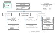
June 1 - 3 , 1978 - University of Hawaii at Manoa
June 1 - 3 , 1978 - University of Hawaii at Manoa
June 1 - 3 , 1978 - University of Hawaii at Manoa

You also want an ePaper? Increase the reach of your titles
YUMPU automatically turns print PDFs into web optimized ePapers that Google loves.
Areas for these veget<strong>at</strong>ion communities were gener<strong>at</strong>ed using<br />
an electronic planimeter. Scrub communities had the largest<br />
total area <strong>of</strong> 3691.7 hectares (9122 acres). High altitude desert<br />
communities were next with an area <strong>of</strong> 3119.7 hectares (7708<br />
acres) and grassland communities covered 568.6 hectares (1405<br />
acres). Forest communities had the smallest total area <strong>of</strong> 164.9<br />
hectares (407 acres).<br />
Using the map as a base, three topographic veget<strong>at</strong>ion pro-<br />
files were constructed to aid in the interpret<strong>at</strong>ion <strong>of</strong> the map<br />
units. The courses <strong>of</strong> the pr<strong>of</strong>iles are shown in Figure 1. These<br />
courses were chosen so as to cross as much <strong>of</strong> the study area as<br />
possible while illustr<strong>at</strong>ing as much <strong>of</strong> the range in vege-<br />
t<strong>at</strong>ion-types and environmental factors as possible. Pr<strong>of</strong>ile 1<br />
runs from Pu'u Nianiau <strong>at</strong> the Park boundary on the northwestern<br />
outer slope <strong>at</strong> 2087.5 m (6849 ft) elev<strong>at</strong>ion to Kilohana on the<br />
western rim <strong>of</strong> the cr<strong>at</strong>er <strong>at</strong> 2926.1 m (9600 ft). Pr<strong>of</strong>ile 2 runs<br />
from Kilohana, across the cr<strong>at</strong>er floor, to the eastern rim above<br />
Paliku Cabin th<strong>at</strong> separ<strong>at</strong>es Haleakala Cr<strong>at</strong>er from Kipahulu Valley<br />
<strong>at</strong> 2133.6 m (7000 ft). Pr<strong>of</strong>ile 3 runs from the southern Park<br />
boundary in Kaupo Gap <strong>at</strong> 1158.2 m (3800 ft) up over Kalapawili<br />
Ridge <strong>at</strong> 2484 m (8150 ft) to the northern Park boundary on the<br />
northern outer slope <strong>at</strong> 2316.5 m (7600 ft).<br />
Pr<strong>of</strong>ile 1 (Fig. 2) shows a decrease in both mean annual<br />
precipit<strong>at</strong>ion and mean annual temper<strong>at</strong>ure to be associ<strong>at</strong>ed with<br />
the increase in elev<strong>at</strong>ion. An apparent effect <strong>of</strong> the temper<strong>at</strong>ure<br />
gradient on the veget<strong>at</strong>ion can be seen <strong>at</strong> approxim<strong>at</strong>ely 2590.8 n<br />
(8500 ft) where the veget<strong>at</strong>ion becomes very sparse and is termed<br />
a high altitude desert. This change may be associ<strong>at</strong>ed with the<br />
diurnal frost boundary, above which freezing temper<strong>at</strong>ures occur<br />
<strong>at</strong> ground level every night <strong>of</strong> the year. Mueller-Dombois (1967)<br />
found the diurnal frost boundary to occur <strong>at</strong> about this elev<strong>at</strong>ion<br />
on Mauna Loa.<br />
Pr<strong>of</strong>ile 2 (Fig. 3) shows an increase in mean annual temper-<br />
<strong>at</strong>ure associ<strong>at</strong>ed with the decrease in elev<strong>at</strong>ion, and an increase<br />
in mean annual precipit<strong>at</strong>ion associ<strong>at</strong>ed with the west-east orien-<br />
t<strong>at</strong>ion. The increase in rainfall is rel<strong>at</strong>ed to a gre<strong>at</strong>er expo-<br />
sure to the effects <strong>of</strong> the predominant northeasterly trade winds.<br />
These factors result in a gradual increase in cover and st<strong>at</strong>ure<br />
<strong>of</strong> the veget<strong>at</strong>ion from a low growing very sparse veget<strong>at</strong>ion (high<br />
altitude desert), through several vari<strong>at</strong>ions <strong>of</strong> scrub<br />
communities, to a low st<strong>at</strong>ure 'ohi'a rain forest.<br />
Pr<strong>of</strong>ile 3 (Fig. 4) shows a decrease in mean annual temper-<br />
<strong>at</strong>ure associ<strong>at</strong>ed with the increase in elev<strong>at</strong>ion, and an increase<br />
in mean annual precipit<strong>at</strong>ion resulting from gre<strong>at</strong>er exposure to<br />
the effects <strong>of</strong> the northeasterly trade winds associ<strong>at</strong>ed with the<br />
south to north orient<strong>at</strong>ion. Also, the lower end <strong>of</strong> this pr<strong>of</strong>ile<br />
extends below the inversion layer which occurs between 1700 and<br />
2300 m (5000-7000 ft) elev<strong>at</strong>ion (Blumenstock & Price 1967). This<br />
complex <strong>of</strong> factors is associ<strong>at</strong>ed with the occurrence <strong>of</strong> several<br />
forest communities between 1292 and 1890 m (4240-6200 ft) which<br />
are unique to this section in the study area.