

Appendix 2 - Vegetation Communities and Regional Ecosystems
Appendix 2 - Vegetation Communities and Regional Ecosystems
Appendix 2 - Vegetation Communities and Regional Ecosystems

You also want an ePaper? Increase the reach of your titles
YUMPU automatically turns print PDFs into web optimized ePapers that Google loves.
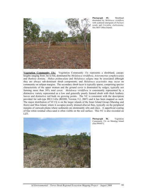
Photograph 85. Shrubl<strong>and</strong><br />
dominated by Melaleuca viridiflora<br />
with scattered emergents of Parinari<br />
nonda <strong>and</strong> Corymbia clarksoniana.<br />
Site MO7 (Moa Isl<strong>and</strong>).<br />
<strong>Vegetation</strong> Community 13c: <strong>Vegetation</strong> Community 13c represents a shrubl<strong>and</strong>, canopy<br />
heights ranging from 3m to 6m, dominated by Melaleuca viridiflora, Asteromyrtus symphyocarpa<br />
<strong>and</strong> Banksia dentata. Hakea pedunculata <strong>and</strong> Melaleuca saligna may be associated although<br />
they are always sub-dominant shrub components, <strong>and</strong> Melaleuca acacioides may occur on<br />
community on saltpan margins. The secondary shrub layer is typically sparse, comprising species<br />
characteristic of the upper stratum <strong>and</strong> the ground cover is dominated by sedges, typically not<br />
forming more than 30% total cover. Melaleuca viridiflora is consistently represented by a<br />
distinctive variety represented as a low <strong>and</strong> generally poorly formed shrub with thick leathery<br />
leaves <strong>and</strong> distinctive red buds on growing points. The VC is consistent with the description<br />
provided for sub-type RE3.3.42a (REDD, Version 5.2, 2007) <strong>and</strong> it has been mapped as such.<br />
The major distribution of VC13j is on the larger isl<strong>and</strong>s of the Inner Isl<strong>and</strong> Group (Muralug <strong>and</strong><br />
Horn) <strong>and</strong> Moa Isl<strong>and</strong>, where it occupies poorly drained alluvial flats, typically on the peripheral<br />
margins of outwash plains where sediments are dominantly silts <strong>and</strong> clays. A superficial coating<br />
of fine white residual silica s<strong>and</strong> is often visible on the soil surface. This VC is also recorded on<br />
LZ5.<br />
Photograph 86. <strong>Vegetation</strong><br />
Community 13c on Muralug Isl<strong>and</strong><br />
(Site PW057).<br />
3d Environmental – Torres Strait <strong>Regional</strong> Ecosystem Mapping Project – August 2008<br />
99