

Appendix 2 - Vegetation Communities and Regional Ecosystems
Appendix 2 - Vegetation Communities and Regional Ecosystems
Appendix 2 - Vegetation Communities and Regional Ecosystems

You also want an ePaper? Increase the reach of your titles
YUMPU automatically turns print PDFs into web optimized ePapers that Google loves.
5.2.23 <strong>Regional</strong> Ecosystem 3.2.27<br />
Description: Ephemeral <strong>and</strong> perennial lakes in coastal dunefields.<br />
Status: Of Concern<br />
<strong>Vegetation</strong> <strong>Communities</strong>: 20b<br />
Survey Locations: No Representative Sites.<br />
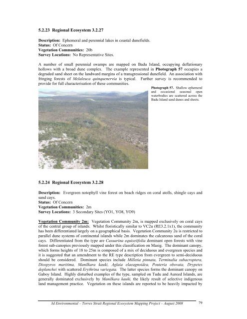
A number of small perennial swamps are mapped on Badu Isl<strong>and</strong>, occupying deflationary<br />
hollows with a broad dune complex. The example represented in Photograph 57 occupies a<br />
degraded s<strong>and</strong> sheet on the l<strong>and</strong>ward margins of a transgressional dunefield. An association with<br />
fringing forests of Melaleuca quinquenervia is typical. Further survey is recommended to<br />
provide for full characterisation of these communities.<br />
Photograph 57. Shallow ephemeral<br />
<strong>and</strong> occasional seasonal open<br />
waterbodies are scattered across the<br />
Badu Isl<strong>and</strong> s<strong>and</strong> dunes <strong>and</strong> sheets.<br />
5.2.24 <strong>Regional</strong> Ecosystem 3.2.28<br />
Description: Evergreen notophyll vine forest on beach ridges on coral atolls, shingle cays <strong>and</strong><br />
s<strong>and</strong> cays.<br />
Status: Of Concern<br />
<strong>Vegetation</strong> <strong>Communities</strong>: 2m<br />
Survey Locations: 3 Secondary Sites (YO1, YO8, YO9)<br />
<strong>Vegetation</strong> Community 2m: <strong>Vegetation</strong> Community 2m, is mapped exclusively on coral cays<br />
of the central group of isl<strong>and</strong>s. Whilst floristically similar to VC2u (RE3.2.1x1), the community<br />
has been differentiated largely on a geographical basis. <strong>Vegetation</strong> Community 2u is restricted to<br />
parallel dune systems of continental isl<strong>and</strong>s while 2m dominates the calcareous s<strong>and</strong> of the coral<br />
cays. Differentiated from the type are Casuarina equisetifolia dominant open forests with vine<br />
forest sub-canopies previously mapped under this classification on Masig. The dominant canopy,<br />
which forms heights of 18 to 25m is composed of a mix of deciduous <strong>and</strong> evergreen species <strong>and</strong><br />
it is suggested that an amendment to the RE type description from evergreen to semi-deciduous<br />
should be considered. Dominant species include Milletia pinnata, Terminalia subacroptera,<br />
Diospyros maritima, Manilkara kauki, Aglaia elaeagnoidea, Pouteria obovata, Drypetes<br />
deplanchei with scattered Erythrina variegata. The latter species forms the dominant canopy on<br />
Gaboy Isl<strong>and</strong>. Highly disturbed examples of the type, sampled on Tudu <strong>and</strong> Aureed Isl<strong>and</strong>s, are<br />
generally dominated exclusively by Manilkara kauki, the likely result of selective indigenous<br />
l<strong>and</strong> management practice. <strong>Vegetation</strong> on these isl<strong>and</strong>s are reported to be heavily impacted by<br />
3d Environmental – Torres Strait <strong>Regional</strong> Ecosystem Mapping Project – August 2008<br />
79