

Appendix 2 - Vegetation Communities and Regional Ecosystems
Appendix 2 - Vegetation Communities and Regional Ecosystems
Appendix 2 - Vegetation Communities and Regional Ecosystems

You also want an ePaper? Increase the reach of your titles
YUMPU automatically turns print PDFs into web optimized ePapers that Google loves.
5.2.48 <strong>Regional</strong> Ecosystem 3.5.5<br />
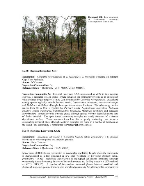
Photograph 102. Low open forest<br />
of Lophostemon suaveolens.<br />
Alluvial plains of Saibai Isl<strong>and</strong>.<br />
Description: Corymbia novoguinensis or C. nesophila ± C. tessellaris woodl<strong>and</strong> on northern<br />
Cape York Peninsula.<br />
Status: Of Concern<br />
<strong>Vegetation</strong> <strong>Communities</strong>: 5a<br />
Reference Sites: 4 Quaternary (MO5, MO15, MO23, MO153).<br />
<strong>Vegetation</strong> Community 5a: <strong>Regional</strong> Ecosystem 3.5.5, represented as VC5a in this mapping<br />
exercise, is restricted to Moa Isl<strong>and</strong>. Where surveyed, the community presents as an open forest<br />
with a canopy height range of 18m to 25m dominated by Corymbia novoguinensis. Associated<br />
canopy species typically include Parinari nonda, Lophostemon suaveolens, Acacia crassicarpa<br />
<strong>and</strong> Melaleuca viridiflora although these species are never dominant. The sub-canopy, which<br />
ranges from 10 to 15m is typified by Parinari nonda, Lophostemon suaveolens, Livistona<br />
muelleri, Acacia crassicarpa, Welchiodendron longivalve, Melaleuca viridiflora <strong>and</strong> Syzygium<br />
suborbiculare. Ground cover is typically grassy although species were not identified due to lack<br />
of fertile material. The open forest community occupies the s<strong>and</strong>y remnants of a former<br />
depositional surface. These remnants form low, flat or gently undulating rises above a<br />
surrounding erosional plain, although scattered examples are found in a number of locations on<br />
the isl<strong>and</strong>. The community is represented in Photograph 103 overleaf.<br />
5.2.49 <strong>Regional</strong> Ecosystem 3.5.8c<br />
Description: Eucalyptus tetrodonta ± Corymbia hyl<strong>and</strong>ii subsp. peninsularis ± C. stockeri<br />
woodl<strong>and</strong> on erosional plains <strong>and</strong> s<strong>and</strong>tone plateaus.<br />
Status: Not of Concern<br />
<strong>Vegetation</strong> <strong>Communities</strong>: 5q<br />
Reference Sites: 2 Quaternary (FRQ9, WEQ9)<br />
Minor areas of RE3.5.8c are represented on Wednesday <strong>and</strong> Friday Isl<strong>and</strong>s where the community<br />
is characteristed as a low woodl<strong>and</strong> or low open woodl<strong>and</strong> of Corymbia stockerii subsp.<br />
peninsularis (VC5q). Melaleuca stenostachya is the typical sub-canopy dominant, although<br />
occasionally forms the canopy in areas of low soil moisture <strong>and</strong> fertility where it is differentiated<br />
as VC13i (RE3.5.7). A number of intermediate structural phases between woodl<strong>and</strong> <strong>and</strong><br />
shrubl<strong>and</strong> may exist, passing through open woodl<strong>and</strong> community 5m, although this community is<br />
3d Environmental – Torres Strait <strong>Regional</strong> Ecosystem Mapping Project – August 2008<br />
112