

Appendix 2 - Vegetation Communities and Regional Ecosystems
Appendix 2 - Vegetation Communities and Regional Ecosystems
Appendix 2 - Vegetation Communities and Regional Ecosystems

You also want an ePaper? Increase the reach of your titles
YUMPU automatically turns print PDFs into web optimized ePapers that Google loves.
occurs on drainage swamps, it has been classified as RE3.3.14 (VC7b), which is discussed in the<br />
following section.<br />
5.2.33 <strong>Regional</strong> Ecosystem 3.3.14<br />
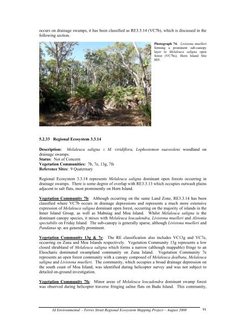
Photograph 74. Livistona muelleri<br />
forming a prominent sub-canopy<br />
layer to Melaleuca saligna open<br />
forest (VC7bs). Horn Isl<strong>and</strong> Site<br />
HI5.<br />
Description: Melaleuca saligna ± M. viridiflora, Lophostemon suaveolens woodl<strong>and</strong> on<br />
drainage swamps.<br />
Status: Not of Concern<br />
<strong>Vegetation</strong> <strong>Communities</strong>: 7b, 7e, 13g, 7fs<br />
Reference Sites: 9 Quaternary<br />
<strong>Regional</strong> Ecosystem 3.3.14 represents Melaleuca saligna dominant open forests occurring in<br />
drainage swamps. There is some degree of overlap with RE3.3.13 which occupies outwash plains<br />
adjacent to salt flats, most prominently on Horn Isl<strong>and</strong>.<br />
<strong>Vegetation</strong> Community 7b: Although occurring on the same L<strong>and</strong> Zone, RE3.3.14 has been<br />
classified where VC7b occurs in drainage depressions <strong>and</strong> represents a much more extensive<br />
expression of Melaleuca saligna dominant open forest, occurring on the majority of isl<strong>and</strong>s in the<br />
Inner Isl<strong>and</strong> Group, as well as Mabuiag <strong>and</strong> Moa Isl<strong>and</strong>. Whilst Melaleuca saligna is the<br />
dominant canopy species, it mixes with Melaleuca leucadendra, Livistona muelleri <strong>and</strong> Alstonia<br />
spectabilis on Friday Isl<strong>and</strong>. The sub-canopy is generally sparse, although Livistona muelleri <strong>and</strong><br />
P<strong>and</strong>anus sp. are generally prominent.<br />
<strong>Vegetation</strong> Community 13g & 7e: The RE classification also includes VC13g <strong>and</strong> VC7e,<br />
occurring on Zuna <strong>and</strong> Moa Isl<strong>and</strong>s respectively. <strong>Vegetation</strong> Community 13g represents a low<br />
closed shrubl<strong>and</strong> of Melaleuca saligna which forms a narrow (although mappable) fringe to an<br />
Eleocharis dominated swampl<strong>and</strong> community on Zuna Isl<strong>and</strong>. <strong>Vegetation</strong> Community 7e<br />
represents an open forest community with a canopy composed of Melaleuca dealbata, Melaleuca<br />
saligna <strong>and</strong> Livistona muelleri. The community, which occupies a broad drainage depression on<br />
the south coast of Moa Isl<strong>and</strong>, was identified during helicopter survey <strong>and</strong> was not subject to<br />
detailed on-ground investigation.<br />
<strong>Vegetation</strong> Community 7fs: Minor areas of Melaleuca leucadendra dominant swamp forest<br />
was observed during helicopter traverse fringing saline flats on Badu Isl<strong>and</strong>. This community,<br />
3d Environmental – Torres Strait <strong>Regional</strong> Ecosystem Mapping Project – August 2008<br />
91