

Appendix 2 - Vegetation Communities and Regional Ecosystems
Appendix 2 - Vegetation Communities and Regional Ecosystems
Appendix 2 - Vegetation Communities and Regional Ecosystems

Create successful ePaper yourself
Turn your PDF publications into a flip-book with our unique Google optimized e-Paper software.
Zone classification more robust. Thin surficial layers of alluvial sediment <strong>and</strong> fine silica s<strong>and</strong> are<br />
present on some coastal plains on the inner isl<strong>and</strong>s although these are generally extremely<br />
shallow with the majority of the fringing coastal plain being influenced by alluvial process which<br />
is continuing in the present geomorphic regime.<br />
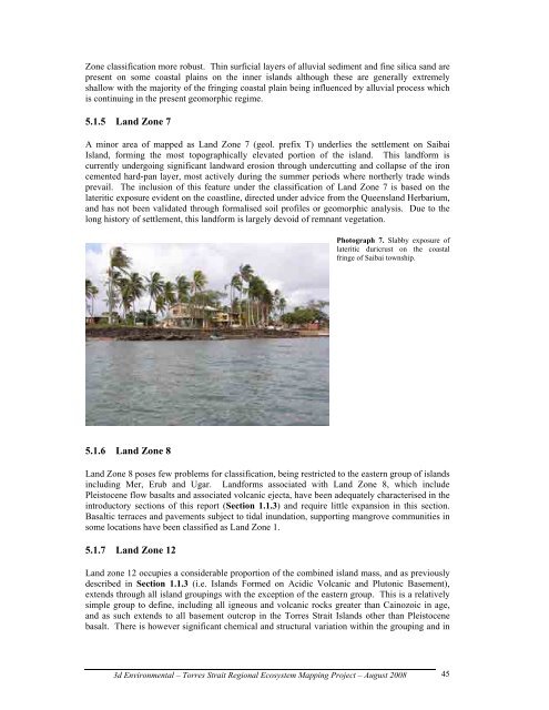
5.1.5 L<strong>and</strong> Zone 7<br />
A minor area of mapped as L<strong>and</strong> Zone 7 (geol. prefix T) underlies the settlement on Saibai<br />
Isl<strong>and</strong>, forming the most topographically elevated portion of the isl<strong>and</strong>. This l<strong>and</strong>form is<br />
currently undergoing significant l<strong>and</strong>ward erosion through undercutting <strong>and</strong> collapse of the iron<br />
cemented hard-pan layer, most actively during the summer periods where northerly trade winds<br />
prevail. The inclusion of this feature under the classification of L<strong>and</strong> Zone 7 is based on the<br />
lateritic exposure evident on the coastline, directed under advice from the Queensl<strong>and</strong> Herbarium,<br />
<strong>and</strong> has not been validated through formalised soil profiles or geomorphic analysis. Due to the<br />
long history of settlement, this l<strong>and</strong>form is largely devoid of remnant vegetation.<br />
5.1.6 L<strong>and</strong> Zone 8<br />
Photograph 7. Slabby exposure of<br />
lateritic duricrust on the coastal<br />
fringe of Saibai township.<br />
L<strong>and</strong> Zone 8 poses few problems for classification, being restricted to the eastern group of isl<strong>and</strong>s<br />
including Mer, Erub <strong>and</strong> Ugar. L<strong>and</strong>forms associated with L<strong>and</strong> Zone 8, which include<br />
Pleistocene flow basalts <strong>and</strong> associated volcanic ejecta, have been adequately characterised in the<br />
introductory sections of this report (Section 1.1.3) <strong>and</strong> require little expansion in this section.<br />
Basaltic terraces <strong>and</strong> pavements subject to tidal inundation, supporting mangrove communities in<br />
some locations have been classified as L<strong>and</strong> Zone 1.<br />
5.1.7 L<strong>and</strong> Zone 12<br />
L<strong>and</strong> zone 12 occupies a considerable proportion of the combined isl<strong>and</strong> mass, <strong>and</strong> as previously<br />
described in Section 1.1.3 (i.e. Isl<strong>and</strong>s Formed on Acidic Volcanic <strong>and</strong> Plutonic Basement),<br />
extends through all isl<strong>and</strong> groupings with the exception of the eastern group. This is a relatively<br />
simple group to define, including all igneous <strong>and</strong> volcanic rocks greater than Cainozoic in age,<br />
<strong>and</strong> as such extends to all basement outcrop in the Torres Strait Isl<strong>and</strong>s other than Pleistocene<br />
basalt. There is however significant chemical <strong>and</strong> structural variation within the grouping <strong>and</strong> in<br />
3d Environmental – Torres Strait <strong>Regional</strong> Ecosystem Mapping Project – August 2008<br />
45