

Appendix 2 - Vegetation Communities and Regional Ecosystems
Appendix 2 - Vegetation Communities and Regional Ecosystems
Appendix 2 - Vegetation Communities and Regional Ecosystems

You also want an ePaper? Increase the reach of your titles
YUMPU automatically turns print PDFs into web optimized ePapers that Google loves.
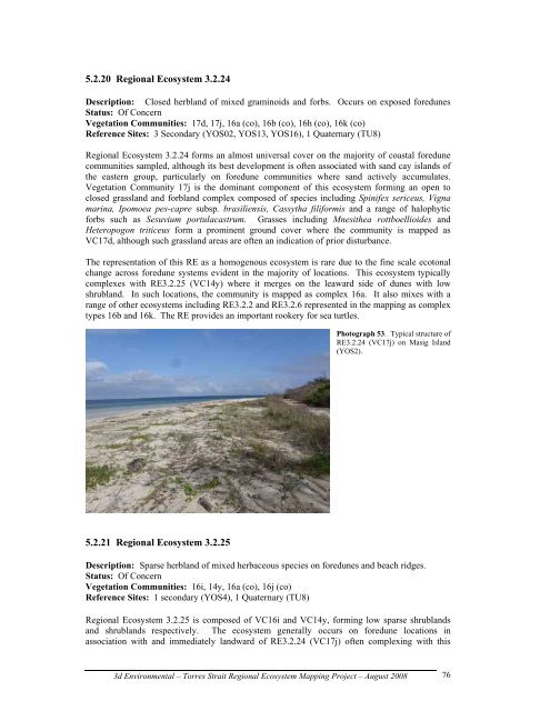
5.2.20 <strong>Regional</strong> Ecosystem 3.2.24<br />
Description: Closed herbl<strong>and</strong> of mixed graminoids <strong>and</strong> forbs. Occurs on exposed foredunes<br />
Status: Of Concern<br />
<strong>Vegetation</strong> <strong>Communities</strong>: 17d, 17j, 16a (co), 16b (co), 16h (co), 16k (co)<br />
Reference Sites: 3 Secondary (YOS02, YOS13, YOS16), 1 Quaternary (TU8)<br />
<strong>Regional</strong> Ecosystem 3.2.24 forms an almost universal cover on the majority of coastal foredune<br />
communities sampled, although its best development is often associated with s<strong>and</strong> cay isl<strong>and</strong>s of<br />
the eastern group, particularly on foredune communities where s<strong>and</strong> actively accumulates.<br />
<strong>Vegetation</strong> Community 17j is the dominant component of this ecosystem forming an open to<br />
closed grassl<strong>and</strong> <strong>and</strong> forbl<strong>and</strong> complex composed of species including Spinifex sericeus, Vigna<br />
marina, Ipomoea pes-capre subsp. brasiliensis, Cassytha filiformis <strong>and</strong> a range of halophytic<br />
forbs such as Sesuvium portulacastrum. Grasses including Mnesithea rottboellioides <strong>and</strong><br />
Heteropogon triticeus form a prominent ground cover where the community is mapped as<br />
VC17d, although such grassl<strong>and</strong> areas are often an indication of prior disturbance.<br />
The representation of this RE as a homogenous ecosystem is rare due to the fine scale ecotonal<br />
change across foredune systems evident in the majority of locations. This ecosystem typically<br />
complexes with RE3.2.25 (VC14y) where it merges on the leaward side of dunes with low<br />
shrubl<strong>and</strong>. In such locations, the community is mapped as complex 16a. It also mixes with a<br />
range of other ecosystems including RE3.2.2 <strong>and</strong> RE3.2.6 represented in the mapping as complex<br />
types 16b <strong>and</strong> 16k. The RE provides an important rookery for sea turtles.<br />
5.2.21 <strong>Regional</strong> Ecosystem 3.2.25<br />
Photograph 53. Typical structure of<br />
RE3.2.24 (VC17j) on Masig Isl<strong>and</strong><br />
(YOS2).<br />
Description: Sparse herbl<strong>and</strong> of mixed herbaceous species on foredunes <strong>and</strong> beach ridges.<br />
Status: Of Concern<br />
<strong>Vegetation</strong> <strong>Communities</strong>: 16i, 14y, 16a (co), 16j (co)<br />
Reference Sites: 1 secondary (YOS4), 1 Quaternary (TU8)<br />
<strong>Regional</strong> Ecosystem 3.2.25 is composed of VC16i <strong>and</strong> VC14y, forming low sparse shrubl<strong>and</strong>s<br />
<strong>and</strong> shrubl<strong>and</strong>s respectively. The ecosystem generally occurs on foredune locations in<br />
association with <strong>and</strong> immediately l<strong>and</strong>ward of RE3.2.24 (VC17j) often complexing with this<br />
3d Environmental – Torres Strait <strong>Regional</strong> Ecosystem Mapping Project – August 2008<br />
76