

Appendix 2 - Vegetation Communities and Regional Ecosystems
Appendix 2 - Vegetation Communities and Regional Ecosystems
Appendix 2 - Vegetation Communities and Regional Ecosystems

You also want an ePaper? Increase the reach of your titles
YUMPU automatically turns print PDFs into web optimized ePapers that Google loves.
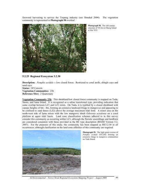
firewood harvesting to service the Trepang industry (see Shnukal 2004). The vegetation<br />
community is represented in Photograph 58 overleaf.<br />
5.2.25 <strong>Regional</strong> Ecosystem 3.2.30<br />
Photograph 58. The sub-canopy<br />
structure of VC2m on Masig Isl<strong>and</strong><br />
at Site YO1.<br />
Description: Pemphis acidula ± low closed forest. Restricted to coral atolls, shingle cays <strong>and</strong><br />
s<strong>and</strong> cays.<br />
Status: Of Concern<br />
<strong>Vegetation</strong> <strong>Communities</strong>: 23b<br />
Reference Sites: 2 Quaternary<br />
<strong>Vegetation</strong> Community 23b: This shrubl<strong>and</strong>/low closed forest community is mapped on Tudu,<br />
Sassie, <strong>and</strong> Iama Isl<strong>and</strong>. It is recognised as a saline transitional type, providing indication that<br />
some overlap between LZ1 <strong>and</strong> LZ2 exists. On Tudu, it is typified by a closed shrubl<strong>and</strong> with<br />
canopy heights of 6m - 8m, forming an extensive l<strong>and</strong>ward fringe to mangroves <strong>and</strong> appearing to<br />
be confined to s<strong>and</strong> dunes (LZ2) above the average maximum tidal limit. A minor area on the<br />
north-west side of Iama mixes with the low mangrove shrub Osbornia octodonta on a coral<br />
platform at upper tidal limits. L<strong>and</strong> zone classification schemes adhered to in this survey<br />
consider this community as occurring within LZ1, although the floristic assemblage <strong>and</strong> l<strong>and</strong>form<br />
are considered consistent with those provided in the RE type description (REDD Version 5.2,<br />
2007). For the purposes of this study, the community has been mapped as RE3.2.30 in all<br />
occurrences, although clarification on the l<strong>and</strong> zone affinities of this community are required.<br />
Photograph 59. The light green crowns of<br />
Pemphis acidula (VC23b) forming an<br />
extensive fringe to mangrove communities<br />
on Tudu Isl<strong>and</strong>.<br />
3d Environmental – Torres Strait <strong>Regional</strong> Ecosystem Mapping Project – August 2008<br />
80