

Final Environmental Impact Statement Rio de los Pinos Vegetation ...
Final Environmental Impact Statement Rio de los Pinos Vegetation ...
Final Environmental Impact Statement Rio de los Pinos Vegetation ...

Create successful ePaper yourself
Turn your PDF publications into a flip-book with our unique Google optimized e-Paper software.
<strong>Final</strong> <strong>Environmental</strong> <strong>Impact</strong> <strong>Statement</strong> <strong>Rio</strong> <strong>de</strong> <strong>los</strong> <strong>Pinos</strong> <strong>Vegetation</strong> Management Project<br />
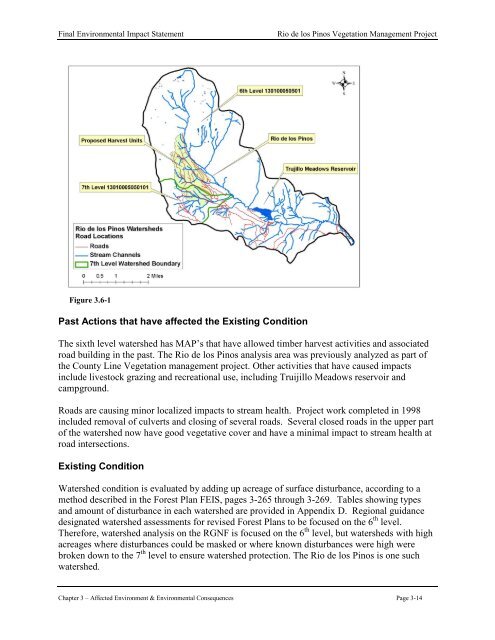
Figure 3.6-1<br />
Past Actions that have affected the Existing Condition<br />
The sixth level watershed has MAP’s that have allowed timber harvest activities and associated<br />
road building in the past. The <strong>Rio</strong> <strong>de</strong> <strong>los</strong> <strong>Pinos</strong> analysis area was previously analyzed as part of<br />
the County Line <strong>Vegetation</strong> management project. Other activities that have caused impacts<br />
inclu<strong>de</strong> livestock grazing and recreational use, including Truijillo Meadows reservoir and<br />
campground.<br />
Roads are causing minor localized impacts to stream health. Project work completed in 1998<br />
inclu<strong>de</strong>d removal of culverts and c<strong>los</strong>ing of several roads. Several c<strong>los</strong>ed roads in the upper part<br />
of the watershed now have good vegetative cover and have a minimal impact to stream health at<br />
road intersections.<br />
Existing Condition<br />
Watershed condition is evaluated by adding up acreage of surface disturbance, according to a<br />
method <strong>de</strong>scribed in the Forest Plan FEIS, pages 3-265 through 3-269. Tables showing types<br />
and amount of disturbance in each watershed are provi<strong>de</strong>d in Appendix D. Regional guidance<br />
<strong>de</strong>signated watershed assessments for revised Forest Plans to be focused on the 6 th level.<br />
Therefore, watershed analysis on the RGNF is focused on the 6 th level, but watersheds with high<br />
acreages where disturbances could be masked or where known disturbances were high were<br />
broken down to the 7 th level to ensure watershed protection. The <strong>Rio</strong> <strong>de</strong> <strong>los</strong> <strong>Pinos</strong> is one such<br />
watershed.<br />
Chapter 3 – Affected Environment & <strong>Environmental</strong> Consequences Page 3-14


