Executive Summary - Fss.aero
Executive Summary - Fss.aero
Executive Summary - Fss.aero

You also want an ePaper? Increase the reach of your titles
YUMPU automatically turns print PDFs into web optimized ePapers that Google loves.
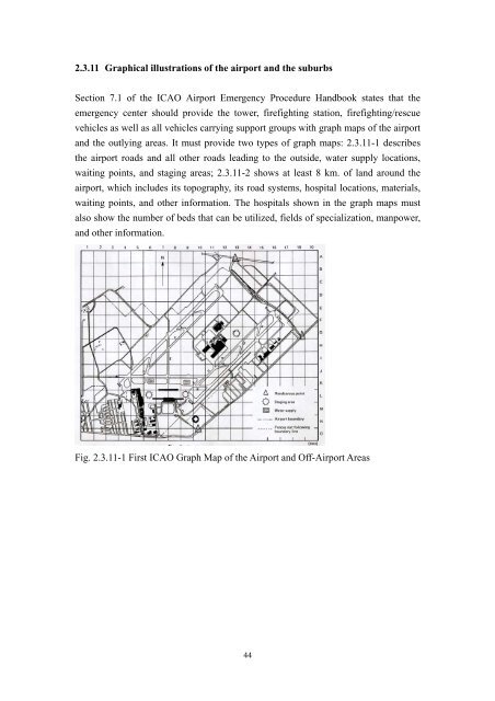
2.3.11 Graphical illustrations of the airport and the suburbs<br />
Section 7.1 of the ICAO Airport Emergency Procedure Handbook states that the<br />
emergency center should provide the tower, firefighting station, firefighting/rescue<br />
vehicles as well as all vehicles carrying support groups with graph maps of the airport<br />
and the outlying areas. It must provide two types of graph maps: 2.3.11-1 describes<br />
the airport roads and all other roads leading to the outside, water supply locations,<br />
waiting points, and staging areas; 2.3.11-2 shows at least 8 km. of land around the<br />
airport, which includes its topography, its road systems, hospital locations, materials,<br />
waiting points, and other information. The hospitals shown in the graph maps must<br />
also show the number of beds that can be utilized, fields of specialization, manpower,<br />
and other information.<br />
Fig. 2.3.11-1 First ICAO Graph Map of the Airport and Off-Airport Areas<br />
44