wradlib Documentation - Bitbucket
wradlib Documentation - Bitbucket
wradlib Documentation - Bitbucket
Create successful ePaper yourself
Turn your PDF publications into a flip-book with our unique Google optimized e-Paper software.
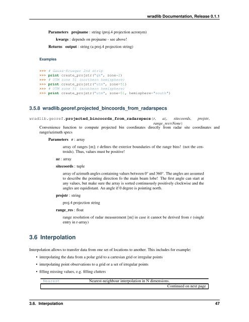
<strong>wradlib</strong> <strong>Documentation</strong>, Release 0.1.1<br />
Parameters projname : string (proj.4 projection acronym)<br />
kwargs : depends on projname - see above!<br />
Returns output : string (a proj.4 projection string)<br />
Examples<br />
>>> # Gauss-Krueger 2nd strip<br />
>>> print create_projstr("gk", zone=2)<br />
>>> # UTM zone 51 (northern hemisphere)<br />
>>> print create_projstr("utm", zone=51)<br />
>>> # UTM zone 51 (southern hemisphere)<br />
>>> print create_projstr("utm", zone=51, hemisphere="south")<br />
3.5.8 <strong>wradlib</strong>.georef.projected_bincoords_from_radarspecs<br />
<strong>wradlib</strong>.georef.projected_bincoords_from_radarspecs(r, az, sitecoords, projstr,<br />
range_res=None)<br />
Convenience function to compute projected bin coordinates directly from radar site coordinates and<br />
range/azimuth specs<br />
Parameters r : array<br />
array of ranges [m]; r defines the exterior boundaries of the range bins! (not the centroids).<br />
Thus, values must be positive!<br />
az : array<br />
sitecoords : tuple<br />
array of azimuth angles containing values between 0° and 360°. The angles are assumed<br />
to describe the pointing direction fo the main beam lobe! The first angle can start at<br />
any values, but make sure the array is sorted continuously positively clockwise and the<br />
angles are equidistant. An angle if 0 degree is pointing north.<br />
projstr : string<br />
proj.4 projection string<br />
range_res : float<br />
range resolution of radar measurement [m] in case it cannot be derived from r (single<br />
entry in r-array)<br />
3.6 Interpolation<br />
Interpolation allows to transfer data from one set of locations to another. This includes for example:<br />
• interpolating the data from a polar grid to a cartesian grid or irregular points<br />
• interpolating point observations to a grid or a set of irregular points<br />
• filling missing values, e.g. filling clutters<br />
Nearest<br />
Nearest-neighbour interpolation in N dimensions.<br />
Continued on next page<br />
3.6. Interpolation 47


