Chapter 9: Road drainage and the water environment
Chapter 9: Road drainage and the water environment
Chapter 9: Road drainage and the water environment
Create successful ePaper yourself
Turn your PDF publications into a flip-book with our unique Google optimized e-Paper software.
Memor<strong>and</strong>um<br />
(Continued)<br />
Page 5 of 6<br />
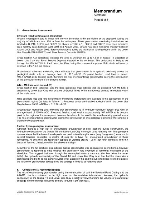
5. Ground<strong>water</strong> Assessment<br />
Swinford <strong>Road</strong> Cutting (area around S9)<br />
Ground investigation data is limited with only six boreholes within <strong>the</strong> vicinity of <strong>the</strong> proposed cutting, <strong>the</strong><br />
majority of which are over 100 m from <strong>the</strong> underpass. Three ground<strong>water</strong> monitoring installations are<br />
located in BH216, BH212 <strong>and</strong> BH323 (as shown in Table 4.1). BH216 <strong>and</strong> BH212 have been monitored<br />
on a monthly basis between April 2004 <strong>and</strong> August 2006. BH323 has been monitored monthly between<br />
August 2005 <strong>and</strong> August 2006. Screened response zones are installed at varying depths within <strong>the</strong> Lower<br />
Lias Clay (BH216 & BH212) <strong>and</strong> River Terrace Deposits (BH323).<br />
Cross Section A-A’ (attached) indicates <strong>the</strong> area is underlain by up to 4.5 m of Glacial Till underlain by<br />
Lower Lias Clay with River Terrace Deposits situated to <strong>the</strong> nor<strong>the</strong>ast. The underpass is likely to cut<br />
through <strong>the</strong> Glacial Till into <strong>the</strong> Lower Lias Clay during <strong>the</strong> construction phase. Both strata will also be<br />
exposed in <strong>the</strong> 1:3.5 cut slopes.<br />
Ground<strong>water</strong> strike <strong>and</strong> monitoring data indicates that ground<strong>water</strong> is in hydraulic continuity across <strong>the</strong><br />
geological strata with an average head of 111.5 mAOD. Proposed finished road level is around<br />
108.1 mAOD at its deepest point, <strong>the</strong>refore <strong>the</strong> risk of encountering ground<strong>water</strong> during <strong>the</strong> construction<br />
of this particular element of <strong>the</strong> scheme is high.<br />
A14 – M6 Link (area around S1)<br />
Cross Section B-B’ (attached) <strong>and</strong> <strong>the</strong> BGS geological map indicate that <strong>the</strong> proposed A14-M6 Link is<br />
underlain by Lower Lias Clay with an area of Glacial Till up to 4m in thickness situated immediately west<br />
of <strong>the</strong> underpass.<br />
Nine borehole logs <strong>and</strong> nine ground<strong>water</strong> monitoring installations are available in <strong>the</strong> assessment of <strong>the</strong><br />
ground<strong>water</strong> regime (as listed in Table 4.1). Response zones are installed at depths within <strong>the</strong> Lower Lias<br />
Clay between 85.93 mAOD <strong>and</strong> 118.32 mAOD.<br />
Ground<strong>water</strong> monitoring data indicates that ground<strong>water</strong> is in hydraulic continuity across area with an<br />
average head of 109.6 mAOD. Proposed finished road level is approximately 107 mAOD at its deepest<br />
point in <strong>the</strong> region of <strong>the</strong> underpass, however this drops to <strong>the</strong> east to tie in with existing ground levels.<br />
The risk of encountering ground<strong>water</strong> during <strong>the</strong> construction of this particular element of <strong>the</strong> scheme is<br />
<strong>the</strong>refore considered high.<br />
Fur<strong>the</strong>r hydrogeological assessment<br />
Although <strong>the</strong>re is a high risk of encountering ground<strong>water</strong> at both locations during construction, <strong>the</strong><br />
hydraulic conductivity of <strong>the</strong> Glacial Till <strong>and</strong> Lower Lias Clay is thought to be relatively low. The geological<br />
memoir states that <strong>the</strong> Lower Lias deposits are predominantly argillaceous (very fine-grained) in nature. In<br />
several localities boreholes to depths of over 60 m have not encountered ground<strong>water</strong> in <strong>the</strong>se<br />
formations. At best <strong>the</strong>y are reportedly capable of yielding around 1-2 m 3 per hour, generally from thin<br />
b<strong>and</strong>s of fissured Limestone within <strong>the</strong> shales <strong>and</strong> clays.<br />
A number of <strong>the</strong> GI borehole logs indicate that no ground<strong>water</strong> was encountered during boring, however<br />
ground<strong>water</strong> is reported to have entered <strong>the</strong> exploratory hole overnight or following installation of <strong>the</strong><br />
st<strong>and</strong>pipe. This suggest that even though <strong>the</strong> intercepted strata is saturated (i.e. lies below <strong>the</strong> <strong>water</strong><br />
table), <strong>the</strong> hydraulic conductivity of <strong>the</strong> Glacial Till <strong>and</strong> Lower Lias Clay is so low that <strong>the</strong> bores take a<br />
significant period to fill to <strong>the</strong> st<strong>and</strong>ing <strong>water</strong> level. Based on this <strong>and</strong> <strong>the</strong> published data referred to above,<br />
<strong>the</strong> volume of ground<strong>water</strong> seepage into <strong>the</strong> cuttings is likely to be relatively slow.<br />
6. Conclusions & recommendations<br />
The risk of encountering ground<strong>water</strong> during <strong>the</strong> construction of both <strong>the</strong> Swinford <strong>Road</strong> Cutting <strong>and</strong> <strong>the</strong><br />
A14-M6 Link is considered to be high based on <strong>the</strong> available information. However, <strong>the</strong> hydraulic<br />
conductivity of <strong>the</strong> Glacial Till <strong>and</strong> Lower Lias Clay is relatively low; <strong>the</strong>refore <strong>the</strong> volume of ground<strong>water</strong><br />
seepage into <strong>the</strong> cuttings is likely to be slow (around 1-2m 3 per hour).<br />
Jacobs Engineering U.K. Limited<br />
Jacobs_MemoA4.doc


