Carvins Cove Trail Plan - Roanoke
Carvins Cove Trail Plan - Roanoke
Carvins Cove Trail Plan - Roanoke

Create successful ePaper yourself
Turn your PDF publications into a flip-book with our unique Google optimized e-Paper software.
<strong>Carvins</strong> <strong>Cove</strong> Natural Reserve<br />
2010 <strong>Trail</strong> Management <strong>Plan</strong><br />
2.2.5 Watershed Protection<br />
The 630-acre <strong>Carvins</strong> <strong>Cove</strong> Reservoir provides approximately 45% of the drinking<br />
water for <strong>Roanoke</strong> City and County. Watershed protection is of paramount importance<br />
and a central focus of the 2007 Park Management <strong>Plan</strong> as well as the 2000 Land Use<br />
<strong>Plan</strong>. It was a driving force behind the conservation easement placed on the <strong>Cove</strong>.<br />
<strong>Trail</strong>-building crews working at the <strong>Cove</strong> follow the standards of USDA Forest Service<br />
and the International Mountain Biking Association (IMBA) to ensure that water quality is<br />
not adversely impacted by the construction of trails. The trail assessment process<br />
makes note of soil erosion and other potential impacts on water quality so that these<br />
conditions can be corrected. While eroding trails are recognized as problematic, for<br />
most trails at the <strong>Cove</strong> there is a substantial buffer zone where sediment is able to<br />
settle before reaching streams or the reservoir.<br />
2.3 Data Collection Process and Methods<br />
2.3.1 Process<br />
The <strong>Trail</strong> <strong>Plan</strong> Task Force used the following process:<br />
1. Assessment of <strong>Trail</strong>s<br />
a. Development of assessment forms and system.<br />
b. Training and procedure review with Assessment Team.<br />
c. Assessment of official trails and road beds.<br />
d. Review of unofficial trails and connections.<br />
2. Mapping of official and other existing trails.<br />
3. Research on issues and standards.<br />
4. Review of trail data by Assessment Team to determine user suitability<br />
and difficulty.<br />
5. Input from stakeholders and trail maintainers.<br />
6. Coordination and review with Parks and Recreation staff.<br />
7. Development of recommendations for each trail of actions needed.<br />
8. Development with Assessment Team of recommendations for new<br />
trails and connections.<br />
9. Authorization by the City.<br />
2.3.2 Assessment Method<br />
The <strong>Trail</strong> <strong>Plan</strong> Task Force reviewed several existing trail assessment systems, including<br />
the USDA Forest Service, National Park Service, Appalachian <strong>Trail</strong> Conservancy,<br />
Universal <strong>Trail</strong> Assessment Process (UTAP), and IMBA. The Task Force used a form<br />
similar to the one developed for Mill Mountain <strong>Trail</strong> <strong>Plan</strong>, with modifications<br />
recommended during that process. The form is shown in Figure 6, with the data for<br />
each trail summarized in Section 3 of this plan.<br />
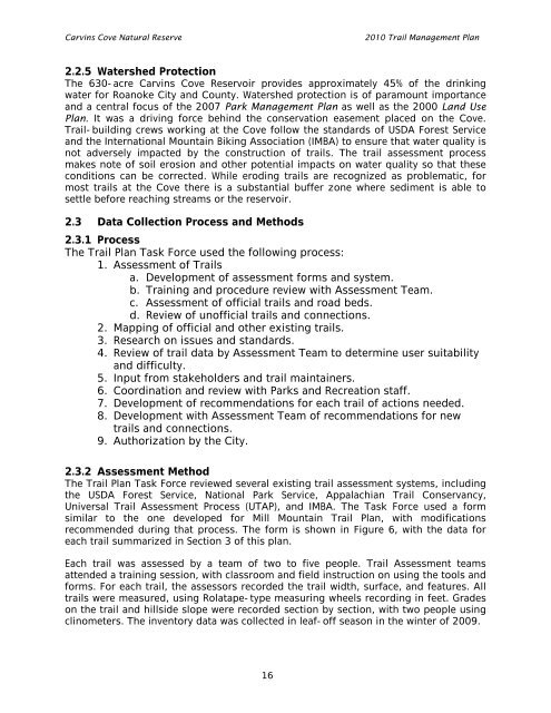
Each trail was assessed by a team of two to five people. <strong>Trail</strong> Assessment teams<br />
attended a training session, with classroom and field instruction on using the tools and<br />
forms. For each trail, the assessors recorded the trail width, surface, and features. All<br />
trails were measured, using Rolatape-type measuring wheels recording in feet. Grades<br />
on the trail and hillside slope were recorded section by section, with two people using<br />
clinometers. The inventory data was collected in leaf-off season in the winter of 2009.<br />
16