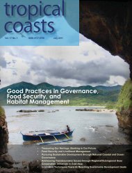
Download PDF Copy - Pemsea
Download PDF Copy - Pemsea
Download PDF Copy - Pemsea

Create successful ePaper yourself
Turn your PDF publications into a flip-book with our unique Google optimized e-Paper software.
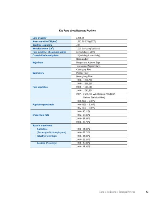
Key Facts about Batangas Province<br />
Land area (km 2 )<br />
Area covered by ICM (km 2 )<br />
Coastline length (km)<br />
Municipal waters (km 2 )<br />
Total number of cities/municipalities<br />
Coastal cities/municipalities<br />
Major bays<br />
Major rivers<br />
Total population<br />
Population growth rate<br />
Employment Rate<br />
Sectoral employment<br />
• Agriculture<br />
(Percentage of total employment)<br />
• Industry (Percentage)<br />
• Services (Percentage)<br />
3,165.81<br />
1,663.51 (53%) (2007)<br />
492<br />
7,000 (excluding Taal Lake)<br />
34 (including 3 cities)<br />
15 (including 1 coastal city)<br />
Batangas Bay<br />
Balayan and Adjacent Bays<br />
Tayabas and Adjacent Bays<br />
Calumpang River<br />
Pansipit River<br />
Benangbang River<br />
1990 – 1,476,783<br />
1995 – 1,658,567<br />
2000 – 1,905,348<br />
2006 – 2,283,351<br />
2007 – 2,245,869 (Actual census population,<br />
National Statistics Office)<br />
1980–1990 – 2.32 %<br />
1990–1995 – 2.20 %<br />
1995–2000 – 3.02 %<br />
1990 – 90.11 %<br />
1995 – 90.05 %<br />
2000 – 87.89 %<br />
2003 – 87.73 %<br />
1990 – 34.00 %<br />
2003 – 28.71 %<br />
1990 – 34.00 %<br />
2003 – 23.24 %<br />
1990 – 19.00 %<br />
2003 – 47.32 %<br />
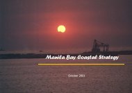
State of the Coasts of Batangas Province<br />
13