Download PDF Copy - Pemsea
Download PDF Copy - Pemsea
Download PDF Copy - Pemsea

Create successful ePaper yourself
Turn your PDF publications into a flip-book with our unique Google optimized e-Paper software.
S U S T A I N A B L E D E V E L O P M E N T A S P E C T S<br />
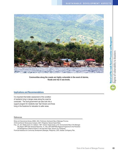
Communities along the coasts are highly vulnerable in the event of storms,<br />
floods and rise in sea levels.<br />
Natural and Man-made Hazard Prevention and Management<br />
Degree of vulnerability to disasters<br />
Implications and Recommendations<br />
It is important that better assessment of the condition<br />
of residents living in danger areas along the coast be<br />
conducted. The local government can also look into a<br />
support program for residents near Taal Volcano and those<br />
living in the foreshore for relocation to safer areas.<br />
References<br />
Mines and Geosciences Bureau (MGB). 2004. Preliminary Geohazard Map of Batangas Province.<br />
OCHA and Munich Reinsurance Company. 2007. Philippines: Natural Hazard Risks.<br />
Paw, J.N., N.A. Robles and E.T.A. Calderon. 1997. Volcanic Hazard Zones, p119. Environmental Atlas of the Batangas<br />
Bay Region. MPP-EAS Technical Report No. 14, 144p. GEF/UNDP/IMO Regional Programme for the Prevention<br />
and Management of Marine Pollution in the East Asian Seas, Quezon City, Philippines.<br />
Provincial Assistance for Community Development (Batangas, Philippines). 2005. Disaster Contingency Plan.<br />
State of the Coasts of Batangas Province<br />
63