Download PDF Copy - Pemsea
Download PDF Copy - Pemsea
Download PDF Copy - Pemsea

Create successful ePaper yourself
Turn your PDF publications into a flip-book with our unique Google optimized e-Paper software.
G O V E R N A N C E<br />
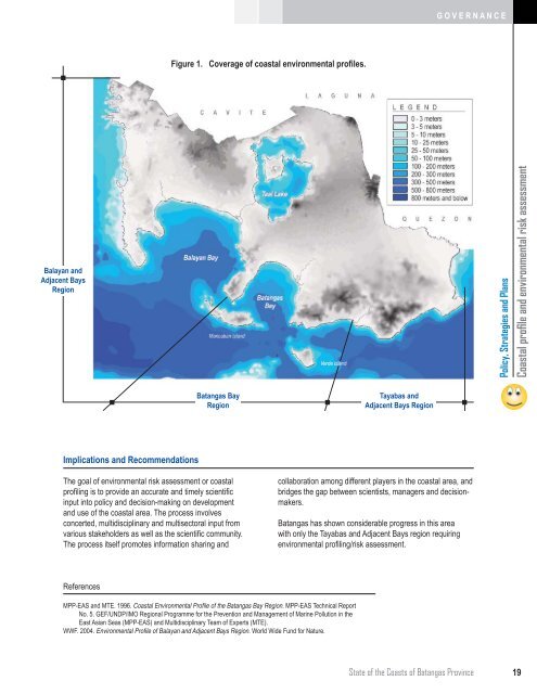
Figure 1. Coverage of coastal environmental profiles.<br />
Balayan and<br />
Adjacent Bays<br />
Region<br />
Policy, Strategies and Plans<br />
Coastal profile and environmental risk assessment<br />
Batangas Bay<br />
Region<br />
Tayabas and<br />
Adjacent Bays Region<br />
Implications and Recommendations<br />
The goal of environmental risk assessment or coastal<br />
profiling is to provide an accurate and timely scientific<br />
input into policy and decision-making on development<br />
and use of the coastal area. The process involves<br />
concerted, multidisciplinary and multisectoral input from<br />
various stakeholders as well as the scientific community.<br />
The process itself promotes information sharing and<br />
collaboration among different players in the coastal area, and<br />
bridges the gap between scientists, managers and decisionmakers.<br />
Batangas has shown considerable progress in this area<br />
with only the Tayabas and Adjacent Bays region requiring<br />
environmental profiling/risk assessment.<br />
References<br />
MPP-EAS and MTE. 1996. Coastal Environmental Profi le of the Batangas Bay Region. MPP-EAS Technical Report<br />
No. 5. GEF/UNDP/IMO Regional Programme for the Prevention and Management of Marine Pollution in the<br />
East Asian Seas (MPP-EAS) and Multidisciplinary Team of Experts (MTE).<br />
WWF. 2004. Environmental Profi le of Balayan and Adjacent Bays Region. World Wide Fund for Nature.<br />
State of the Coasts of Batangas Province<br />
19