Download full report in pdf format - Natural Resources Institute
Download full report in pdf format - Natural Resources Institute
Download full report in pdf format - Natural Resources Institute

Create successful ePaper yourself
Turn your PDF publications into a flip-book with our unique Google optimized e-Paper software.
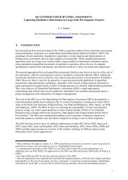
General Resource Status<br />
of Project Watersheds<br />
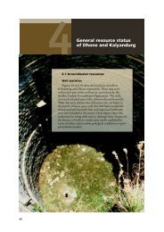
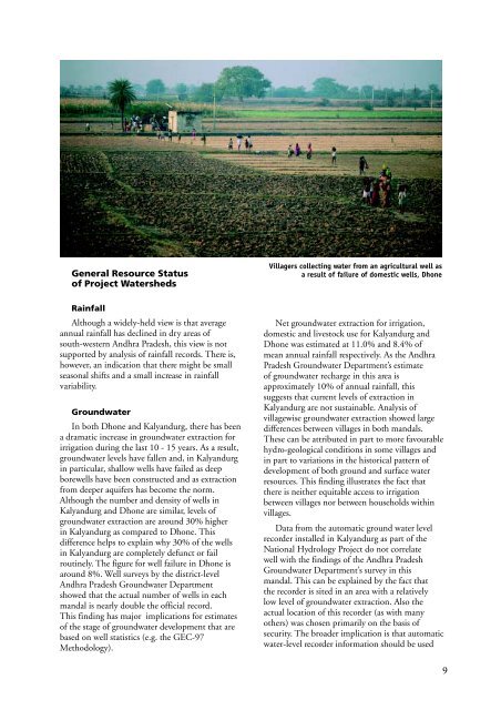
Villagers collect<strong>in</strong>g water from an agricultural well as<br />
a result of failure of domestic wells, Dhone<br />
Ra<strong>in</strong>fall<br />
Although a widely-held view is that average<br />
annual ra<strong>in</strong>fall has decl<strong>in</strong>ed <strong>in</strong> dry areas of<br />
south-western Andhra Pradesh, this view is not<br />
supported by analysis of ra<strong>in</strong>fall records. There is,<br />
however, an <strong>in</strong>dication that there might be small<br />
seasonal shifts and a small <strong>in</strong>crease <strong>in</strong> ra<strong>in</strong>fall<br />
variability.<br />
Groundwater<br />
In both Dhone and Kalyandurg, there has been<br />
a dramatic <strong>in</strong>crease <strong>in</strong> groundwater extraction for<br />
irrigation dur<strong>in</strong>g the last 10 - 15 years. As a result,<br />
groundwater levels have fallen and, <strong>in</strong> Kalyandurg<br />
<strong>in</strong> particular, shallow wells have failed as deep<br />
borewells have been constructed and as extraction<br />
from deeper aquifers has become the norm.<br />
Although the number and density of wells <strong>in</strong><br />
Kalyandurg and Dhone are similar, levels of<br />
groundwater extraction are around 30% higher<br />
<strong>in</strong> Kalyandurg as compared to Dhone. This<br />
difference helps to expla<strong>in</strong> why 30% of the wells<br />
<strong>in</strong> Kalyandurg are completely defunct or fail<br />
rout<strong>in</strong>ely. The figure for well failure <strong>in</strong> Dhone is<br />
around 8%. Well surveys by the district-level<br />
Andhra Pradesh Groundwater Department<br />
showed that the actual number of wells <strong>in</strong> each<br />
mandal is nearly double the official record.<br />
This f<strong>in</strong>d<strong>in</strong>g has major implications for estimates<br />
of the stage of groundwater development that are<br />
based on well statistics (e.g. the GEC-97<br />
Methodology).<br />
Net groundwater extraction for irrigation,<br />
domestic and livestock use for Kalyandurg and<br />
Dhone was estimated at 11.0% and 8.4% of<br />
mean annual ra<strong>in</strong>fall respectively. As the Andhra<br />
Pradesh Groundwater Department’s estimate<br />
of groundwater recharge <strong>in</strong> this area is<br />
approximately 10% of annual ra<strong>in</strong>fall, this<br />
suggests that current levels of extraction <strong>in</strong><br />
Kalyandurg are not susta<strong>in</strong>able. Analysis of<br />
villagewise groundwater extraction showed large<br />
differences between villages <strong>in</strong> both mandals.<br />
These can be attributed <strong>in</strong> part to more favourable<br />
hydro-geological conditions <strong>in</strong> some villages and<br />
<strong>in</strong> part to variations <strong>in</strong> the historical pattern of<br />
development of both ground and surface water<br />
resources. This f<strong>in</strong>d<strong>in</strong>g illustrates the fact that<br />
there is neither equitable access to irrigation<br />
between villages nor between households with<strong>in</strong><br />
villages.<br />
Data from the automatic ground water level<br />
recorder <strong>in</strong>stalled <strong>in</strong> Kalyandurg as part of the<br />
National Hydrology Project do not correlate<br />
well with the f<strong>in</strong>d<strong>in</strong>gs of the Andhra Pradesh<br />
Groundwater Department’s survey <strong>in</strong> this<br />
mandal. This can be expla<strong>in</strong>ed by the fact that<br />
the recorder is sited <strong>in</strong> an area with a relatively<br />
low level of groundwater extraction. Also the<br />
actual location of this recorder (as with many<br />
others) was chosen primarily on the basis of<br />
security. The broader implication is that automatic<br />
water-level recorder <strong>in</strong><strong>format</strong>ion should be used<br />
9