

Hurstville REF - Transport for NSW - NSW Government
Hurstville REF - Transport for NSW - NSW Government
Hurstville REF - Transport for NSW - NSW Government
- No tags were found...

You also want an ePaper? Increase the reach of your titles
YUMPU automatically turns print PDFs into web optimized ePapers that Google loves.
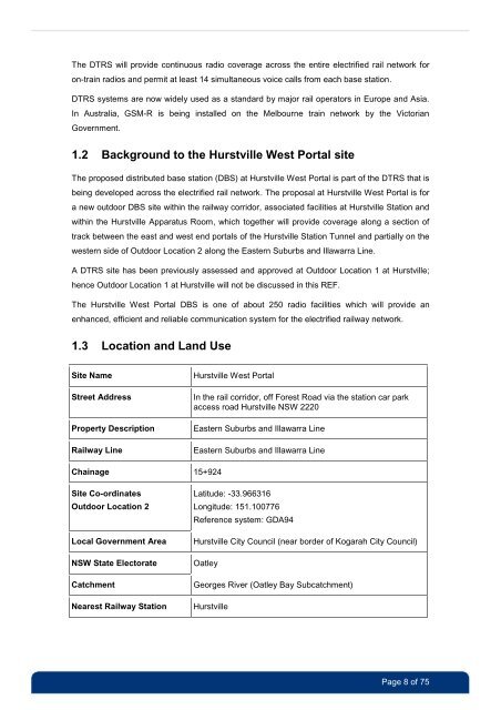
The DTRS will provide continuous radio coverage across the entire electrified rail network <strong>for</strong>on-train radios and permit at least 14 simultaneous voice calls from each base station.DTRS systems are now widely used as a standard by major rail operators in Europe and Asia.In Australia, GSM-R is being installed on the Melbourne train network by the Victorian<strong>Government</strong>.1.2 Background to the <strong>Hurstville</strong> West Portal siteThe proposed distributed base station (DBS) at <strong>Hurstville</strong> West Portal is part of the DTRS that isbeing developed across the electrified rail network. The proposal at <strong>Hurstville</strong> West Portal is <strong>for</strong>a new outdoor DBS site within the railway corridor, associated facilities at <strong>Hurstville</strong> Station andwithin the <strong>Hurstville</strong> Apparatus Room, which together will provide coverage along a section oftrack between the east and west end portals of the <strong>Hurstville</strong> Station Tunnel and partially on thewestern side of Outdoor Location 2 along the Eastern Suburbs and Illawarra Line.A DTRS site has been previously assessed and approved at Outdoor Location 1 at <strong>Hurstville</strong>;hence Outdoor Location 1 at <strong>Hurstville</strong> will not be discussed in this <strong>REF</strong>.The <strong>Hurstville</strong> West Portal DBS is one of about 250 radio facilities which will provide anenhanced, efficient and reliable communication system <strong>for</strong> the electrified railway network.1.3 Location and Land UseSite NameStreet AddressProperty DescriptionRailway Line<strong>Hurstville</strong> West PortalIn the rail corridor, off Forest Road via the station car parkaccess road <strong>Hurstville</strong> <strong>NSW</strong> 2220Eastern Suburbs and Illawarra LineEastern Suburbs and Illawarra LineChainage 15+924Site Co-ordinatesOutdoor Location 2Local <strong>Government</strong> Area<strong>NSW</strong> State ElectorateCatchmentNearest Railway StationLatitude: -33.966316Longitude: 151.100776Reference system: GDA94<strong>Hurstville</strong> City Council (near border of Kogarah City Council)OatleyGeorges River (Oatley Bay Subcatchment)<strong>Hurstville</strong>Page 8 of 75


