years the abbey operated its own stone quarry 53.8<strong>and</strong> mill, <strong>and</strong> St. Meinrad s<strong>and</strong>stone wasshipped as far as Chicago <strong>and</strong> Clevel<strong>and</strong>. Majoruses were for residential ashlar Cacindimension stone in church buildings <strong>and</strong> relatedstructures. or many years the abbeyalso operated its own coal mine.Ab<strong>and</strong>oned drift mine workings behind barnan right (west) are iber (Hutchison, 1passes through lowCrawford Upl<strong>and</strong>. Scattered exposures for theremainder <strong>of</strong> the route in leas<strong>and</strong>stones <strong>and</strong> shales <strong>of</strong> the Mansfield Formation.Village <strong>of</strong> Fulda, named for the cathedraltown in Germany. Many areas in southvvesternIndiana were settled <strong>by</strong> Germans arid Swiss.At crest <strong>of</strong> hill, now mostly covered at left(east) <strong>of</strong> road is upper ed <strong>of</strong> the Lead CreekLimestone Member <strong>of</strong> Mansfield Formation(fig. IN-2). Ostracsd fauna <strong>of</strong> this memberindicates a late Ivsrrowan aSmith, 1974).Cross Anderssn River. Terraces are underlaintly ca!careous silt) as muchthick <strong>and</strong> probably entirelyWisconsinan, latest PBeis~0-ene) in age.Enter village <strong>of</strong> Troy, ne <strong>of</strong> the earliest rivertowns on this pawas the seat <strong>of</strong> gfrom 1815to 181at this place was a pottery that prostoneware from local day. According to(1859, p. 49) -fobrought from Staffordshire ts man this enterprise,but it was not successiuI <strong>and</strong> was soonab<strong>and</strong>oned.Turn left (east) onto IndianaOhio River is to right (south). To left <strong>of</strong> roadare exposed lenticular s<strong>and</strong>s<strong>of</strong> the Mansfield Formationfeet (37 rn) in thickness <strong>and</strong> including twothin <strong>and</strong> discontinucpcas coal memBlue Creek (in two beds with a I-fooshale parting, near road level at crest<strong>and</strong> Mariah Hifl (about 5 feet [I5 m] higher).At top <strong>of</strong> exposure is a 19-foot (5.bed <strong>of</strong> fossiliferous s<strong>and</strong>y iron ore that apparentlyrepresents the Lead Creek LimestoneMember.To left (north), roadcut exposes more than 5feet (15 rn) <strong>of</strong> MOS~!~ ripple-stratified intelaminated s<strong>and</strong>stone <strong>and</strong> shale <strong>of</strong> the MansfieldFormation.Cuts on both sides <strong>of</strong> road expose about75feet (23 m) <strong>of</strong> s<strong>and</strong>stone, mtidstone, <strong>and</strong> graycarbonaceous shale <strong>of</strong> the Mansfield Formation.The coal member mast extensmined in this area is the St. MeinradMember, which I lat at the Bevel ovalley floor some66 through town.Turn left at traffic light.Turn righi at tmff ht, Founded <strong>by</strong> theSwiss Colonization ty irr W5Xi8, Tell Cityis named for the legendary Swiss hers <strong>of</strong> inde-I!. The satiety purchasedacres OF S<strong>and</strong> foSt. IWeinrad Coal Member <strong>and</strong> is O to 2 feet (wha"rhieker, this csa! <strong>and</strong> a lower one haveierous small drifts. From aio River just ss~hthwe/.es"sfcoal known rss be mined inIndiana was taken Eu 8812. If ~vas takecuriosity is not known; for many years, river-% because there was an<strong>and</strong> that rizre~~.~.aer~ believedthereafter the town sf Canpaelto12 was platted.Caal was <strong>of</strong>fered to prospective industries at 1cent per bushel. tower^ sf triver trade generally, if was nearer csrnrnercial<strong>by</strong>sr~ecessfuf, although rhe building continuedin use untij '1965. "Tkw cottonchurch (on the !eft at -traffic light), a<strong>of</strong> the older residences are built sf lostone from the Mansfield Formation, eachCoal Co, in the hills northeast <strong>of</strong> Canr~eiton,<strong>and</strong> most csP it from the St. Ii4einrad CoalMember, also known locally as the LowerCanneiton coal (Hu.tcirisorr, 9 87'11.Thoughthis productiol~ may seem small <strong>by</strong> today'sst<strong>and</strong>ards, it is Earge for cFormation; it also shoulda7earlgi all o-% this was resmall underground mines
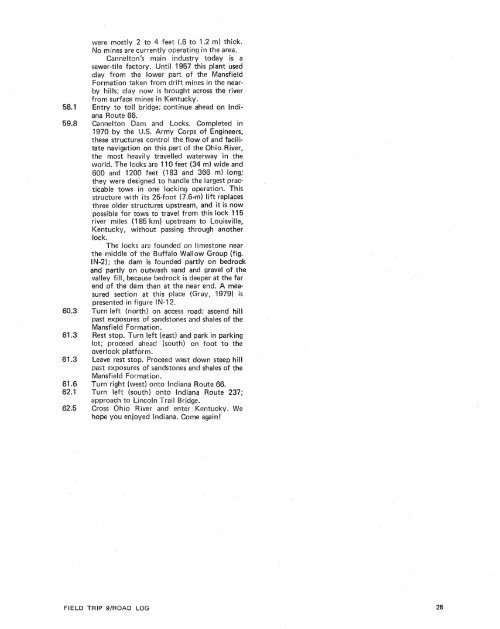
were mostly 2 to 4 feet (.6 to 1.2 m) thick.No mines are currently operating in the area.Cannelton's main industry today is asewer-tile factory. Until 1957 this plant usedclay from the lower part <strong>of</strong> the MansfieldFormation taken from drift mines in the near<strong>by</strong>hills; clay now is brought across the riverfrom surface mines inEntry to toll bridge; continue ahead can Indi-<strong>and</strong> Locks. Completed in. Army Corps <strong>of</strong> Engineers,these structures control the flow <strong>of</strong> <strong>and</strong> facilitatenavigation on this part <strong>of</strong> the Ohio River,the most heavily travelled waterway in theworld. The locks are 11 feet (34 m) wide <strong>and</strong>608 <strong>and</strong> 1200 feet (1 3 <strong>and</strong> 366 m) long;they were designed to h<strong>and</strong>le the largest practicabletows in one locking operation. Thisstructure with its 25-foot (7.6-m) lift replacesthree older structures upstream, <strong>and</strong> it is nowpossible for tows to travel from this lock 115river miles (185 km) upstream to Louisville,Kentucky, without passing through anotherBock.The locks are founded on limestone nearthe middle <strong>of</strong> the Buffalo Wallow Group (fig.IN-2); the dam is foun ed partly on bedrock<strong>and</strong> partly on outwask <strong>and</strong> <strong>and</strong> gravel <strong>of</strong> thevalley fill, because bedrock is deeper at the farend <strong>of</strong> the dam than at the near end. A measuredsection at this place (Gray, I9791 ispresented in figure IN-1 2.) on access road; ascend hillpast exposures <strong>of</strong> s<strong>and</strong>stones <strong>and</strong> shales <strong>of</strong> theMansfieid Formation.Rest stop. Turn left (east) <strong>and</strong> park in parkinglot; proceed ahead (south) on foot to theoverlook platform.Leave rest stop. Proceed west down steep hillpast exposures <strong>of</strong> s<strong>and</strong>stones <strong>and</strong> shales <strong>of</strong> theMansf ield Formation.Turn right (west) onto lndiana Route 66.Turn Deft (south) onto lndiana Route 237;approach to Lincoln TrailCross Ohio River <strong>and</strong> ehope you enjoyed lndianaFIELD TRIP 9IROAB LOG
- Page 1: Edited by James E. Palmer and Russe
- Page 6 and 7: Day 6. Carbondale, I l linois, to s
- Page 8 and 9: Please note that the individuals li
- Page 11 and 12: The lllinois Basin Coal Field has b
- Page 13 and 14: TrowbridgeGeiger LukeCalhounShelbyv
- Page 15 and 16: &/ Anticline 7 Downs Antlcl~nc)( Sy
- Page 17 and 18: Organizational day. New armony, Ind
- Page 19 and 20: Figure IN-1.Field trip route for In
- Page 21 and 22: Entering Gibson County, which was o
- Page 23 and 24: is similar to that exposed in highw
- Page 25 and 26: own sandstone that crops out in the
- Page 27 and 28: THOLOGYSANDSTONESILTSTONESUPPLEMENT
- Page 29 and 30: AREA ADAPTED FROMMALOTT (1931)- ---
- Page 31 and 32: heyday of the spas, from about 18as
- Page 33: f . Quarrying was then extendedunde
- Page 37 and 38: Monday, May 28, 1979DAY 2. Hawesvil
- Page 39 and 40: FIELD TRIP S/ROAD LOG
- Page 41 and 42: FIELD TRIP 91ROAD LOG
- Page 43 and 44: fill sequence of dark shaie, sandst
- Page 45 and 46: - 800w_I aJWest East ,.- 0+D5--:0 w
- Page 47: Engineers. The reservoir, completed
- Page 51 and 52: Geiger Lake CoalLisman CoalCarthage
- Page 53 and 54: IGeneral settingPlaza eastbound.Exi
- Page 55: Soil profile omittedlevel of Parkwa
- Page 58 and 59: Strata of the Permian System were r
- Page 60 and 61: Mine, on the right for the next few
- Page 62 and 63: the southeastern corner of the Illi
- Page 64 and 65: Figure KY-23.Field trip route for K
- Page 66 and 67: a few feet to as much as 3,000 feet
- Page 68 and 69: STOP 1.STOP 2A.STOP 2B.STOP 3.STOP
- Page 70 and 71: Would you know the thrilling storie
- Page 72 and 73: Board buses and proceed west on par
- Page 74 and 75: SoilSandy shaleShale, carbonaceousC
- Page 76 and 77: south rim of Eagle Valley Syncline
- Page 78 and 79: Figure 11-1 3.Extensively cross-bed
- Page 80 and 81: Leave Stop 28.Intersection with acc
- Page 82 and 83: weathering. Heavy minerals are stab
- Page 84 and 85:
NO Anvil RockApproximate areaof Sto
- Page 86 and 87:
Figure IL-23. Old Slave House on Hi
- Page 88 and 89:
Surface mining in this area removed
- Page 90 and 91:
ThicknessIm)lft)Sandstone; thin and
- Page 92 and 93:
(south) side of the road, where Anv
- Page 94 and 95:
Leaders: George #I. Fraunfelter and
- Page 96 and 97:
oadcut consists of about 170 feet (
- Page 98 and 99:
Figure I L-36.Large-scale planar cr
- Page 100 and 101:
Abbott and Caseyville formations, U
- Page 102 and 103:
FaciesAbandoneddistributarychannelA
- Page 104 and 105:
Glacial drift. Undifferentiated, gr
- Page 106 and 107:
Board buses, Holiday Inn parking lo
- Page 108 and 109:
Anvil Rock Sandstone filling channe
- Page 110 and 111:
Table 1 L-1 . Description of strata
- Page 112 and 113:
WELawsonShaleMbr. \BreretonLimeston
- Page 114 and 115:
Harrisburg (No. 5) CoalIApproximate
- Page 116 and 117:
Table I L-2. Characteristics and in
- Page 118 and 119:
General geologic settingHarvey, Ill
- Page 120 and 121:
Table I L-3. Lithology and paleonto
- Page 122 and 123:
l important geographical data relat
- Page 124 and 125:
'98-LL -d'ZZ uo!le3


