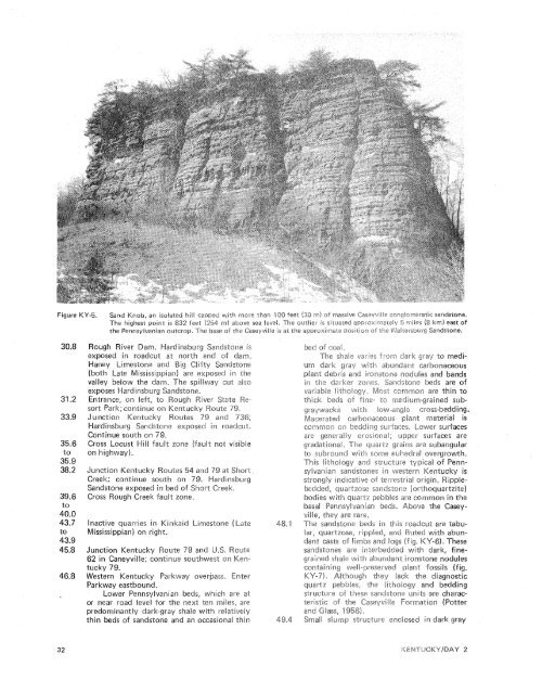
The highest point is 832 feet 1254 m) above sea level. The oiatller 15 situated cpa;~ :a:c!rria ti.:[\ 5 nrilcs (8 kmE east <strong>of</strong>the Pennsylvanian outcrop. The base <strong>of</strong> the Caseyville i5 at zhe approxirnc;ee pasltlorr ot the \fdai$e:*;buig S<strong>and</strong>stone.Rough River Dam. Hardinsburg Sawdstol-~e isexposed in roadcut at north end <strong>of</strong> darn.Haney Limestone <strong>and</strong> ig Clifty S<strong>and</strong>stor~e(both Late Mississippia are exposed in tk~valley below the dam. The spillway cut alsoexposes Hardinsburg S<strong>and</strong>s tone,Entrance, on left, -to ough Rives State Werstinueon I
fill sequence <strong>of</strong> dark shaie, s<strong>and</strong>stesne, seat rock, <strong>and</strong>coal. Capping the cut, except where removed <strong>by</strong> recenterosion or l<strong>and</strong>slide, is a thin coal bed <strong>and</strong> thin-beddeds<strong>and</strong>stone that is biotucoal blocks presumablcoal <strong>and</strong> slumped into their present position. Thus, aBIbeds visible in this roadcut, possibluppermost s<strong>and</strong>stone unit, must havethe paleosiurnp.Figure KV-6. Thin, ripple-bedded, orthoquartmitic s<strong>and</strong>stonein the Caseyville Formation nearMilepost 95, Western Kentucky Parkway.claystone (bay fill) which grades up into arooted ferruginous s<strong>and</strong>stone <strong>and</strong> is cappedwith a thin, impure coal bed.are interpreted as a basal Perarasylvanian dump depositon an irregull ar pre-Pennsylvar-iliara surface. The degree<strong>of</strong> relief on this pre-Pennsylvanian surface is problematical.At Nolin Dam, about 2&n be demonstrated; at the keitcExposed at road level at the center <strong>of</strong> the roadcutis a gray to dark-brown, dense, Fossiliferous limestone(fig. KY-8) in the Upper Mississippian Menard Forma-. Johnson, personal co munieation). Thislimestone is absent toward the west, its position occu-. pied <strong>by</strong> a rooted claystone <strong>and</strong> thin coal. Above thelower coal is a reasonably coherent sequence <strong>of</strong> coarsening-upwardbeds beginning witharea. Some <strong>of</strong> this apparent hiatus may be due "L onsndepositionrather than to ethick, conglomeratic Caseywiltify an estimate <strong>of</strong> erosional relief on the pre-Pennsy1-vanian surface in tens <strong>of</strong> feetPennsylvanian beds presentrepetitive infilling <strong>of</strong> a shallow interdistributary bay.is interrupted <strong>by</strong> aseries <strong>of</strong> irregular s<strong>and</strong>stone pods. These pods aremoderately weis sorted, m-red Eum- to coa rse-grained,orthoquartzitic, <strong>and</strong> quartz-pebble bearing.rippled, <strong>and</strong> the lower surfacer commonlydant sale marks, flow rolls, <strong>and</strong> fluting.somewhat irregular with casts <strong>of</strong> logs, <strong>and</strong> limbs one pods exhibit fracdaljointing. Somebedding is convoluted. lsslated coalthis unit are fragmental <strong>and</strong> osDvisusBy allocthonous.Eastward, bed continuity is reestablished. Bedlithobgag shifts from chaystotle-s<strong>and</strong>st017e-coal "t interbeddedmaroon to eentsh-gray claystone <strong>and</strong> thingreenish-gray, silty, orly bedded s<strong>and</strong>stone. Dip increasessharply to approximately 30' at the east end,where bedrock is obscured <strong>by</strong> recent l<strong>and</strong>slides.Eastward from the red beds is an undisturbed bay-Figure MY-7.---L-I- - -Section exposed in roadcut east <strong>of</strong> Milepost95 illustrating the alternations <strong>of</strong> orthoquartzitics<strong>and</strong>stone <strong>and</strong> dark bay fill shale.Photograph in figure KY-6 is <strong>of</strong> upper s<strong>and</strong>stonebed in rhis figure. The Mississippian-Pennsylvanian boundary is less than 100 feet(30 m) below surface.
- Page 1: Edited by James E. Palmer and Russe
- Page 6 and 7: Day 6. Carbondale, I l linois, to s
- Page 8 and 9: Please note that the individuals li
- Page 11 and 12: The lllinois Basin Coal Field has b
- Page 13 and 14: TrowbridgeGeiger LukeCalhounShelbyv
- Page 15 and 16: &/ Anticline 7 Downs Antlcl~nc)( Sy
- Page 17 and 18: Organizational day. New armony, Ind
- Page 19 and 20: Figure IN-1.Field trip route for In
- Page 21 and 22: Entering Gibson County, which was o
- Page 23 and 24: is similar to that exposed in highw
- Page 25 and 26: own sandstone that crops out in the
- Page 27 and 28: THOLOGYSANDSTONESILTSTONESUPPLEMENT
- Page 29 and 30: AREA ADAPTED FROMMALOTT (1931)- ---
- Page 31 and 32: heyday of the spas, from about 18as
- Page 33 and 34: f . Quarrying was then extendedunde
- Page 35 and 36: were mostly 2 to 4 feet (.6 to 1.2
- Page 37 and 38: Monday, May 28, 1979DAY 2. Hawesvil
- Page 39 and 40: FIELD TRIP S/ROAD LOG
- Page 41: FIELD TRIP 91ROAD LOG
- Page 45 and 46: - 800w_I aJWest East ,.- 0+D5--:0 w
- Page 47: Engineers. The reservoir, completed
- Page 51 and 52: Geiger Lake CoalLisman CoalCarthage
- Page 53 and 54: IGeneral settingPlaza eastbound.Exi
- Page 55: Soil profile omittedlevel of Parkwa
- Page 58 and 59: Strata of the Permian System were r
- Page 60 and 61: Mine, on the right for the next few
- Page 62 and 63: the southeastern corner of the Illi
- Page 64 and 65: Figure KY-23.Field trip route for K
- Page 66 and 67: a few feet to as much as 3,000 feet
- Page 68 and 69: STOP 1.STOP 2A.STOP 2B.STOP 3.STOP
- Page 70 and 71: Would you know the thrilling storie
- Page 72 and 73: Board buses and proceed west on par
- Page 74 and 75: SoilSandy shaleShale, carbonaceousC
- Page 76 and 77: south rim of Eagle Valley Syncline
- Page 78 and 79: Figure 11-1 3.Extensively cross-bed
- Page 80 and 81: Leave Stop 28.Intersection with acc
- Page 82 and 83: weathering. Heavy minerals are stab
- Page 84 and 85: NO Anvil RockApproximate areaof Sto
- Page 86 and 87: Figure IL-23. Old Slave House on Hi
- Page 88 and 89: Surface mining in this area removed
- Page 90 and 91: ThicknessIm)lft)Sandstone; thin and
- Page 92 and 93:
(south) side of the road, where Anv
- Page 94 and 95:
Leaders: George #I. Fraunfelter and
- Page 96 and 97:
oadcut consists of about 170 feet (
- Page 98 and 99:
Figure I L-36.Large-scale planar cr
- Page 100 and 101:
Abbott and Caseyville formations, U
- Page 102 and 103:
FaciesAbandoneddistributarychannelA
- Page 104 and 105:
Glacial drift. Undifferentiated, gr
- Page 106 and 107:
Board buses, Holiday Inn parking lo
- Page 108 and 109:
Anvil Rock Sandstone filling channe
- Page 110 and 111:
Table 1 L-1 . Description of strata
- Page 112 and 113:
WELawsonShaleMbr. \BreretonLimeston
- Page 114 and 115:
Harrisburg (No. 5) CoalIApproximate
- Page 116 and 117:
Table I L-2. Characteristics and in
- Page 118 and 119:
General geologic settingHarvey, Ill
- Page 120 and 121:
Table I L-3. Lithology and paleonto
- Page 122 and 123:
l important geographical data relat
- Page 124 and 125:
'98-LL -d'ZZ uo!le3