Edited by James E. Palmer and Russell R. Dutcher - University of ...
Edited by James E. Palmer and Russell R. Dutcher - University of ...
Edited by James E. Palmer and Russell R. Dutcher - University of ...
Create successful ePaper yourself
Turn your PDF publications into a flip-book with our unique Google optimized e-Paper software.
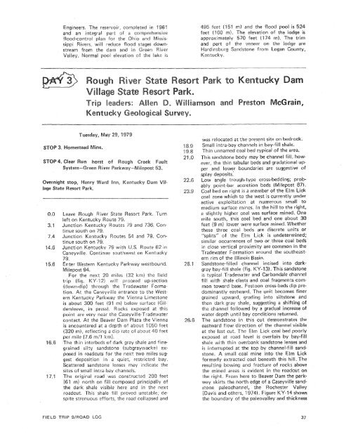
Engineers. The reservoir, completed in 196'1<strong>and</strong> an integral part sf a comprehensiveflood-control plan for the Ohio <strong>and</strong> MississippiRivers, will reduce flood stages downstreamfrom the dam <strong>and</strong> in Green RiverValley. Normal pool elevation csf the lake is495 feet (151 rn) <strong>and</strong> the flood pool is 524feet (160 m). The elevation <strong>of</strong> the lodge isapproximately 578 feet (1174 m). The trim<strong>and</strong> part <strong>of</strong> the veneer on the Dodge areWardinsburg S<strong>and</strong>stone from Logan County,Kentucky.Leave Rough River State Resort Park. Turnleft on Kentucky Route 79.Junction. Kentucky Routes 74 <strong>and</strong> 736. Continuesouth on 79.Junction Kentucky Routes 54 <strong>and</strong> 79. Continuesouth on 79.Junction Kentucky 79 with U.S.Caneyville. Continue southwest on Kentucky79.Enter Western Kentucky Parkway westbound.Milepost 94.For the next 20 miles (32 lam) the fieldtrip (fig. KY-"I) will prsceed up-section(down-dip) through the Tradevvater Formation.At the Ganeyville entrance to the WesternKentucky Parkway the Vienna Limestoneis about 300 feet (91 m) below surface (Gildersleeve,in press). Rocks exposed at thispoint are very near the Caseyville-Tradewatercontact. At the Beaver Dam Plaza the Viennais encountered at a depth <strong>of</strong> about 2050 feet(320 m), reflecting a dip rate <strong>of</strong> about 40 feetper mile (7.6 rn/l Itrn).The thin interbeds <strong>of</strong> dark gray shale <strong>and</strong> finegrainedsilty s<strong>and</strong>stone (subgraywackej exposedin roadcuts for the next two miles suggestdeposition in a quiet, restricted bay.Scattered s<strong>and</strong>stone lenses may indicate thesites <strong>of</strong> small intra-bay channels.The original road was constructed 200 feet(61 m) north on fill composed principally <strong>of</strong>the dark shale visible here <strong>and</strong> in the nextroadcut. This shale fill proved unstable; despitestrenuous efforts, the road cotlapsed <strong>and</strong>was relocated at the present site on bedrock.Small intra-bay channels in bay-fill shale.Thin unnamed coal bed typical <strong>of</strong> the area.This s<strong>and</strong>stone body may be channel fill; however,the thin tabular beds <strong>and</strong> gradational upper<strong>and</strong> 1owe.r boundaries are suggestive <strong>of</strong>splay deposits.Low angle trough-type cross-bedding; probablypoint-bar accretion beds (Milepost 87).Coal bed on right is a member <strong>of</strong> the Elm Lickcoal zone which to the west is currently underactive exploitation at numerous small tomedium surface mines. In the hill to the right,a slightly higher coal was surface mined. Onemile south, this coal bed <strong>and</strong> one about 30feet (9 m) lower were sur.face mined. Whetherthese three coal beds are discrete units or"splits" <strong>of</strong> the Elm Lick is undetermined;similar occurrences <strong>of</strong> two or three coal bedsin close vertical proximity are common in theTradewater Formation around the southeasternrim <strong>of</strong> the Illinois Basin.S<strong>and</strong>stone-filled channel incised into darkgraybay-fill shale (fig. KY-13). This s<strong>and</strong>stoneis typical Tradewater <strong>and</strong> Carbondale channelfill with shale clasts <strong>and</strong> coal fragments commontoward base. Festoon cross-beds dip predominantlyeastward. The unit becomes finergrained upward, grading into siltstone <strong>and</strong>then dark gray shale, suggesting a shifting <strong>of</strong>the channel followed <strong>by</strong> a gradual increase <strong>of</strong>water depth until bay conditions returned.The s<strong>and</strong>stone in this cut demonstrates theeastward flow direction <strong>of</strong> the channel visibleat the last cut. The Elm Lick coal bed poorlyexposed at road level is overlain <strong>by</strong> bay-fillshale with thin overbank s<strong>and</strong>stone lenses <strong>and</strong>is interrupted at the top <strong>by</strong> channel-fill s<strong>and</strong>stone.A small coal mine into the Elm Lickformerly extracted coal beneath this hill. Theresulting bowing <strong>and</strong> fracture <strong>of</strong> rocks abovethe mined areas is evident in the roadcut onthe right. From here to Beaver Dam the parkwayskirts the north edge <strong>of</strong> a Caseyville s<strong>and</strong>stonepaleochannel, the Rochester Valley(Davis <strong>and</strong> others, 1974). Figure KY-14 showsthe boundary <strong>of</strong> the paleovalley <strong>and</strong> thicknessFIELD TRIP SIROAD LOG


