

Edited by James E. Palmer and Russell R. Dutcher - University of ...
Edited by James E. Palmer and Russell R. Dutcher - University of ...
Edited by James E. Palmer and Russell R. Dutcher - University of ...

Create successful ePaper yourself
Turn your PDF publications into a flip-book with our unique Google optimized e-Paper software.
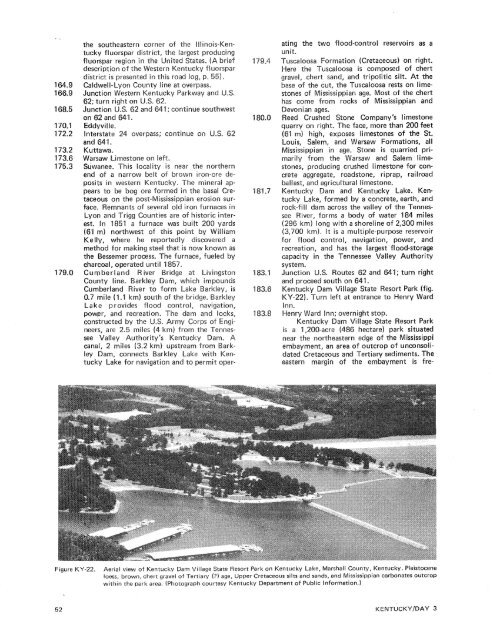
the southeastern corner <strong>of</strong> the Illinois-Kentuckyfluorspar district, the largest producingfluorspar region in the ired States. (A briefdescription <strong>of</strong> the West Kentucky f Suorspardistrict is presented in this road log, p. 55).Caldwell-Lyor~ County line aJunction Western Kentucky; continue so~~thwestEddyvil Ie.e 24 overpass; cgsntirwe onKuttawa.Warsaw Limestone on leSwwanee. This locality is near the northernend d a narrow belt sf brown iron-ore depositsin western Kentucky. Thepears to be bog ore formed in thpost-Mississippian<strong>of</strong> several old iron furnaces inCounties are <strong>of</strong> historic interfurnacewas built(61 m) northwest <strong>of</strong> this point <strong>by</strong> WilliamKelly, where he reportedly discovered amethod for making steel that is now known asthe Besserner process. The furnace, fueled <strong>by</strong>ating the two flood-control reservoirs as aunit.Tuscalossa Formation (Cretaceous) on right.Here the Tuscaloosa is composed <strong>of</strong> chertgravel, chert s<strong>and</strong>, <strong>and</strong> tripolitic silt. At thebase <strong>of</strong> the cut, the uscasoosa rests on limestonessf Mississippian age. Most <strong>of</strong> the cherthas come from rocks <strong>of</strong> Mississippian <strong>and</strong>onian ages.d Crushed Stone mpany's limestonerry on right. The fa more than 200 feetgh, exposes limestones <strong>of</strong> the St.lem, <strong>and</strong> Warsaw Formations, allMississippian in age. Stone is quarried primarilyfrom the Warsaw <strong>and</strong> Salem limestones,producing crushed limestone for concreteaggregate, roadstone, riprap, railroadballast, <strong>and</strong> agricultural limestone.Kentucky Darn <strong>and</strong> Kentucky Lake. KentuckyLake, formed <strong>by</strong> a concrete, earth, <strong>and</strong>dam across the valley <strong>of</strong> the Tennesr,forms a body <strong>of</strong> water 184 miles) long with a shoreline <strong>of</strong> 2,300 miles(3,700 km). It is a multiple-purpose reservoirfor flood control, navigation, power, <strong>and</strong>recreation, <strong>and</strong> has the largest flood-storagecapacity in the Tennessee Valley Authority8.7 mile (1.1 km) south <strong>of</strong> the bridge, BarkleyLake provides flood control, navigation,power, <strong>and</strong> recreati n. The darn <strong>and</strong> locks,c~nstructed <strong>by</strong> the .S. Army Corps <strong>of</strong> Engineers,are 2.5 miles 4 km) from the TennesseeValley Authority's Kentucky Dacanal, 2 miles (3.2 km) upstream fromley Dam, connects Barkley Lake with KentuckyLake for navigation <strong>and</strong> to permit oper-KY-22). Turn left at entrance to Henry WardInn.rtheastern edge <strong>of</strong> the Mississippi, an area <strong>of</strong> outcrop <strong>of</strong> unconsoli-eastern margin <strong>of</strong> the embayrnent is fre-Figure KY-22.Aerial view <strong>of</strong> Kentucky Dam Village State Resort Park on Kentucky Lake, Marshall County, Kentucky. Pleistoceneloess, brown, chert gravel <strong>of</strong> Tertiary (?) age, Upper Cretaceous silts <strong>and</strong> s<strong>and</strong>s, <strong>and</strong> Mississippian carbonates outcropwithin the park area. (Photograph courtesy Kentucky Department <strong>of</strong> Public Information.)


