Edited by James E. Palmer and Russell R. Dutcher - University of ...
Edited by James E. Palmer and Russell R. Dutcher - University of ...
Edited by James E. Palmer and Russell R. Dutcher - University of ...
You also want an ePaper? Increase the reach of your titles
YUMPU automatically turns print PDFs into web optimized ePapers that Google loves.
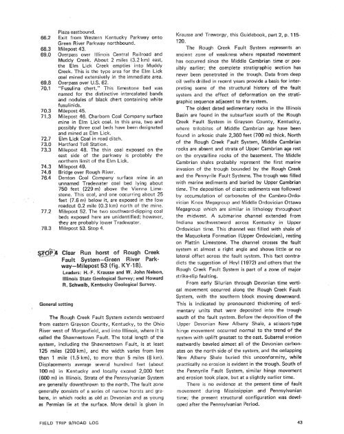
IGeneral settingPlaza eastbound.Exit from Western Kentucky Parkway ontoGreen River Parkway northbound.Milepost 43.Overpass over Illinois Central Railroad <strong>and</strong>Muddy Creek. About 2 miles (3.2 km) east,the Elm Lick Creek empties into MuddyCreek. This is the type area for the Elm Lickcoal mined extensively in the immediate area.Overpass over U.S. 62."Fusulina chert.'This limestone bed wasnamed for the distinctive intercalated b<strong>and</strong>s<strong>and</strong> nodules <strong>of</strong> black chert containing whitefusul inids.Milepost 45.Milepost 46. Charborn Coal Company surfacemine in Elm Lick coal. In this area, two <strong>and</strong>possibly three coal beds have been designated<strong>and</strong> mined as Elm Lick.Elm Lick Coal in road ditch.Hartford Toll Station.Milepost 48. The thin coal exposed on theeast side <strong>of</strong> the parkway is probably thenorthern limit <strong>of</strong> the Elm Lick.Milepost 49.Bridge over Rough River.Denton Coat Company surface mine in anunnamed Tradewater coal bed lying about750 feet (229 m) above the Vienna Limestone.This coal, <strong>and</strong> one occurring about 25feet (7.6 m) below it, are exposed in the towroadcut 0.2 mile (0.3 km) north <strong>of</strong> the mine.Milepost 52. The two southward-dipping coalbeds exposed here are unidentified; however,they are probably lower Tradewater.Milepost 53. Stop 4.The Rough Creek Fault System extends westwardfrom eastern Grayson County, I


