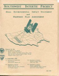
Bureau of Land Management's Decision Record and Environmental
Bureau of Land Management's Decision Record and Environmental
Bureau of Land Management's Decision Record and Environmental

Create successful ePaper yourself
Turn your PDF publications into a flip-book with our unique Google optimized e-Paper software.
approved in writing by the Authorized Officer in advance <strong>of</strong> use.<br />
14. The Holder shall mark the exterior boundaries <strong>of</strong> the right-<strong>of</strong>-way with a stake <strong>and</strong>/or lath at 50-foot<br />
intervals. The intervals may be varied at the time <strong>of</strong> staking at the discretion <strong>of</strong> the Authorized<br />
Officer. The tops <strong>of</strong> the stakes <strong>and</strong>/or laths will be painted <strong>and</strong> the laths flagged in a distinctive color<br />
as determined by the Holder. The survey station numbers will be marked on the boundary stakes<br />
<strong>and</strong>/or laths at the entrance to <strong>and</strong> the exit from public l<strong>and</strong>. Holder shall maintain all boundary<br />
stakes <strong>and</strong>/or laths in place until final cleanup <strong>and</strong> restoration is completed <strong>and</strong> approved by the<br />
Authorized Officer. The stakes <strong>and</strong>/or laths will then be removed at the direction <strong>of</strong> the Authorized<br />
Officer.<br />
15. Use <strong>of</strong> pesticides shall comply with the applicable Federal <strong>and</strong> state laws. Pesticides shall be used<br />
only in accordance with their registered uses <strong>and</strong> within limitations imposed by the Secretary <strong>of</strong> the<br />
Interior. Prior to the use <strong>of</strong> pesticides, the Holder shall obtain from the Authorized Officer written<br />
approval <strong>of</strong> a plan showing the type <strong>and</strong> quantity <strong>of</strong> material to be used, pest(s) to be controlled,<br />
method <strong>of</strong> application, location <strong>of</strong> storage <strong>and</strong> disposal <strong>of</strong> containers, <strong>and</strong> any other information<br />
deemed necessary by the Authorized Officer. Emergency use <strong>of</strong> pesticides shall be approved in<br />
writing by the Authorized Officer prior to such use.<br />
16. During the period <strong>of</strong> May 1 through October 1 <strong>of</strong> each year, Holder should consider using spark<br />
arresters on vehicles <strong>and</strong> equipment in the project area, due to the potential for fire ignition from<br />
project related activities. This includes emission <strong>of</strong> hot carbon particles from diesel powered<br />
equipment, improperly equipped or poorly operating exhaust systems on gas powered vehicles <strong>and</strong><br />
direct contact <strong>of</strong> wildl<strong>and</strong> fuels with catalytic converters. Individuals, groups, businesses or<br />
corporations found responsible for the ignition <strong>of</strong> a wild fire may be held liable for the costs<br />
associated with the suppression <strong>of</strong> that fire.<br />
17. The Holder shall permit free <strong>and</strong> unrestricted public access to <strong>and</strong> upon the RJW for all lawful<br />
purposes, except for those specific areas designated as restricted by the Authorized Officer to protect<br />
the public, wildlife, livestock, or facilities constructed within the R/W.<br />
18. Within 90 days <strong>of</strong> construction completion, the Holder shall provide the Authorized Officer with data<br />
in a format compatible with the <strong>Bureau</strong>’s Arc-Info Geographic Information System to accurately<br />
locate <strong>and</strong> identify the right-<strong>of</strong>-way:<br />
Acceptable data formats are:<br />
• Corrected Global Positioning System files with sub-meter accuracy or better, in<br />
UTM NAD 83; Zone 11;<br />
• ARCGIS export files on a CD ROM, shapefile, geodatabase.<br />
Data may be submitted in any <strong>of</strong> the following formats:<br />
• ARCGIS interchange, shapefile or geodatabase format.<br />
• CD ROM in compressed or uncompressed format.<br />
19. The Holder shall comply with all applicable Federal, State, <strong>and</strong> local laws <strong>and</strong> regulations existing or<br />
thereafter enacted or promulgated.<br />
20. In accordance with Federal regulations in 43 CFR 2807.21 any proposed transfer <strong>of</strong> any right or<br />
interest in the right-<strong>of</strong>-way grant shall be filed with the BLM Authorized Officer. An application for<br />
assignment shall be accompanied by a showing <strong>of</strong> qualifications <strong>of</strong> the Assignee. The assignment<br />
3