Bureau of Land Management's Decision Record and Environmental
Bureau of Land Management's Decision Record and Environmental
Bureau of Land Management's Decision Record and Environmental

Create successful ePaper yourself
Turn your PDF publications into a flip-book with our unique Google optimized e-Paper software.
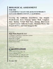
LEGEND<br />
Soil Association Symbol<br />
1340<br />
211<br />
— 482<br />
— 653<br />
251<br />
— 662<br />
— 911<br />
673<br />
• Construction Water Source<br />
— Existing Access Road<br />
Proposed Access Road<br />
— 120 kV Power ROW -Alternative<br />
Proposed Power Plant Location<br />
Construction Water Pipelines<br />
Injection, Production, <strong>and</strong> Construction Water Pipelines<br />
Injection Pipeline<br />
Production Pipeline<br />
Currently Approved Gravel Source<br />
:: Geothermal Lease Boundary<br />
([Jersey Valley Geothermal Unit Area (NVN-83483X)<br />
0 0.5<br />
United States Department <strong>of</strong> the Interior<br />
<strong>Bureau</strong> <strong>of</strong> <strong>L<strong>and</strong></strong> Management<br />
Mount Lewis Fieid Office<br />
50 Bastian Road<br />
Battie Mountain, NV ff9820<br />
‘nio,..arrsniys macicbyihe<strong>Bureau</strong>oi<br />
<strong>L<strong>and</strong></strong> Menagemnni as in the acc,srraoy<br />
,er,ab ito. or compieie005e 01 these dais<br />
for nd v,doai use oraggrenaieuSeso,ifl<br />
oiher dais<br />
The dais shOar on the map lees ic<br />
Uruuersairrars”nerusio-izoee lisUi<br />
Coordrate syninm <strong>and</strong> jses lie NODES<br />
Woie5<br />
0n<br />
Map cain ManOr 16 2010<br />
We<br />
2 Miles