- Page 2 and 3: Authors Dr. Ghulam Akbar, Ph.D Dr.
- Page 4 and 5: 1.1 1.1 Preface: This guidebook has
- Page 6 and 7: How to use this Floral Guide: This
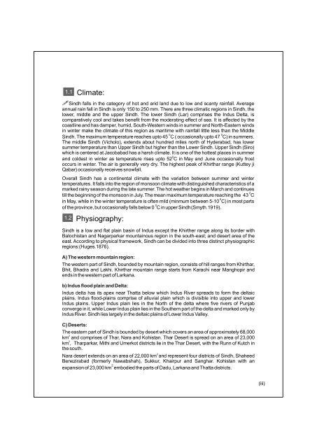
- Page 10 and 11: (iv) 1.3 Demographic profile: Sindh
- Page 12 and 13: (vi) 1.1 (III) It is the largest hi
- Page 14 and 15: (Viii) 1.1 1.6 Land use systems: Si
- Page 16 and 17: (X) 1.1 Deltaic Ecosystem: 3.3 The
- Page 18 and 19: (Xii) 1.1 3.5 Deserts: The arid zon
- Page 20 and 21: (Xiv) of ducks of which three are t
- Page 22 and 23: (Xvi) Wetlands have significant eco
- Page 25 and 26: Adiantaceae Adiantum capillus-vener
- Page 27 and 28: Equisetaceae Equisetum debile Roxb.
- Page 29: Salviniaceae Salvinia molesta Mitch
- Page 33 and 34: Acanthaceae Barleria acanthoides Va
- Page 35 and 36: Acanthaceae Barleria prionitis L. E
- Page 37 and 38: Acanthaceae Peristrophe paniculata
- Page 39 and 40: Acanthaceae Ruellia linearibracteol
- Page 41 and 42: Aizoaceae Gisekia pharnaceoides L.
- Page 43 and 44: Aizoaceae Sesuvium sesuvioides (Fen
- Page 45 and 46: Aizoaceae Trianthema triquetra Rott
- Page 47 and 48: Amaranthaceae Achyranthes aspera L.
- Page 49 and 50: Amaranthaceae Alternanthera sessili
- Page 51 and 52: Amaranthaceae Amaranthus viridis L.
- Page 53 and 54: Amaranthaceae Digera muricata (L.)
- Page 55 and 56: Aristolochiaceae Aristolochia bract
- Page 57 and 58: 30 Asclepiadaceae Calotropis procer
- Page 59 and 60:
32 Asclepiadaceae Glossonema varian
- Page 61 and 62:
34 Asclepiadaceae Oxystelma esculen
- Page 63 and 64:
36 Asclepiadaceae Sarcostemma vimin
- Page 65 and 66:
38 Asteraceae / Compositae Echinops
- Page 67 and 68:
40 Asteraceae / Compositae Gnaphali
- Page 69 and 70:
42 Asteraceae / Compositae Iphiona
- Page 71 and 72:
44 Asteraceae / Compositae Launaea
- Page 73 and 74:
46 Asteraceae / Compositae Pluchea
- Page 75 and 76:
48 Asteraceae / Compositae Pulicari
- Page 77 and 78:
50 Asteraceae / Compositae Pulicari
- Page 79 and 80:
52 Asteraceae / Compositae Sonchus
- Page 81 and 82:
54 Asteraceae / Compositae Xanthium
- Page 83 and 84:
56 Bignoniaceae Tecomella undulata
- Page 85 and 86:
58 Bombacaceae Bombax ceiba L. (Syn
- Page 87 and 88:
60 Boraginaceae Coldenia procumbens
- Page 89 and 90:
62 Boraginaceae Heliotropium calcar
- Page 91 and 92:
64 Boraginaceae Heliotropium curass
- Page 93 and 94:
66 Boraginaceae Heliotropium ovalif
- Page 95 and 96:
68 Boraginaceae Heliotropium supinu
- Page 97 and 98:
70 Boraginaceae Trichodesma indicum
- Page 99 and 100:
72 Burseraceae Commiphora stocksian
- Page 101 and 102:
74 Caesalpiniaceae Bauhinia retusa
- Page 103 and 104:
76 Caesalpiniaceae Senna holoserice
- Page 105 and 106:
Caesalpinaceae Tamarindus indica L.
- Page 107 and 108:
80 Capparidaceae Capparis cartilagi
- Page 109 and 110:
82 Capparidaceae Cleome brachycarpa
- Page 111 and 112:
84 Capparidaceae Cleome viscosa L.
- Page 113 and 114:
86 Capparidaceae Gynandropsis gynan
- Page 115 and 116:
88 Caryophyllaceae Polycarpaea spic
- Page 117 and 118:
90 Chenopodiaceae Arthrocnemum indi
- Page 119 and 120:
92 Chenopodiaceae Atriplex stocksii
- Page 121 and 122:
94 Chenopodiaceae Chenopodium atrip
- Page 123 and 124:
96 Chenopodiaceae Halostachys belan
- Page 125 and 126:
98 Chenopodiaceae Haloxylon stocksi
- Page 127 and 128:
100 Chenopodiaceae Suaeda fruticosa
- Page 129 and 130:
102 Combretaceae Terminalia catappa
- Page 131 and 132:
104 Convolvulaceae Convolvulus glom
- Page 133 and 134:
106 Convolvulaceae Convolvulus rhyn
- Page 135 and 136:
108 Convolvulaceae Cressa cretica L
- Page 137 and 138:
110 Convolvulaceae Ipomoea carnea J
- Page 139 and 140:
112 Convolvulaceae Merremia aegypti
- Page 141 and 142:
114 Convolvulaceae Seddera latifoli
- Page 143 and 144:
116 Cucurbitaceae Coccinia grandis
- Page 145 and 146:
118 Cucurbitaceae Cucumis prophetar
- Page 147 and 148:
120 Cucurbitaceae Luffa echinata Ro
- Page 149 and 150:
122 Elatinaceae Bergia aestvosa Wig
- Page 151 and 152:
124 Euphorbiaceae Euphorbia caducif
- Page 153 and 154:
126 Euphorbiaceae Euphorbia granula
- Page 155 and 156:
128 Euphorbiaceae Euphorbia hirta L
- Page 157 and 158:
130 Euphorbiaceae Euphorbia prostra
- Page 159 and 160:
132 Euphorbiaceae Phyllanthus frate
- Page 161 and 162:
134 Euphorbiaceae Phyllanthus retic
- Page 163 and 164:
136 Fabaceae / Papilionaceae Alysic
- Page 165 and 166:
138 Fabaceae / Papilionaceae Astrag
- Page 167 and 168:
140 Fabaceae / Papilionaceae Crotol
- Page 169 and 170:
142 Fabaceae / Papilionaceae Cyamop
- Page 171 and 172:
Fabaceae / Papilionaceae Indigofera
- Page 173 and 174:
146 Fabaceae / Papilionaceae Indigo
- Page 175 and 176:
148 Fabaceae / Papilionaceae Indigo
- Page 177 and 178:
150 Fabaceae / Papilionaceae Indigo
- Page 179 and 180:
152 Fabaceae / Papilionaceae Lathyr
- Page 181 and 182:
154 Fabaceae / Papilionaceae Medica
- Page 183 and 184:
156 Fabaceae / Papilionaceae Melilo
- Page 185 and 186:
158 Fabaceae / Papilionaceae Rhynch
- Page 187 and 188:
160 Fabaceae / Papilionaceae Rhynch
- Page 189 and 190:
162 Fabaceae / Papilionaceae Tavern
- Page 191 and 192:
164 Fabaceae / Papilionaceae Tephro
- Page 193 and 194:
166 Fabaceae / Papilionaceae Trifol
- Page 195 and 196:
168 Fabaceae / Papilionaceae Vicia
- Page 197 and 198:
170 Fumariaceae Fumaria indica (Hau
- Page 199 and 200:
172 Illecebraceae Cometes surattens
- Page 201 and 202:
174 Malvaceae Abutilon bidentatum A
- Page 203 and 204:
176 Malvaceae Abutilon indicum (L.)
- Page 205 and 206:
178 Malvaceae Hibiscus lobatus (J.A
- Page 207 and 208:
180 Malvaceae Hibiscus scindicus St
- Page 209 and 210:
182 Malvaceae Senra incana Cav. Eng
- Page 211 and 212:
184 Malvaceae Sida spinosa L. Engli
- Page 213 and 214:
186 Menyanthaceae Nymphoides crista
- Page 215 and 216:
Mimosaceae Acacia nilotica (L.) Del
- Page 217 and 218:
Meliaceae Azadirachta indica Adr. J
- Page 219 and 220:
Molluginaceae Glinus lotoides (L.)
- Page 221 and 222:
Moraceae Ficus benghalensis L. (Syn
- Page 223 and 224:
Moringaceae Moringa oleifera Lam. (
- Page 225 and 226:
Myrtaceae Syzygium cumini (L.) Skee
- Page 227 and 228:
Nelumbonaceae Nelumbo nucifera Gaer
- Page 229 and 230:
Nyctaginaceae Boerhavia procumbens
- Page 231 and 232:
Nymphaeaceae Nymphaea nouchalli Wil
- Page 233 and 234:
206 Plumbaginaceae Limonium stocksi
- Page 235 and 236:
208 Polygalaceae Polygala irregular
- Page 237 and 238:
210 Polygonaceae Persicaria barbata
- Page 239 and 240:
212 Polygonaceae Polygonum effusum
- Page 241 and 242:
214 Polygonaceae Rumex dentatus L.
- Page 243 and 244:
216 Primulaceae Anagallis arvensis
- Page 245 and 246:
218 Resedaceae Ochradenus baccatus
- Page 247 and 248:
220 Rhamnaceae Ziziphus nummularia
- Page 249 and 250:
222 Rubiaceae Kohautia retrorsa (Bo
- Page 251 and 252:
224 Salvadoraceae Salvadora oleoide
- Page 253 and 254:
226 Scrophulariaceae Anticharis lin
- Page 255 and 256:
228 Scrophulariaceae Lindenbergia i
- Page 257 and 258:
230 Scrophulariaceae Verbascum thap
- Page 259 and 260:
232 Solanaceae Datura stramonium L.
- Page 261 and 262:
234 Solanaceae Lycium ruthenicum Mu
- Page 263 and 264:
236 Solanaceae Physalis divaricata
- Page 265 and 266:
238 Solanaceae Solanum cordatum For
- Page 267 and 268:
Solanaceae Solanum surattense Burm.
- Page 269 and 270:
Solanaceae Withania somnifera (L.)
- Page 271 and 272:
Sterculiaceae Melhania denhamii R.
- Page 273 and 274:
Tamaricaceae Tamarix alii Qaiser En
- Page 275 and 276:
Tamaricaceae Tamarix indica Willd.
- Page 277 and 278:
Tamaricaceae Tamarix pakistanica Qa
- Page 279 and 280:
Tamaricaceae Tamarix sarenensis Qai
- Page 281 and 282:
Tamaricaceae Tamarix szovitsiana Bu
- Page 283 and 284:
Tiliaceae Corchorus depressus (L.)
- Page 285:
Tiliaceae Corchorus tridens L. Engl
- Page 290 and 291:
Tiliaceae Grewia erythraea Schweinf
- Page 292 and 293:
Tiliaceae Grewia villosa Willd. Eng
- Page 294 and 295:
Verbenaceae Phyla nodiflora (L.) Gr
- Page 296 and 297:
Zygophyllaceae Fagonia indica Burm.
- Page 298 and 299:
Zygophyllaceae Tribulus terrestris
- Page 300:
Zygophyllaceae Zygophyllum simplex
- Page 303 and 304:
Arecaceae / Palmae Cocos nucifera L
- Page 305 and 306:
273 Arecaceae / Palmae Phoenix dact
- Page 307 and 308:
275 Asparagaceae Asparagus dumosus
- Page 309 and 310:
277 Cyperaceae Bolboschoenus affini
- Page 311 and 312:
279 Cyperaceae Cyperus alopecuroide
- Page 313 and 314:
281 Cyperaceae Cyperus aucheri Jaub
- Page 315 and 316:
283 Cyperaceae Cyperus difformis L.
- Page 317 and 318:
285 Cyperaceae Cyperus laevigatus L
- Page 319 and 320:
287 Cyperaceae Cyperus pangorei Rot
- Page 321 and 322:
289 Cyperaceae Cyperus rotundus L.
- Page 323 and 324:
291 Cyperaceae Eleocharis palustris
- Page 325 and 326:
293 Cyperaceae Pycreus dwarkensis (
- Page 327 and 328:
295 Hydrocharitaceae Hydrilla verti
- Page 329 and 330:
297 Hydrocharitaceae Vallisneria sp
- Page 331 and 332:
299 Poaceae / Gramineae Aeluropus l
- Page 333 and 334:
301 Poaceae / Gramineae Aristida fu
- Page 335 and 336:
Poaceae / Gramineae Avena fatua Lin
- Page 337 and 338:
305 Poaceae / Gramineae Brachiaria
- Page 339 and 340:
307 Poaceae / Gramineae Cenchrus bi
- Page 341 and 342:
309 Poaceae / Gramineae Cenchrus pe
- Page 343 and 344:
311 Poaceae / Gramineae Cenchrus se
- Page 345 and 346:
313 Poaceae / Gramineae Chrysopogon
- Page 347 and 348:
315 Poaceae / Gramineae Cynodon dac
- Page 349 and 350:
317 Poaceae / Gramineae Dactylocten
- Page 351 and 352:
319 Poaceae / Gramineae Desmostachy
- Page 353 and 354:
321 Poaceae / Gramineae Dichanthium
- Page 355 and 356:
323 Poaceae / Gramineae Digitaria c
- Page 357 and 358:
325 Poaceae / Gramineae Echinochloa
- Page 359 and 360:
327 Poaceae / Gramineae Echinochloa
- Page 361 and 362:
329 Poaceae / Gramineae Elionurus r
- Page 363 and 364:
331 Poaceae / Gramineae Eragrostis
- Page 365 and 366:
333 Poaceae / Gramineae Eragrostis
- Page 367 and 368:
335 Poaceae / Gramineae Eragrostis
- Page 369 and 370:
337 Poaceae / Gramineae Hemarthria
- Page 371 and 372:
Poaceae / Gramineae Lasiurus scindi
- Page 373 and 374:
Poaceae / Gramineae Leptothrium sen
- Page 375 and 376:
Poaceae / Gramineae Ochthochloa com
- Page 377 and 378:
Poaceae / Gramineae Panicum antidot
- Page 379 and 380:
Poaceae / Gramineae Paspalidium fla
- Page 381 and 382:
Poaceae / Gramineae Paspalum paspal
- Page 383 and 384:
Poaceae / Gramineae Paspalum vagina
- Page 385 and 386:
Poaceae / Gramineae Phalaris minor
- Page 387 and 388:
Poaceae / Gramineae Phragmites kark
- Page 389 and 390:
357 Poaceae / Gramineae Saccharum b
- Page 391 and 392:
359 Poaceae / Gramineae Saccharum r
- Page 393 and 394:
361 Poaceae / Gramineae Setaria ver
- Page 395 and 396:
363 Poaceae / Gramineae Sporobolus
- Page 397 and 398:
365 Poaceae / Gramineae Sporobolus
- Page 399 and 400:
367 Poaceae / Gramineae Tragus roxb
- Page 401 and 402:
369 Pontederiaceae Eichhornia crass
- Page 403 and 404:
371 Potamogetonaceae Potamogeton na
- Page 405 and 406:
373 Typhaceae Typha dominghensis Pe
- Page 407 and 408:
357 Poaceae / Gramineae Saccharum b
- Page 409 and 410:
359 Poaceae / Gramineae Saccharum r
- Page 411 and 412:
361 Poaceae / Gramineae Setaria ver
- Page 413 and 414:
363 Poaceae / Gramineae Sporobolus
- Page 415 and 416:
365 Poaceae / Gramineae Sporobolus
- Page 417 and 418:
367 Poaceae / Gramineae Tragus roxb
- Page 419 and 420:
369 Pontederiaceae Eichhornia crass
- Page 421 and 422:
371 Potamogetonaceae Potamogeton na
- Page 423 and 424:
373 Typhaceae Typha dominghensis Pe
- Page 425 and 426:
375 S# 1 2 3 4 5 6 7 8 9 10 11 12 1
- Page 427 and 428:
377 Glossary of Botany Terms Cladod
- Page 429 and 430:
Glossary of Botany Terms Introduced
- Page 431 and 432:
381 Glossary of Botany Terms Radica
- Page 433 and 434:
377 383 GLOSSARY OF PHARMACOLOGICAL
- Page 435 and 436:
385 GLOSSARY OF PHARMACOLOGICAL F F
- Page 437 and 438:
387 GLOSSARY OF PHARMACOLOGICAL Res
- Page 439 and 440:
389 Blatter, E., C. McCann, and T.
- Page 441 and 442:
Acanthaceae Adiantaceae Aizoaceae A
- Page 443 and 444:
Index of Scientific Names Cleome sc
- Page 445 and 446:
Index of Scientific Names Melia aze
- Page 447 and 448:
Index of Scientific Names Vicia sat
- Page 449:
Dr. Ghulam Akbar A passionate envir


