Institution
Institution
Institution
Create successful ePaper yourself
Turn your PDF publications into a flip-book with our unique Google optimized e-Paper software.
~'<br />
\'~<br />
-i<br />
-1. -ater "'ge -<br />
f1odsile õcnog¡;ic YñituTI<br />
I WHOI-74-1<br />
-1. -ater "'ge - -i<br />
f1ods il e õcnog¡;i c YñituTI<br />
I WHOI-74-l<br />
2. Sedimentation<br />
2. Sedimentation<br />
1<br />
3. Antilles<br />
I.<br />
3. Antilles<br />
I<br />
ANTILLES<br />
THE HISTORY<br />
OUTER<br />
OF<br />
RIOGE<br />
SEDIMENTATION<br />
by Brian E.<br />
AND<br />
Tucholke.<br />
ABYSSAL<br />
314<br />
CIRCULATION<br />
pages. January<br />
ON THE<br />
1974.<br />
GREATER<br />
N00014-66-C0241; NR 083-004 (W.H.O.I.), N00014-67-A-0108"0004 (Lamont-<br />
Doherty Geological Observatory), National Science Foundation Grants<br />
GA-24872 (W.H.O.I.) and GA-35454 (L.D.G.O.).<br />
I ANTILLES THE HISTORY OUTER OF RIDGE SEDIMENTATION by Brian E. AND Tucholke. ABYSSAL 314 CIRCULATION pages. January ON THE 1974. GREATER<br />
NODD14-66-CD24l; NR 083-D04 (W.H.O.I.), NDOD14-67-A-01D8-00D4 (Lamont-<br />
i<br />
i. Tucholke, Brian E.<br />
i<br />
i. Tucholke, Brian E.<br />
I<br />
GA-24872<br />
Doherty Geological (W.H.O.I.) Observatory), and GA-35454 (L.D.G.D.).<br />
National Science Foundation Grants<br />
i i. N00014-66-C024l; NR 083-004 1<br />
I<br />
Atlantic, Ocean. Seismic reflection prOfiles an~. core data indicate<br />
1 sedimentary The Greater ridge Antilles which Outer lies below Ridge 5000 is an m in 18DO the km southwestern long, submarine North<br />
III. NOD014-67-A-0108-DD04<br />
I<br />
I<br />
IV. NSF Grant GA-24872<br />
transparent sediment "hi ch has acc~mul ated above a sequence of acous-<br />
V. NSF Grant GA-35454<br />
I<br />
I<br />
I that the ridge is composed of more than 6xl04 km3 of acoustically<br />
tically stratified sediments deposited before late Eocene time. The<br />
low-carbonate, homogeneous, terrigenous lutites<br />
which have accumülàted at rates of up to 30 cm/lODO yr. since the<br />
I.<br />
middle<br />
sediments<br />
Eocene.<br />
consist<br />
Clay-mineral<br />
of.<br />
analyses indicate that the chlorite-<br />
I<br />
1<br />
of North Amrica. Abyssal contour-following currents which flow .<br />
I around enriched the sediment Greater is Antilles derived Outer from Ridge the northeastern are interpreted continental as an extension margin of the Ilestern Boundary Undercurrent (W8UC)<br />
found along the continental rise of eastern North Amrica. This current system is proposed to be the agent which<br />
I<br />
I<br />
I Sediment has transported is presently sediment carried southward in concentrations for more than up 2500 to 65 km uglliter and deposited in the it currents on the Greater flowing Antilles around the Outer outer Ridge. ridge,<br />
and mineral analyses show that the suspended sediment has a northern provenance; it is similar in composition to<br />
I<br />
I<br />
I The the Puerto bottom Rico sediment Trench and began is interpreted to form in as middle the source Eocene of time, sediment and it deposited cut off direct on the Greater downslope Antilles sedimentation Outer Ridge. to the<br />
Greater Antilles Outer Ridge. At the ,same time, the newly formed WBUC interacted with existing sea-floor topography<br />
I<br />
I<br />
I<br />
transparent<br />
and the Antarctic<br />
sediment<br />
Bottom<br />
on the<br />
Water<br />
eastern<br />
(AABW)<br />
outer<br />
flowing<br />
ridge.<br />
in from<br />
This<br />
the<br />
depositional<br />
South Atlantic,<br />
pattern<br />
and<br />
persisted<br />
it began<br />
Until<br />
to deposit<br />
the middle<br />
acoustically<br />
or late<br />
Miocene, when increased AA8W flow diverted the W8UC to the northwest and initiated deposition of the western sector<br />
I<br />
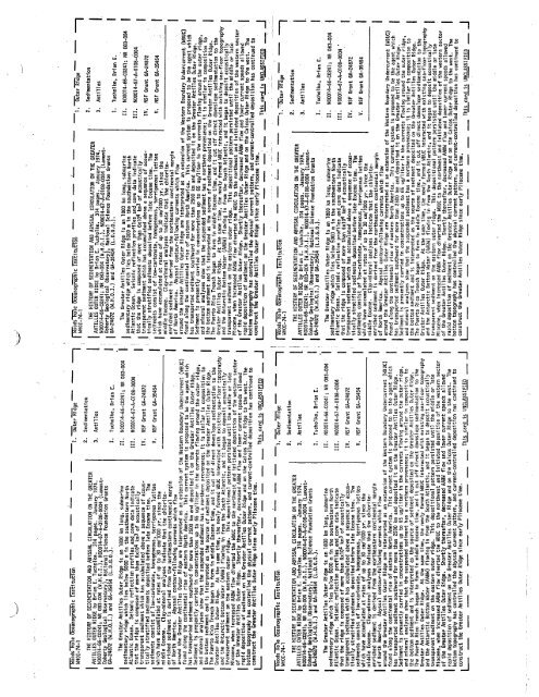
The Greater Antilles Outer Ridge is an 1800 km long, submarine<br />
II. N00014-66-C024l; NR 083-004<br />
sedimentary ridge which lies below 5000 m in the southwestern North<br />
Atlantic Ocean. Seismic reflection profiles and core data indicate<br />
II. ND0014-67-A-0108-0004<br />
that the ridge is composed of more than 6xl04 km3 of acoustically .<br />
transparent sediment which has accumulated above a sequence of acous-<br />
IV. NSF Grant GA-24872<br />
tically stratified sediments deposited before late Eocene time. The<br />
sediments consist of low-carbonate, homogeneous, terrigenous lutites<br />
V. NSF Grant GA-35454<br />
which have accumulated at rates of up to.30 cmllOOO yr. since the<br />
middle Eocene. Clay-mineral analyses indicate that the chloriteenriched<br />
sediment is derived from the northeastern continental margin<br />
of North Amrica. Abyssal contour-following currents which flow<br />
around the Greater Antilles Outer Ridge are interpreted as an extension of the Western Boundary Undercurrent (WBUC)<br />
found along the continental rise of eastern North Amrica. This current system is proposed to be the agent which<br />
has transported sediment southward for more than 2500 km and deposited it on the Greater Antilles Outer Ridge.<br />
Sediment is presently carried in concentrations up to 65, uglliter in the<br />
currents flowing around the outer ridge,<br />
and mineral analyses show that the suspended sediment has a northern provenance; it is similar in composition to<br />
the bottom sediment and is interpreted as the source of sediment deposited on the Greater Antilles Outer Ridge.<br />
The Puerto Rico Trench began to form in middle Eocene time, and it cut off direct downslope sedimentation to the<br />
Greater Antilles Outer Ridge. At the same time, the newly formd WBUC interacted with existing sea-floor topography<br />
and the Antarctic Bottom Water (AABW) flowing in from the South Atlantic, and it began to deposit acoustically<br />
transparent sediment on the eastern outer ridge. This depositional pattern persisted until the middle or late<br />
Miocene, when increased AABW flow diverted the W8UC to the northwest and initiated deposition of the western sector<br />
of the Greater Antilles Outer Ridge. Shortly thereafter, decreased AABW flow and lower current speeds allowed<br />
rapid deposition of sediment on the Greater Antilles Outer Ridge and on the Calcos Outer Ridge to the west. The<br />
bottom topography has controlled the abyssal current pattern, and current-controlled deposition has continued to<br />
I<br />
I construct the Greater Antilles Outer Ridge since early Pliocene time. ' .<br />
L- _ _ _ _ _ _ _ __ __. _ _ T~cai: UN..SIf! _ -i<br />
n1ods il e õcnog¡;i c Yñi tuTI<br />
I IIHOI-74-l .. , -l."'ter'Rge ~ -i<br />
-i<br />
rapid deposition of sediment on the Greater Antilles Duter Ridge and on the Caicos Outer Ridge to the west. The<br />
I bottom of the topography Greater Antilles has controlled Outer Ridge. the abyssal Shortly current thereafter, pattern, decreased and current-controlled AABW flow and lower deposition current speeds has continued allowedto<br />
I construct the Greater Antilles Outer Ridge since early Pliocene time.<br />
L- _ _ _ _ _ _ _ _ _ _ _ T~car.i U~SIf!<br />
1 . -ater "'ge -i<br />
f1ods il e õcnog¡;i c tñituTI<br />
I WHOI-74-1<br />
2. Sedimentation<br />
2. Sedimentation<br />
3. Antilles<br />
I ANTILLES THE HISTORY OUTER OF RIDGE SEDIMENTATION by 8rian E. AND Tucholke. ABYSSAL 314 CIRCULATION pages. January ON THE 1974. GREATER<br />
N00014-66-C024l; NR 083-004 (W.H.O. i'), N00014-67-A-0108-0004 (Lamont-<br />
I.<br />
3. Antilles<br />
I ANTILLES THE HISTORY OUTER OF RIDGE SEDIMENTATlDN by Brian E. AND Tucholke. ABYSSAL 314 CIRCULATION pages. January ON THE 1974. GREATER<br />
N00014-66-C024l; NR 083-004 (W .H.O. i'), NOD014-67-A-0l 08-0004 (Lamont-<br />
i<br />
i. Tucholke, Brian E.<br />
I<br />
GA-24872<br />
OohertyGeological<br />
(W.H.O.I.)<br />
Observatory),<br />
and GA-35454<br />
National<br />
(L.o.G.o.).<br />
Science Foundation Grants<br />
i. Tucholke, Brian E.<br />
I<br />
GA-24872<br />
Ooherty Geological<br />
(W.H.O.I.)<br />
Observatory),<br />
and GA-35454 (L.D.G.O.).<br />
National Science Foundation Grants<br />
II. ND0014-66-C024l; NR 083-004<br />
II. N00014-66-C0241; NR 083-004 .1<br />
III. NOOOl 4-67-A-0108-0004<br />
I sedimentary The Greater ridge Antilles which Outer lies below Ridge 5000 is an m in 1800 the km southwestern long, submarine North<br />
Atlantic Ocean. Seismic reflection prOfiles and core data indicate<br />
III. N00014-67-A-0108-0004'<br />
I sedimentary The Greater ridge Antilles which Outer lies below Ridge 5000 is an m in 1800 the km southwestern long, submarine North<br />
Atlantic Ocean. Seismic reflection profiles and core data indicate<br />
transparent sediment whi ch has accumul ated above a sequence of acous-<br />
I that the ridge is composed of more than 6xl04 km3 of acoustically<br />
tically stratified sediments deposited before late Eocene time. The<br />
I<br />
IV. NSF Grant GA-24872<br />
IV. NSF Grant GA-24872<br />
transparent sediment which has acc~mulated above a sequence of acous-<br />
I that the ridge is composed of more than 6xl04 km3 of acoustically<br />
tically stratified sediments deposited before late Eocene time. . The<br />
V. NSF Grant GA-35454<br />
which. have accumulated at rates of up to 30 cm/lOOO yr. since the<br />
I<br />
middle<br />
sediments<br />
Eocene.<br />
consist<br />
Clay-mineral<br />
of low"carbonate,<br />
analyses<br />
homogeneous,<br />
indicate that<br />
terrigenous<br />
the chloritelutites<br />
V. NSF Grant GA-35454<br />
I<br />
which have accumulated at rates of up to 30 cm/1000 yr. since the<br />
I<br />
middle<br />
sediments<br />
Eocene.<br />
consist<br />
Clay-mineral<br />
O,f low-carbonate,<br />
analyses<br />
homogeneous,<br />
indicate that<br />
terrigenous<br />
the chloritelutites<br />
of North Amrica. Abyssal contour-follOWing currents which flow .<br />
I<br />
I around enriched the sediment Greater is Antilles derived Outer from Ridge the northeastern are interpreted continental as an extension margin of the Western Boundary Undercurrent (WBUC)<br />
found along the continental rise of eastern North Amrica. This current system is proposed to be the agent which<br />
of North Amrica. Abyssal contour-following currents which flow<br />
I around enriched the sediment Greater is Antilles derived Outer from Ridge the northeastern are interpreted continental as an extension margin of the lies tern Boundary Undercurrent (WBUC)<br />
found along the continental rise of eastern North Amrica. This current system is proposed to be the agent which<br />
I<br />
I Sediment has transported is presently sediment carried southward in concentrations for more than up 2500 to 65 km uglliter and deposited in the it currents on the Greater flowing Antilles around the Outer outer Ridge. ridge,<br />
and mineral analyses show that the suspended sediment has a northern provenance; it is similar in composition to<br />
I Sediment has transported is present.ly sediment carried southward in concentrations for more than up 2500 to km 65 and uglliter deposited in the it currents on the Greater flowing Antilles around the Outer outer Ridge. ridge,<br />
and mineral analyses show that the suspended sediment has a northern provenance; it is similar in composition to<br />
I The the Puerto bottom Rico sediment Trench and began is interpreted to form in as middle the source Eocene of time, sediment and it deposited cut off on direct the Greater downslope Antilles sedimentation Outer Ridge. to the<br />
Greater Antilles Outer Ridge. At the same time, the newly formed liBUC interacted with existing sea-floor topography<br />
- ---------------<br />
I<br />
.<br />
and<br />
transparent<br />
the Antarctic<br />
sediment<br />
Bottom<br />
on the<br />
Water<br />
eastern<br />
(AABW)<br />
outer<br />
flowing<br />
ridge.<br />
in from<br />
This<br />
the<br />
depositional<br />
South Atlantic,<br />
pattern<br />
and<br />
persisted<br />
it began<br />
until<br />
to deposit<br />
the middle<br />
acoustically<br />
or late<br />
Miocene, when increased AABW flow diverted the WBUC to the northwest and initiated deposition of the western sector<br />
rapid deposition of sediment on the Greater Antilles Outer Ridge and on the Caicos Outer Ridge to the west. The<br />
I<br />
bottom<br />
of the<br />
topography<br />
Greater Antilles<br />
has controlled<br />
Outer Ridge.<br />
the abyssal<br />
Shortly<br />
current<br />
thereafter,<br />
pattern,<br />
decreased<br />
and current-controlled<br />
AABW flow and lower<br />
deposition<br />
current speeds<br />
has continued<br />
allowed<br />
to<br />
I<br />
I The the Puerto bottom Rico sediment Trench and began is interpreted to form in as middle the source Eocene of time, sediment and it deposited cut off on direct the Greater downslope Antilles sedimentation Outer Ridge. to the<br />
Greater Antilles Outer Ridge. At the same time, the newly formed WBUC interacted with existing sea-floor topography<br />
I<br />
transparent sediment on the eastern outer ridge. This depositional pattern persisted until the middle or late<br />
I and the Antarctic Bottom Water (AABW) flowing in from the South Atlantic, and it began to deposit acoustically<br />
Miocene, when increased AABW flow diverted the WBUC to the northwest and initiated deposition of the western sector<br />
I<br />
Cconstruct the Greater Antilles Outer Ridge since early Pliocene time. -i<br />
This card is UNCLASSIFIED<br />
-i<br />
rapid deposition of sediment on the Greater Antilles Outer Ridge and on the Caicos Outer Ridge to the west. The<br />
I<br />
bottom<br />
of the<br />
topography<br />
Greater Antilles<br />
has controlled<br />
Outer Ridge,<br />
the abyssal<br />
Shortly<br />
current<br />
thereafter,<br />
pattern,<br />
decreased<br />
and current-controlled<br />
AABW flow and lower<br />
deposition<br />
current speeds<br />
nas continued<br />
allowed<br />
to<br />
I construct the Greater Antilles Outer Ridge since early Pliocene time.<br />
L- _ _ _ _ _ _ _ _ _ _ _ Tllcar.il:~SIf!


