Untitled - Neccdep.com
Untitled - Neccdep.com
Untitled - Neccdep.com

Create successful ePaper yourself
Turn your PDF publications into a flip-book with our unique Google optimized e-Paper software.
TRINCOMALEE BAY SPECIAL MANAGEMENT AREA Page | 6<br />
21. The first Sri Lanka CZMP Plan was produced in 1990 some 9 years after the 1981 Act<br />
came into force. It included the concept of Special Area Management (SAM).<br />
22. The second Sri Lanka CZMP Plan was approved on 10th September 1997 and<br />
included SAM plans for Rekawa and Hikkaduwa (Ref.0945). The Plan identified 21 more sites as<br />
important coastal sites based on a set of criteria which included: (a) severity of resource<br />
management issues, (b) biodiversity, (c) viability of SAM concept at the site and (d) economic<br />
significance. The Plan also addressed issues of permits, prohibited activities, setback,<br />
exemptions and variations, monitoring of <strong>com</strong>pliance, Environmental Impact Assessment<br />
(EIA) and Initial Environmental Examinations (IEE).<br />
23. The third Sri Lanka CZMP was <strong>com</strong>pleted before the tsunami on 26th December<br />
2004. The CZMP was revised following the tsunami and was published in the Gazette on the<br />
24th January 2006 and became operational from that date (Ref.0903).<br />
24. SAM sites are categorised at 2 levels. SAM level-1 sites have larger geographical<br />
areas with multiple resource use conflicts and SAM level-2 sites have a smaller geographical<br />
area with fewer resource user conflicts. In this categorization process, Trin<strong>com</strong>alee Bay was<br />
identified as a potential SAM Level-1 site.<br />
25. Special Area Management (SAM) is an innovative approach where local <strong>com</strong>munities<br />
play a significant role in planning and management. The concept of SAM is the collaborative,<br />
adaptive and flexible approach to resource management within a defined geographic area.<br />
The SAM concept, introduced to Sri Lanka in 1980, is now an integral <strong>com</strong>ponent of national<br />
coastal zone management policy.<br />
SAM Planning is a locally-based, geographically-specific planning process that, in theory, is a<br />
highly participatory practice that allows for the <strong>com</strong>prehensive management of natural resources<br />
with the active involvement of the local <strong>com</strong>munity as the main stakeholder group. It involves <strong>com</strong>anagement<br />
of resources where local <strong>com</strong>munity groups are considered the custodians of the<br />
resources being managed under the SAM process through which sustainable livelihood practices<br />
allow for sustainable natural resources use and management within the designated area.<br />
(CZMP, 2004, Gazette, 2006)<br />
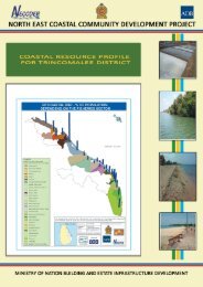
F. Trin<strong>com</strong>alee Bay<br />
26. Trin<strong>com</strong>alee bay is a prominent landscape in the geography of Sri Lanka due to an<br />
extensive deep water bay, which functioned as natural harbour for thousands of years before<br />
be<strong>com</strong>ing a <strong>com</strong>mercial harbour about 200 years back. Trin<strong>com</strong>alee bay is a large basin<br />
estuarine ecosystem rather than a single water body and consists of the large central estuary<br />
of Koddiyar bay that is contiguous with smaller bays including Inner harbour bay with China<br />
bay and Thampalagamam bay, Shell bay, and Dutch bay.<br />
27. A 1-2 km stretch from the shoreline towards sea in the southern and eastern sections<br />
of the bay is generally shallow with 10-12 m depth and then sharply deepens to a depth of<br />
400-800 m in the core area of the bay. The bay mouth towards the northern harbour area is<br />
about 55-68 m deep. Due to the depth, these areas are not suitable for the growth of coastal<br />
vegetation such as mangroves and associates. However the western section of<br />
Thampalagamam bay is generally shallow (1-2 m in depth) and provide suitable habitats for<br />
mangrove vegetation and mudflats. Prominent mangrove vegetation could be identified along<br />
the southern and south-western sections of Thampalagamam bay.