Untitled - Neccdep.com
Untitled - Neccdep.com
Untitled - Neccdep.com

You also want an ePaper? Increase the reach of your titles
YUMPU automatically turns print PDFs into web optimized ePapers that Google loves.
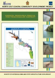
TRINCOMALEE BAY SPECIAL MANAGEMENT AREA Page | 24<br />
together with the proposed construction of bridges at existing ferry crossings, will open up<br />
rapid access to the coastal area south of Trin<strong>com</strong>alee and enhance opportunities for<br />
development of this area.<br />
3. Climate<br />
97. The entire eastern coast is located within the dry zone of Sri Lanka, which has a hot<br />
and humid tropical climate. The mean annual temperature is 28.5 o C, although typically this<br />
ranges from 18 o C on cooler nights during the rainy season, to 39 o C during the day in the dry<br />
months. Eastern Province receives rainfall of between 1000 to 2000 mm per annum,<br />
primarily, about 60%, from the northeast monsoon during October to February.<br />
98. Trin<strong>com</strong>alee District has a longer dry spell than the three months dry spell found in<br />
the other two Districts of the Eastern Province. Average annual rainfall during the period<br />
1995-2000 was 1,469 mm most of which fell in the north east monsoon. This suggests a<br />
decline in annual rainfall from earlier years, since the 1951 to 1980 average was 1,615 mm.<br />
99. Sri Lanka’s east coast is frequently hit by storms and cyclones, especially during the<br />
northeast monsoon, and these can cause considerable damage to property and threaten<br />
lives. Trin<strong>com</strong>alee bay is also frequently hit by minor storms in the rainy season. Winds are<br />
generally moderate, ranging from 7-15 km per hour with the evening winds being stronger.<br />
100. According to the agro-climatic zone of Sri Lanka, the area covered in the Trin<strong>com</strong>alee<br />
bay SAM area belongs to the DL 1 , DL 2 and DL 4 agro-climatic zone. Accordingly, DSDs of<br />
Town & Gravets, Kuchchaveli, Thampalagamam and half of Kinniya Division fall within the<br />
DL 1, which is dry zone low country-1. Half of Kinniya DS division and part of the Muthur<br />
Division fall within the DL 2, which is dry zone low country-2. Sampoor section of Muthur DS<br />
Division belongs to the DL 4, which is dry zone low country-4, which is equivalent to an arid<br />
zone. The rainfall, major soil types and land use features vary according to these agroclimatic<br />
zones.<br />
4. Geology & soils<br />
101. The geological formations to the north and northwest of Trin<strong>com</strong>alee bay consist of<br />
charnockites and quartzites, along with more recent alluvium. The hilly areas around the<br />
harbour mainly consist of rocky areas with charnockites and quartzites. Bands and lenses of<br />
base charnockite of variable thickness are found in the Inner Harbour area and form the<br />
Elephant Ostenburg, Clappenburg, Engineer and Cod ridges, China and Orr’s Hill, along with<br />
the southern ends of Great Sober Island and most of Small Sober Island. Dolerite and<br />
pyroxenite dykes are present in outcrops at Had Cove, Sober Island, Deadman’s Cove and<br />
near the road at China Bay airport. Most of the acid charnockite is found between Elephant<br />
and Ostenburg ridges, Diamond Hill, Nicholson’s Bay, Malay Cove, Deadman’s Cove and<br />
Sweat Bay. Garnet-biotite gneiss bands are found at Snug Cove, Clappenburg bay, off Cod<br />
ridge and north of Engineer ridge. The areas south, southwest and southeast of Trin<strong>com</strong>alee<br />
bay are characterized by recent alluvium, while Norway Point is also characterized by the<br />
presence of garnet-biotic gneiss.<br />
102. Soils are mostly sandy regosols and recent beach and dune sands, with areas of<br />
riverine alluvial soils. Further in the interior there are reddish-brown earths and their<br />
derivatives. Reddish-brown earths occur to the west and southwest of the bay, whilst sandy<br />
regosols and alluvial soils are characteristic around the rest of the bay. Low humic gley soils<br />
dominate the paddy lands in the adjoining areas.